Newark - Newark Liberty Intl
Airport details
| Country | United States of America |
| State | New Jersey |
| Region | K6 |
| Airspace | New York Ctr |
| Municipality | Newark |
| Elevation | 18ft (5m) |
| Timezone | GMT -5 |
| Coordinates | 40.69248, -74.16869 |
| Magnetic var | |
| Type | land |
| Available since | X-Plane v10.40 |
| ICAO code | KEWR |
| IATA code | EWR |
| FAA code | EWR |
Communication
| Newark Liberty Intl ATIS-A | 115.700 |
| Newark Liberty Intl ATIS-D | 134.825 |
| Newark Liberty Intl UNICOM | 122.950 |
| Newark Liberty Intl Clearance DEL | 132.450 |
| Newark Liberty Intl Ground Control | 126.150 |
| Newark Liberty Intl Tower | 118.300 |
| Newark Liberty Intl NEW YORK Approach | 132.800 |
| Newark Liberty Intl NEW YORK Departure | 119.200 |
Approach frequencies
| ILS-cat-III | RW04R | 108.7 | 18.00mi |
| ILS-cat-III | RW22L | 108.7 | 18.00mi |
| ILS-cat-II | RW04L | 110.75 | 18.00mi |
| ILS-cat-I | RW22R | 110.75 | 18.00mi |
| ILS-cat-I | RW11 | 109.15 | 18.00mi |
| 3.1° GS | RW22R | 110.75 | 18.00mi |
| 3.1° GS | RW04L | 110.75 | 18.00mi |
| 3° GS | RW22L | 108.7 | 18.00mi |
| 3° GS | RW11 | 109.15 | 18.00mi |
| 2.9° GS | RW04R | 108.7 | 18.00mi |
Nearby Points of Interest:
Newark Metropolitan Airport Buildings
-Murphy Varnish Works
-South Park Calvary United Presbyterian Church
-Lincoln Park
-Catedral Evangelica Reformada
-Glencoe
-Pan American C.M.A. Church
-Charles N. Fowler House
-Woodruff House
-Newark City Hall
-Second Reformed Dutch Church of Newark
-Newark Female Charitable Society
-Krueger Mansion
-First National State Bank Building
-Belcher–Ogden Mansion; Benjamin Price House; and Price–Brittan House Historic District
-Boxwood Hall
-Mid-Town Historic District
-Four Corners
-Hersch Tower
-Essex County Courthouse
-St. John's Parsonage
-First Presbyterian Church of Elizabeth
-Union County Courthouse
-Wickliffe Presbyterian Church
-Home Office Building
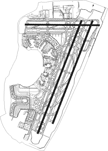
Runway info
Runway 4L / 22R  | ||
| length | 3356m (11010ft) | |
| bearing | 32° / 212° | |
| width | 46m (150ft) | |
| surface | asphalt | |
| displ threshold | 775m (2543ft) / 434m (1424ft) | |
| blast zone | 183m (600ft) / 213m (699ft) | |
| Runway 4R / 22L | ||
| length | 3050m (10007ft) | |
| bearing | 32° / 212° | |
| width | 46m (150ft) | |
| surface | asphalt | |
| displ threshold | 363m (1191ft) / 547m (1795ft) | |
| blast zone | 91m (299ft) / 0m (0ft) | |
| Runway 11 / 29 | ||
| length | 2052m (6732ft) | |
| bearing | 94° / 274° | |
| width | 46m (150ft) | |
| surface | asphalt | |
| displ threshold | 0m (0ft) / 76m (249ft) | |
| blast zone | 155m (509ft) / 55m (180ft) | |
Nearby beacons
| code | identifier | dist | bearing | frequency |
|---|---|---|---|---|
| TE | TORBY (TETERBORO) NDB | 6.9 | 18° | 214 |
| TEB | TETERBORO VOR/DME | 10.5 | 34° | 108.40 |
| CAT | CHATHAM NDB | 12.2 | 280° | 254 |
| CRI | CANARSIE VOR/DME | 13.3 | 106° | 112.30 |
| MM | MOREE (MORRISTOWN) NDB | 13.5 | 319° | 392 |
| LGA | LA GUARDIA (NEW YORK) VOR/DME | 14.7 | 73° | 113.10 |
| JFK | KENNEDY (NEW YORK) VOR/DME | 18.4 | 99° | 115.90 |
| COL | COLTS NECK VOR/DME | 22.8 | 179° | 115.40 |
| SBJ | SOLBERG VOR/DME | 26.9 | 259° | 112.90 |
| SAX | SPARTA VORTAC | 28 | 315° | 115.70 |
| BWZ | BROADWAY (SCHOOLEY'S MT) VOR/DME | 30.3 | 279° | 114.20 |
| FR | FRIKK (FARMINGDALE) NDB | 31.6 | 83° | 407 |
| RBV | ROBBINSVILLE VORTAC | 32.9 | 214° | 113.80 |
| STW | STILLWATER VOR/DME | 36.6 | 293° | 109.60 |
| NEL | LAKEHURST NDB | 39.6 | 194° | 396 |
| DPK | DEER PARK VOR/DME | 39.8 | 83° | 117.70 |
| NEL | LAKEHURST TACAN | 40.2 | 196° | 111.80 |
| ARD | YARDLEY VOR/DME | 42.8 | 239° | 108.20 |
| CMK | CARMEL VOR/DME | 44.2 | 45° | 116.60 |
| GXU | MC GUIRE (WRIGHTSTOWN) VORTAC | 45.4 | 212° | 110.60 |
| HUO | HUGUENOT VOR/DME | 47.1 | 329° | 116.10 |
| SW | NEELY (NEWBURGH) NDB | 47.7 | 356° | 335 |
| SKU | STANWYCK (NEWBURGH) NDB | 50.4 | 8° | 261 |
| CYN | COYLE VORTAC | 53.9 | 197° | 113.40 |
| IGN | KINGSTON VOR/DME | 60.4 | 20° | 117.60 |
Departure and arrival routes
| Transition altitude | 18000ft |
| Transition level | 18000ft |
| SID end points | distance | outbound heading | |
|---|---|---|---|
| RW04 (ALL) | |||
| EWR4 | 11mi | 230° | |
| RW11 | |||
| EWR4 | 11mi | 230° | |
| RW22L | |||
| EWR4 | 11mi | 230° | |
| PORTT4 | 41mi | 269° | |
| RW22R | |||
| EWR4 | 11mi | 230° | |
| PORTT4 | 41mi | 269° | |
| RW29 | |||
| EWR4 | 11mi | 230° | |
| STAR starting points | distance | inbound heading | |
|---|---|---|---|
| ALL | |||
| BRAND1 | 63.3 | 45° | |
| DYLIN4, PHLBO3 | 89.8 | 55° | |
| PENNS2 | 44.2 | 101° | |
| FQM3 | 124.3 | 104° | |
| FLOSI4, SHAFF7 | 51.6 | 169° | |
Instrument approach procedures
| runway | airway (heading) | route (dist, bearing) |
|---|---|---|
| RW04L | KILMA (49°) | KILMA TOCUB (5mi, 83°) 2800ft |
| RNAV | TOCUB 2800ft SWICH (6mi, 32°) 2000ft KEWR (7mi, 32°) 62ft (4688mi, 119°) 440ft JEVAP (4685mi, 299°) TEB (5mi, 11°) 2500ft TEB (turn) | |
| RW04RY | KILMA (49°) | KILMA ISACE (6mi, 77°) 2800ft |
| RNAV | ISACE 2800ft COWWE (6mi, 32°) 1700ft KEWR (6mi, 31°) 66ft (4688mi, 119°) 357ft CANBO (4688mi, 299°) MOSME (3mi, 67°) TEB (7mi, 16°) 2500ft TEB (turn) | |
| RW04RZ | KILMA (49°) | KILMA 4000ft ISACE (6mi, 77°) 2800ft |
| RNAV | ISACE 2800ft COWWE (6mi, 32°) 1700ft KEWR (6mi, 31°) 66ft (4688mi, 119°) 396ft CANBO (4688mi, 299°) MOSME (3mi, 67°) TEB (7mi, 16°) 2500ft TEB (turn) 2500ft | |
| RW22R | GIBTE (213°) | GIBTE 3000ft NICIS (4mi, 213°) 3000ft |
| RNAV | NICIS 3000ft IDACE (2mi, 213°) 2500ft LITBE (4mi, 213°) 1040ft KEWR (4mi, 213°) 58ft (4688mi, 119°) 361ft HENIB (4689mi, 299°) KILMA (15mi, 230°) 3000ft KILMA (turn) | |
| RW29-X | CASHH (4°) | CASHH ZIAAA (7mi, 47°) 3000ft PIJAY (4mi, 47°) 2000ft UJODY (5mi, 355°) 2000ft |
| RW29-X | FLIKR (15°) | FLIKR CASHH (4mi, 55°) 3000ft ZIAAA (7mi, 47°) 3000ft PIJAY (4mi, 47°) 2000ft UJODY (5mi, 355°) 2000ft |
| RW29-X | PIJAY (314°) | PIJAY UJODY (5mi, 355°) 2000ft |
| RW29-X | ZIAAA (339°) | ZIAAA PIJAY (4mi, 47°) 2000ft UJODY (5mi, 355°) 2000ft |
| RNAV | UJODY 2000ft STATU (2mi, 308°) 1400ft ISERE (3mi, 284°) 253ft (4687mi, 119°) 417ft DWIZZ (4698mi, 299°) 2000ft DWIZZ (turn) | |
| RW29-Z | KILMA (49°) | KILMA GRITY (6mi, 77°) 3000ft COWWE (6mi, 32°) 3000ft |
| RNAV | COWWE 3000ft NNICK (4mi, 62°) 3000ft CORTO (2mi, 86°) GOLSN (turn) HALPA (3mi, 336°) KEWR (3mi, 265°) 70ft JETVY (5mi, 279°) FIRSI (4mi, 250°) DIRMY (8mi, 222°) 3000ft DIRMY (turn) |
Holding patterns
| STAR name | hold at | type | turn | heading* | altitude | leg | speed limit |
|---|---|---|---|---|---|---|---|
| BRAND1 | BACKY | VHF | right | 216 (36)° | DME 7.0mi | ICAO rules | |
| BRAND1 | BRAND | VHF | right | 238 (58)° | 2000ft - 17999ft | 1.0min timed | 175 |
| BRAND1 | DQO | NDB | left | 233 (53)° | 6001ft - 14000ft | 1.0min timed | 210 |
| BRAND1 | KERNO | VHF | right | 235 (55)° | 6001ft - 14000ft | DME 7.0mi | 210 |
| BRAND1 | RUUTH | VHF | left | 262 (82)° | DME 4.0mi | ICAO rules | |
| BRAND1 | WATJA | VHF | left | 240 (60)° | 6001ft - 14000ft | DME 4.0mi | 210 |
| BRAND1 | WNDYL | VHF | right | 240 (60)° | 6001ft - 14000ft | DME 4.0mi | 210 |
| DYLIN4 | ARD | VHF | right | 19 (199)° | < 17999ft | 1.0min timed | ICAO rules |
| DYLIN4 | MERSR | VHF | right | 237 (57)° | 6001ft - 14000ft | 1.0min timed | 210 |
| DYLIN4 | METRO | VHF | left | 237 (57)° | 6001ft - 14000ft | 1.0min timed | 210 |
| DYLIN4 | PALEO | VHF | left | 232 (52)° | < 45000ft | 1.5min timed | ICAO rules |
| DYLIN4 | STEFE | VHF | right | 233 (53)° | < 17999ft | 1.0min timed | 210 |
| FLOSI4 | ACOVE | VHF | right | 31 (211)° | 18000ft - 45000ft | 1.5min timed | ICAO rules |
| FLOSI4 | HANAA | VHF | right | 47 (227)° | 18000ft - 45000ft | DME 10.0mi | ICAO rules |
| FLOSI4 | HELON | VHF | right | 29 (209)° | < 17999ft | 1.0min timed | ICAO rules |
| FLOSI4 | KODEY | VHF | left | 313 (133)° | 18000ft - 45000ft | 1.5min timed | ICAO rules |
| FLOSI4 | SHAFF | VHF | left | 29 (209)° | < 17999ft | 1.0min timed | ICAO rules |
| FQM3 | FQM | NDB | right | 290 (110)° | 18000ft - 45000ft | 1.5min timed | ICAO rules |
| FQM3 | PENNS | VHF | right | 302 (122)° | 6001ft - 14000ft | 1.0min timed | 210 |
| FQM3 | SLT | NDB | left | 287 (107)° | 18000ft - 45000ft | 1.5min timed | ICAO rules |
| PENNS2 | PENNS | VHF | right | 302 (122)° | 6001ft - 14000ft | 1.0min timed | 210 |
| PHLBO3 | ARD | VHF | right | 19 (199)° | < 17999ft | 1.0min timed | ICAO rules |
| PHLBO3 | MERSR | VHF | right | 237 (57)° | 6001ft - 14000ft | 1.0min timed | 210 |
| PHLBO3 | METRO | VHF | left | 237 (57)° | 6001ft - 14000ft | 1.0min timed | 210 |
| PHLBO3 | PALEO | VHF | left | 232 (52)° | < 45000ft | 1.5min timed | ICAO rules |
| PHLBO3 | STEFE | VHF | right | 233 (53)° | < 17999ft | 1.0min timed | 210 |
| SHAFF7 | ACOVE | VHF | right | 31 (211)° | 18000ft - 45000ft | 1.5min timed | ICAO rules |
| SHAFF7 | HELON | VHF | right | 29 (209)° | < 17999ft | 1.0min timed | ICAO rules |
| SHAFF7 | KODEY | VHF | left | 313 (133)° | 18000ft - 45000ft | 1.5min timed | ICAO rules |
| SHAFF7 | SHAFF | VHF | left | 29 (209)° | < 17999ft | 1.0min timed | ICAO rules |
| *) magnetic outbound (inbound) holding course | |||||||
Disclaimer
The information on this website is not for real aviation. Use this data with the X-Plane flight simulator only! Data taken with kind consent from X-Plane 12 source code and data files. Content is subject to change without notice.