Fitchburg - Fitchburg Muni
Airport details
| Country | United States of America |
| State | Massachusetts |
| Region | K6 |
| Airspace | Boston Ctr |
| Municipality | Fitchburg |
| Elevation | 347ft (106m) |
| Timezone | GMT -5 |
| Coordinates | 42.55411, -71.75897 |
| Magnetic var | |
| Type | land |
| Available since | X-Plane v10.40 |
| ICAO code | KFIT |
| IATA code | FIT |
| FAA code | FIT |
Communication
| Fitchburg Muni Fitchburg ASOS | 135.175 |
| Fitchburg Muni Fitchburg CTAF/Unicom | 122.700 |
| Fitchburg Muni Boston Approach/Departure | 124.400 |
Nearby Points of Interest:
Billerica Town Common District
-Wellington Piano Case Company Building
-Duck Mill
-F. A. Whitney Carriage Company Complex Historic District
-Whitney & Company
-Wachusett Shirt Company
-Cluett Peabody & Company
-Frances H. and Jonathan Drake House
-Moran Square Historic District
-Monument Park Historic District
-Fitchburg Historical Society
-Crocker Field
-Fitchburg Yarn Mill
-Parkhill Mill
-James Parker House
-Shirley Village Historic District
-Ezra Wood-Levi Warner Place
-Ponakin Bridge
-North Village Historic District
-Nathan Wood House
-Ahijah Wood House
-Fort Devens Historic District
-Groton Leatherboard Company
-Anthony Lane House
-Center Village District
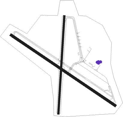
Runway info
Runway 14 / 32  | ||
| length | 1373m (4505ft) | |
| bearing | 120° / 300° | |
| width | 30m (98ft) | |
| surface | asphalt | |
| displ threshold | 0m (0ft) / 74m (243ft) | |
| Runway 2 / 20 | ||
| length | 1069m (3507ft) | |
| bearing | 11° / 191° | |
| width | 23m (75ft) | |
| surface | asphalt | |
| displ threshold | 173m (568ft) / 140m (459ft) | |
Nearby beacons
| code | identifier | dist | bearing | frequency |
|---|---|---|---|---|
| GDM | GARDNER VOR/DME | 13.2 | 268° | 110.60 |
| MJ | FITZY (MANCHESTER) NDB | 21.2 | 37° | 209 |
| MHT | MANCHESTER VOR/DME | 25.5 | 51° | 114.40 |
| EEN | DME | 27.5 | 294° | 109.40 |
| LWM | DME | 31.3 | 74° | 112.50 |
| BOS | BOSTON VOR/DME | 36 | 104° | 112.70 |
| PUT | PUTNAM VOR/DME | 36.1 | 188° | 117.40 |
| CO | EPSOM (CONCORD) NDB | 36.5 | 28° | 216 |
| OW | STOGE (NORWOOD) NDB | 38.2 | 125° | 397 |
| CEF | WESTOVER(SPRINGFIELD/CHIC TACAN | 40.2 | 245° | 114 |
| CON | CONCORD VOR/DME | 40.7 | 15° | 112.90 |
| BAF | BARNES (WESTFIELD/SPRINGF VORTAC | 48.5 | 248° | 113 |
| PSM | (PORTSMOUTH) DME | 51.7 | 60° | 116.50 |
| PVD | PROVIDENCE VOR/DME | 51.9 | 158° | 115.60 |
| CNH | CLAREMONT NDB | 55.8 | 323° | 233 |
| ESG | ROLLINS (ROLLINSFORD) NDB | 57.2 | 54° | 260 |
| LC | BLNAP (LACONIA) NDB | 59.8 | 13° | 328 |
| ORW | NORWICH VOR/DME | 60.8 | 194° | 110 |
| SF | SANFD (SANFORD) NDB | 62 | 50° | 349 |
| HFD | HARTFORD VOR/DME | 65.1 | 221° | 114.90 |
Departure and arrival routes
| Transition altitude | 18000ft |
| Transition level | 18000ft |
| STAR starting points | distance | inbound heading | |
|---|---|---|---|
| ALL | |||
| GRAYM6 | 29.7 | 31° | |
Instrument approach procedures
| runway | airway (heading) | route (dist, bearing) |
|---|---|---|
| RW14 | FIBAB (134°) | FIBAB 4400ft |
| RW14 | GDM (88°) | GDM CONVU (7mi, 355°) 4400ft FIBAB (7mi, 62°) 4400ft |
| RW14 | JIMUG (168°) | JIMUG FIBAB (7mi, 242°) 4400ft |
| RNAV | FIBAB 4400ft EIRRO (5mi, 135°) 2900ft KENAT (1mi, 135°) 2500ft LELIC (2mi, 135°) 1860ft OLLIV (4mi, 135°) 550ft (4605mi, 121°) 745ft DALIA (4606mi, 301°) 3500ft DALIA (turn) | |
| RW32 | DESLO (302°) | DESLO 3000ft |
| RW32 | OWLET (329°) | OWLET DESLO (7mi, 49°) 3000ft |
| RW32 | TOPTO (281°) | TOPTO DESLO (7mi, 229°) 3000ft |
| RNAV | DESLO 3000ft CLETR (9mi, 302°) 2000ft KFIT (5mi, 302°) 379ft (4605mi, 121°) 745ft TAYUN (4608mi, 301°) DALIA (12mi, 34°) 3500ft DALIA (turn) |
Holding patterns
| STAR name | hold at | type | turn | heading* | altitude | leg | speed limit |
|---|---|---|---|---|---|---|---|
| GRAYM6 | DREEM | VHF | left | 233 (53)° | 1.0min timed | ICAO rules | |
| *) magnetic outbound (inbound) holding course | |||||||
Disclaimer
The information on this website is not for real aviation. Use this data with the X-Plane flight simulator only! Data taken with kind consent from X-Plane 12 source code and data files. Content is subject to change without notice.