Farmingdale - Republic
Airport details
| Country | United States of America |
| State | New York |
| Region | K6 |
| Airspace | New York Ctr |
| Municipality | Town of Babylon |
| Elevation | 80ft (24m) |
| Timezone | GMT -5 |
| Coordinates | 40.72471, -73.41540 |
| Magnetic var | |
| Type | land |
| Available since | X-Plane v10.40 |
| ICAO code | KFRG |
| IATA code | FRG |
| FAA code | FRG |
Communication
| Republic ATIS | 126.650 |
| Republic UNICOM | 122.950 |
| Republic CTAF | 118.800 |
| Republic REPUBLIC GROUND | 121.600 |
| Republic REPUBLIC TOWER | 125.200 |
| Republic REPUBLIC TOWER | 118.800 |
| Republic CLEARANCE DELIVERY | 128.250 |
| Republic NEW YORK ApproachROACH | 128.125 |
| Republic NEW YORK ApproachROACH | 132.400 |
| Republic NEW YORK ApproachROACH/ DepartureARTURE | 123.700 |
| Republic NEW YORK ApproachROACH | 118.400 |
| Republic NEW YORK DepartureARTURE | 125.700 |
| Republic NEW YORK DepartureARTURE | 134.350 |
Approach frequencies
| ILS-cat-I | RW14 | 111.9 | 18.00mi |
| 3° GS | RW14 | 111.9 | 18.00mi |
Nearby Points of Interest:
Sisters of St. Dominic Motherhouse Complex
-John Everit House
-Jerusalem District No. 5 Schoolhouse
-Nathaniel Conklin House
-Babylon Town Hall
-Samuel and Elbert Jackson House
-Wantagh Railroad Complex
-Heitz Place Courthouse
-Walt Whitman Birthplace State Historic Site
-Chichester's Inn
-John Coltrane Home
-Ezra Carll Homestead
-Jericho Friends Meeting House Complex
-Bay Shore Hose Company No. 1 Firehouse
-United States Post Office
-Modern Times School
-Marion Carll Farm
-Mitchel Air Force Base
-Harbor Road Historic District
-David Conklin House
-Rogers House
-Old Westbury Gardens
-Old Town Hall Historic District
-Benjamin Moore Estate
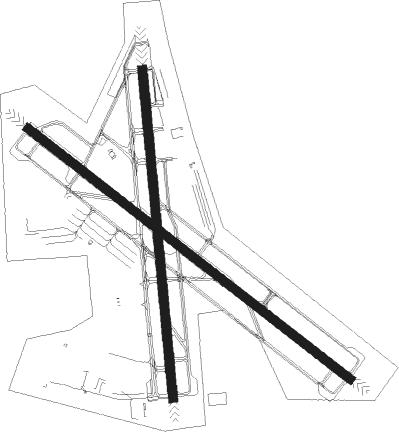
Runway info
Runway 14 / 32  | ||
| length | 2085m (6841ft) | |
| bearing | 125° / 305° | |
| width | 46m (150ft) | |
| surface | asphalt | |
| displ threshold | 201m (659ft) / 0m (0ft) | |
| Runway 1 / 19 | ||
| length | 1684m (5525ft) | |
| bearing | 359° / 179° | |
| width | 46m (150ft) | |
| surface | asphalt | |
| displ threshold | 0m (0ft) / 241m (791ft) | |
Nearby beacons
| code | identifier | dist | bearing | frequency |
|---|---|---|---|---|
| FR | FRIKK (FARMINGDALE) NDB | 4.3 | 308° | 407 |
| DPK | DEER PARK VOR/DME | 6.4 | 59° | 117.70 |
| JFK | KENNEDY (NEW YORK) VOR/DME | 17.1 | 256° | 115.90 |
| LGA | LA GUARDIA (NEW YORK) VOR/DME | 20.9 | 277° | 113.10 |
| CRI | CANARSIE VOR/DME | 22.8 | 257° | 112.30 |
| BDR | BRIDGEPORT VOR/DME | 29.3 | 34° | 108.80 |
| TEB | TETERBORO VOR/DME | 30.3 | 281° | 108.40 |
| CCC | CALVERTON VOR/DME | 30.6 | 72° | 117.20 |
| TE | TORBY (TETERBORO) NDB | 32.9 | 276° | 214 |
| CMK | CARMEL VOR/DME | 34.1 | 343° | 116.60 |
| FOK | SUFFOLK CO (WESTHAMPTON B TACAN | 36.2 | 82° | 111 |
| HVN | HAVEN DME | 40.2 | 45° | 109.80 |
| COL | COLTS NECK VOR/DME | 42 | 241° | 115.40 |
| MM | MOREE (MORRISTOWN) NDB | 42.8 | 280° | 392 |
| MAD | MADISON VOR/DME | 48.2 | 51° | 110.40 |
| SKU | STANWYCK (NEWBURGH) NDB | 56 | 322° | 261 |
| NEL | LAKEHURST NDB | 58.6 | 234° | 396 |
| SW | NEELY (NEWBURGH) NDB | 58.6 | 313° | 335 |
| IGN | KINGSTON VOR/DME | 59.4 | 337° | 117.60 |
| NEL | LAKEHURST TACAN | 59.5 | 234° | 111.80 |
| HFD | HARTFORD VOR/DME | 67.5 | 43° | 114.90 |
Departure and arrival routes
| Transition altitude | 18000ft |
| Transition level | 18000ft |
| SID end points | distance | outbound heading | |
|---|---|---|---|
| RW01 | |||
| DEEZZ5 | 91mi | 265° | |
| RW14 | |||
| DEEZZ5 | 91mi | 265° | |
| RW19 | |||
| DEEZZ5 | 91mi | 265° | |
| RW32 | |||
| DEEZZ5 | 91mi | 265° | |
| STAR starting points | distance | inbound heading | |
|---|---|---|---|
| ALL | |||
| CAMRN4 | 116.8 | 40° | |
| LENDY6 | 108.2 | 104° | |
| IGN1 | 59.4 | 157° | |
| PWL2 | 63.3 | 170° | |
| ROBER2, PARCH3 | 62.9 | 254° | |
Instrument approach procedures
| runway | airway (heading) | route (dist, bearing) |
|---|---|---|
| RW01 | WULUG (321°) | WULUG BLAND (6mi, 270°) 2000ft |
| RW01 | ZACHS (35°) | ZACHS BLAND (7mi, 85°) 2000ft |
| RNAV | BLAND 2000ft DEUCE (6mi, 359°) 1600ft XAREW (2mi, 359°) 880ft KFRG (3mi, 358°) 99ft (4655mi, 119°) 800ft DPK (4651mi, 299°) 3000ft DPK (turn) 3000ft | |
| RW14-Y | JFK (76°) | JFK JUBIL (10mi, 35°) 2000ft LAAZE (5mi, 53°) 2000ft |
| RW14-Y | ODALE (164°) | ODALE LAAZE (7mi, 230°) 2000ft |
| RNAV | LAAZE 2000ft ALABE (6mi, 125°) 1400ft KFRG (4mi, 128°) 137ft (4655mi, 119°) 1800ft DPK (4651mi, 299°) 3000ft DPK (turn) | |
| RW14-Z | CAMRN (32°) | CAMRN HEREK (30mi, 41°) 4000ft SEHDO (14mi, 7°) 2000ft WUPMA (5mi, 305°) 2000ft ALABE (5mi, 50°) 1400ft |
| RW14-Z | HOBAM (141°) | HOBAM LAAZE (8mi, 166°) 2000ft ALABE (6mi, 125°) 1400ft |
| RNAV | ALABE 1400ft KFRG (4mi, 128°) 137ft FRRST (6mi, 123°) NICAD (7mi, 178°) 2000ft NICAD (turn) | |
| RW19 | BLINZ (143°) | BLINZ DEBYE (6mi, 89°) 2000ft |
| RW19 | ZOSAB (215°) | ZOSAB DEBYE (7mi, 261°) 2000ft |
| RNAV | DEBYE 2000ft MOIRE (6mi, 179°) 1500ft WULOP (2mi, 179°) 800ft KFRG (3mi, 180°) 119ft (4655mi, 119°) 2000ft DPK (4651mi, 299°) 3000ft DPK (turn) 3000ft | |
| RW32 | JUSIN (331°) | JUSIN TRCCY (5mi, 50°) 2000ft |
| RW32 | SHYNA (282°) | SHYNA TRCCY (5mi, 230°) 2000ft |
| RNAV | TRCCY 2000ft ALFED (6mi, 305°) 1400ft KFRG (4mi, 302°) 121ft (4655mi, 119°) 328ft FAAYE (4657mi, 299°) WADIR (4mi, 7°) PUGGS (12mi, 61°) 2000ft PUGGS (turn) |
Holding patterns
| STAR name | hold at | type | turn | heading* | altitude | leg | speed limit |
|---|---|---|---|---|---|---|---|
| CAMRN4 | BOTON | VHF | right | 229 (49)° | 18000ft - 45000ft | 1.5min timed | ICAO rules |
| CAMRN4 | CAMRN | VHF | left | 221 (41)° | 6001ft - 14000ft | 1.0min timed | 210 |
| IGN1 | IGN | NDB | right | 13 (193)° | < 17999ft | 1.0min timed | ICAO rules |
| IGN1 | LENDY | VHF | right | 315 (135)° | 18000ft - 45000ft | 1.5min timed | 230 |
| LENDY6 | JENNO | VHF | left | 305 (125)° | 18000ft - 41000ft | 1.5min timed | ICAO rules |
| LENDY6 | LENDY | VHF | right | 315 (135)° | 18000ft - 45000ft | 1.5min timed | 230 |
| PARCH3 | CCC | NDB | left | 85 (265)° | < 17999ft | 1.0min timed | ICAO rules |
| PARCH3 | ENE | NDB | left | 44 (224)° | 1.5min timed | ICAO rules | |
| PARCH3 | PVD | NDB | right | 234 (54)° | 1.0min timed | ICAO rules | |
| PARCH3 | TRAIT | VHF | right | 52 (232)° | < 17999ft | 1.0min timed | ICAO rules |
| PWL2 | LOVES | VHF | left | 336 (156)° | 1.0min timed | ICAO rules | |
| ROBER2 | CCC | NDB | left | 85 (265)° | < 17999ft | 1.0min timed | ICAO rules |
| ROBER2 | ENE | NDB | left | 44 (224)° | 1.5min timed | ICAO rules | |
| ROBER2 | PVD | NDB | right | 234 (54)° | 1.0min timed | ICAO rules | |
| ROBER2 | TRAIT | VHF | right | 52 (232)° | < 17999ft | 1.0min timed | ICAO rules |
| *) magnetic outbound (inbound) holding course | |||||||
Disclaimer
The information on this website is not for real aviation. Use this data with the X-Plane flight simulator only! Data taken with kind consent from X-Plane 12 source code and data files. Content is subject to change without notice.