Fort Worth - Fort Worth Meacham Intl
Airport details
| Country | United States of America |
| State | Texas |
| Region | K4 |
| Airspace | Ft Worth Ctr |
| Municipality | Fort Worth |
| Elevation | 708ft (216m) |
| Timezone | GMT -6 |
| Coordinates | 32.81535, -97.36389 |
| Magnetic var | |
| Type | land |
| Available since | X-Plane v10.40 |
| ICAO code | KFTW |
| IATA code | FTW |
| FAA code | FTW |
Communication
| Fort Worth Meacham Intl ATIS | 120.700 |
| Fort Worth Meacham Intl Clearance DEL | 124.650 |
| Fort Worth Meacham Intl Ground Control | 121.900 |
| Fort Worth Meacham Intl Tower | 118.300 |
| Fort Worth Meacham Intl Approach | 118.100 |
| Fort Worth Meacham Intl Departure | 118.100 |
Approach frequencies
| ILS-cat-I | RW16 | 109.9 | 18.00mi |
| ILS-cat-I | RW34 | 109.9 | 18.00mi |
| 3° GS | RW16 | 109.9 | 18.00mi |
| 3° GS | RW34 | 109.9 | 18.00mi |
Nearby Points of Interest:
Henderson Street Bridge
-Paddock Viaduct
-Heritage Park Plaza
-Tarrant County Courthouse
-William J. Bryce House
-Cotton Belt Railroad Industrial Historic District
-Butler Place Historic District
-Eighth Avenue Historic District
-Burk Burnett Building
-Stephen F. Austin Elementary School
-Thomas Shiels House
-Grand Avenue Historic District
-Elizabeth Boulevard Historic District
-Leuda-May Historic District
-Ridglea Theatre
-Central Handley Historic District
-Fort Worth
-Knights of Pythias Building
-First National Bank Building
-F. W. Woolworth Building
-Fort Worth Elks Lodge 124
-Kress Building
-Markeen Apartments
-Electric Building
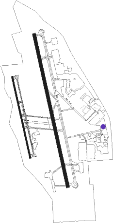
Runway info
Runway 16 / 34  | ||
| length | 2293m (7523ft) | |
| bearing | 170° / 350° | |
| width | 46m (150ft) | |
| surface | concrete | |
| blast zone | 91m (299ft) / 61m (200ft) | |
| Runway 17 / 35 | ||
| length | 1225m (4019ft) | |
| bearing | 170° / 350° | |
| width | 23m (75ft) | |
| surface | asphalt | |
| blast zone | 61m (200ft) / 61m (200ft) | |
Nearby beacons
| code | identifier | dist | bearing | frequency |
|---|---|---|---|---|
| FT | MUFIN (FORT WORTH) NDB | 4.6 | 353° | 365 |
| NFW | NAS JRB FORT WORTH (FT WO TACAN | 4.6 | 240° | 108.70 |
| FUZ | RANGER (DALLAS-FORT WORTH VORTAC | 10.3 | 68° | 115.70 |
| TTT | MAVERICK VOR/DME | 16.6 | 81° | 113.10 |
| CVE | COWBOY (DALLAS) VOR/DME | 23.6 | 81° | 116.20 |
| DT | PINCK (DENTON) NDB | 29.3 | 20° | 257 |
| MQP | MILLSAP (MINERAL WELLS) VORTAC | 32.4 | 262° | 117.70 |
| PQF | MESQUITE NDB | 42.1 | 90° | 248 |
| JEN | GLEN ROSE TACAN | 47.2 | 218° | 115 |
| UKW | BOWIE VORTAC | 49 | 328° | 117.15 |
| CGQ | POWELL (CORSICANA) NDB | 65.5 | 129° | 344 |
| CRS | CORSICANA NDB | 68.1 | 129° | 396 |
Departure and arrival routes
| Transition altitude | 18000ft |
| Transition level | 18000ft |
| SID end points | distance | outbound heading | |
|---|---|---|---|
| ALL | |||
| TEX1 | 96mi | 13° | |
| DALL8 | 171mi | 78° | |
| KUSSO8 | 200mi | 99° | |
| GARL1 | 103mi | 103° | |
| JPOOL3 | 78mi | 168° | |
| SWABR8 | 101mi | 262° | |
| WORTH7 | 292mi | 287° | |
| STAR starting points | distance | inbound heading | |
|---|---|---|---|
| ALL | |||
| LIKES3 | 27.7 | 46° | |
| MOTZA1, WESAT2 | 32.8 | 141° | |
| SASIE6, TRUUK2 | 54.2 | 230° | |
| DODJE6, REEKO3 | 50.7 | 304° | |
Instrument approach procedures
| runway | airway (heading) | route (dist, bearing) |
|---|---|---|
| RW16 | UKW (148°) | UKW FOXEB (36mi, 148°) 3000ft WOROD (5mi, 83°) 3000ft |
| RW16 | WOROD (171°) | WOROD 3000ft |
| RNAV | WOROD 3000ft MESDE (6mi, 170°) 2500ft KFTW (6mi, 173°) 767ft PAXXE (11mi, 169°) 3000ft PAXXE (turn) | |
| RW34 | BARGO (356°) | BARGO PAXXE (12mi, 2°) 3000ft |
| RW34 | CURLE (10°) | CURLE PAXXE (5mi, 52°) 3000ft |
| RW34 | PAXXE (349°) | PAXXE 3000ft |
| RNAV | PAXXE 3000ft DOJED (6mi, 350°) 2200ft WAGMU (2mi, 350°) 1560ft KFTW (3mi, 346°) 734ft (5777mi, 109°) 880ft WOROD (5777mi, 289°) 3000ft WOROD (turn) |
Holding patterns
| STAR name | hold at | type | turn | heading* | altitude | leg | speed limit |
|---|---|---|---|---|---|---|---|
| DODJE6 | CAPTI | VHF | left | 73 (253)° | 1.0min timed | ICAO rules | |
| DODJE6 | CQY | NDB | left | 95 (275)° | < 60000ft | 1.0min timed | ICAO rules |
| DODJE6 | GGG | NDB | right | 114 (294)° | < 17999ft | 1.0min timed | ICAO rules |
| DODJE6 | HERRI | VHF | left | 101 (281)° | 1.0min timed | ICAO rules | |
| DODJE6 | WEIRS | VHF | left | 128 (308)° | < 17999ft | 1.0min timed | ICAO rules |
| LIKES3 | BRRUS | VHF | right | 260 (80)° | DME 10.0mi | ICAO rules | |
| LIKES3 | FOSSL | VHF | right | 205 (25)° | DME 10.0mi | ICAO rules | |
| MOTZA1 | ACKME | VHF | right | 15 (195)° | 1.0min timed | ICAO rules | |
| MOTZA1 | HEATR | VHF | left | 299 (119)° | 1.5min timed | ICAO rules | |
| MOTZA1 | KAJAY | VHF | right | 283 (103)° | 1.5min timed | ICAO rules | |
| MOTZA1 | MOOSE | VHF | left | 15 (195)° | 1.0min timed | ICAO rules | |
| MOTZA1 | PLEBS | VHF | left | 283 (103)° | 1.0min timed | ICAO rules | |
| MOTZA1 | SPS | NDB | left | 348 (168)° | 1.0min timed | ICAO rules | |
| MOTZA1 | TURKI | VHF | right | 266 (86)° | 1.5min timed | ICAO rules | |
| MOTZA1 | UKW | NDB | left | 283 (103)° | 1.0min timed | ICAO rules | |
| MOTZA1 | ZANTO | VHF | left | 283 (103)° | 1.5min timed | ICAO rules | |
| REEKO3 | PURRS | VHF | left | 136 (316)° | DME 10.0mi | ICAO rules | |
| REEKO3 | VDUBB | VHF | left | 83 (263)° | DME 10.0mi | ICAO rules | |
| SASIE6 | BIRLE | VHF | right | 35 (215)° | 1.5min timed | ICAO rules | |
| SASIE6 | BYP | NDB | right | 45 (225)° | < 60000ft | 1.0min timed | ICAO rules |
| SASIE6 | GAATZ | VHF | right | 35 (215)° | 1.0min timed | ICAO rules | |
| SASIE6 | GLOVE | VHF | right | 64 (244)° | 18000ft - 45000ft | 1.5min timed | ICAO rules |
| SASIE6 | ROBEY | VHF | left | 64 (244)° | 1.0min timed | ICAO rules | |
| TRUUK2 | PRIZZ | VHF | left | 38 (218)° | DME 10.0mi | ICAO rules | |
| WESAT2 | FAWNT | VHF | right | 360 (180)° | DME 10.0mi | ICAO rules | |
| WESAT2 | FLOWN | VHF | left | 285 (105)° | DME 10.0mi | ICAO rules | |
| WESAT2 | GREKE | VHF | left | 287 (107)° | DME 10.0mi | ICAO rules | |
| WESAT2 | ROTTR | VHF | left | 355 (175)° | DME 10.0mi | ICAO rules | |
| WESAT2 | TURKI | VHF | right | 266 (86)° | 1.5min timed | ICAO rules | |
| *) magnetic outbound (inbound) holding course | |||||||
Disclaimer
The information on this website is not for real aviation. Use this data with the X-Plane flight simulator only! Data taken with kind consent from X-Plane 12 source code and data files. Content is subject to change without notice.