Atlanta - Fulton County-brown Field
Airport details
| Country | United States of America |
| State | Georgia |
| Region | K7 |
| Airspace | Atlanta Ctr |
| Municipality | Fulton County |
| Elevation | 838ft (255m) |
| Timezone | GMT -5 |
| Coordinates | 33.77913, -84.52137 |
| Magnetic var | |
| Type | land |
| Available since | X-Plane v10.40 |
| ICAO code | KFTY |
| IATA code | FTY |
| FAA code | FTY |
Communication
| Fulton County-Brown Field ATIS | 120.175 |
| Fulton County-Brown Field CTAF | 118.500 |
| Fulton County-Brown Field UNICOM | 122.950 |
| Fulton County-Brown Field Ground Control | 121.700 |
| Fulton County-Brown Field COUNTY Tower | 118.500 |
| Fulton County-Brown Field ATLANTA Approach/Departure | 121.000 |
Approach frequencies
| ILS-cat-I | RW08 | 109.1 | 18.00mi |
| 3° GS | RW08 | 109.1 | 18.00mi |
Nearby Points of Interest:
Riverview Carousel
-Judge William Wilson House
-Whittier Mill Village
-Robert Mable House and Cemetery
-Ruff's Mill and Concord Covered Bridge
-Utoy Cemetery
-Goat Farm Arts Center
-West End Historic District
-Fountain Hall
-Means Street Historic District
-Southern Belting Company Building
-Hotel Row Historic District
-Techwood Homes
-Glenn Building
-Elbert P. Tuttle United States Court of Appeals Building
-Baltimore Block
-J. Mack Robinson College of Business Administration Building
-Fulton County Courthouse
-Carnegie Building
-Flatiron Building
-Rhodes-Haverty Building
-Fire Station No. 11
-Atlanta City Hall
-Fox Theatre Historic District
-Candler Building
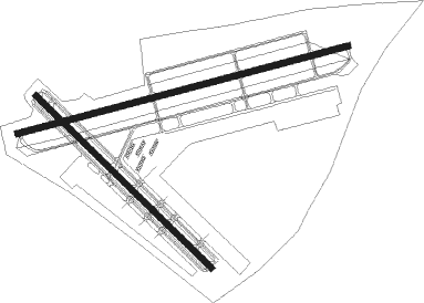
Runway info
Runway 8 / 26  | ||
| length | 1763m (5784ft) | |
| bearing | 81° / 261° | |
| width | 30m (100ft) | |
| surface | asphalt | |
| Runway 14 / 32 | ||
| length | 1268m (4160ft) | |
| bearing | 134° / 314° | |
| width | 30m (100ft) | |
| surface | asphalt | |
| displ threshold | 0m (0ft) / 61m (200ft) | |
Nearby beacons
| code | identifier | dist | bearing | frequency |
|---|---|---|---|---|
| AT | CATTA (ATLANTA) NDB | 8 | 189° | 375 |
| DOB | DOBBINS (MARIETTA) TACAN | 8.1 | 6° | 113 |
| ATL | ATLANTA VORTAC | 9.9 | 150° | 116.90 |
| PDK | PEACHTREE (ATLANTA) VOR/DME | 12.5 | 67° | 116.60 |
| DJD | CHERO NDB | 28.4 | 4° | 415 |
| FFC | PECAT (ATLANTA) NDB | 28.7 | 176° | 316 |
| EQQ | COWETA COUNTY (NEWNAN) NDB | 32.8 | 200° | 234 |
| GPQ | CARROLLTON NDB | 33 | 251° | 278 |
| TX | GWNET (LAWRENCEVILLE) NDB | 35.8 | 70° | 419 |
| RMG | ROME VORTAC | 37.6 | 303° | 115.40 |
| VOF | ALCOVY (COVINGTON) NDB | 38 | 101° | 370 |
| FKV | FLOWERY BRANCH (GAINESVILLE) NDB | 39.8 | 55° | 365 |
| BMW | BARROW COUNTY (WINDER) NDB | 47.4 | 80° | 404 |
| OP | YATES (THOMASTON) NDB | 54.2 | 159° | 339 |
| LGC | LA GRANGE VORTAC | 55.6 | 223° | 115.60 |
Departure and arrival routes
| Transition altitude | 18000ft |
| Transition level | 18000ft |
| STAR starting points | distance | inbound heading | |
|---|---|---|---|
| ALL | |||
| DIFFI4 | 55.6 | 43° | |
| BOKRT3 | 44.0 | 50° | |
| SWTEE2 | 33.1 | 106° | |
| BUKHD3 | 52.0 | 140° | |
| DEHAN3 | 49.8 | 217° | |
| WRGNZ3 | 48.8 | 295° | |
Instrument approach procedures
| runway | airway (heading) | route (dist, bearing) |
|---|---|---|
| RW08-Y | CAVEB (81°) | CAVEB 3000ft |
| RNAV | CAVEB 3000ft FABMA (9mi, 81°) 3000ft WUPLA (4mi, 81°) 1700ft KFTY (3mi, 82°) 860ft (5132mi, 112°) 1600ft MIKEE (5151mi, 292°) 3000ft MIKEE (turn) | |
| RW08-Z | MIKEE (94°) | MIKEE CAVEB (6mi, 134°) 3000ft |
| RW08-Z | TIINI (81°) | TIINI CAVEB (11mi, 81°) 3000ft |
| RNAV | CAVEB 3000ft FABMA (9mi, 81°) 3000ft KFTY (7mi, 82°) 860ft (5132mi, 112°) 1600ft MIKEE (5151mi, 292°) 3000ft MIKEE (turn) | |
| RW26 | CCATT (217°) | CCATT KBEAR (22mi, 200°) 4000ft OVZET (7mi, 186°) 3600ft |
| RW26 | SKYME (287°) | SKYME CADUR (18mi, 337°) 4000ft OVZET (21mi, 269°) 3600ft |
| RNAV | OVZET 3600ft EYLIM (6mi, 261°) 2600ft BACAG (2mi, 261°) 1940ft KFTY (4mi, 261°) 864ft (5132mi, 112°) 1241ft MIKEE (5151mi, 292°) 3000ft MIKEE (turn) |
Holding patterns
| STAR name | hold at | type | turn | heading* | altitude | leg | speed limit |
|---|---|---|---|---|---|---|---|
| BUKHD3 | HLNDS | VHF | right | 327 (147)° | DME 10.0mi | ICAO rules | |
| DEHAN3 | AWSON | VHF | left | 29 (209)° | DME 10.0mi | ICAO rules | |
| DEHAN3 | TRALZ | VHF | right | 32 (212)° | DME 10.0mi | ICAO rules | |
| DIFFI4 | LGC | NDB | right | 228 (48)° | 1.0min timed | ICAO rules | |
| SWTEE2 | BIZKT | VHF | left | 292 (112)° | DME 10.0mi | ICAO rules | |
| *) magnetic outbound (inbound) holding course | |||||||
Disclaimer
The information on this website is not for real aviation. Use this data with the X-Plane flight simulator only! Data taken with kind consent from X-Plane 12 source code and data files. Content is subject to change without notice.