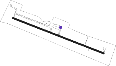
Frenchville - Northern Aroostook Regl
Airport details
| Country | United States of America |
| State | Maine |
| Region | K6 |
| Airspace | Boston Ctr |
| Municipality | Frenchville |
| Elevation | 985ft (300m) |
| Timezone | GMT -5 |
| Coordinates | 47.28550, -68.31272 |
| Magnetic var | |
| Type | land |
| Available since | X-Plane v10.40 |
| ICAO code | KFVE |
| IATA code | WFK |
| FAA code | FVE |
Communication
| Northern Aroostook Regl ASOS | 135.725 |
| Northern Aroostook Regl CTAF/UNICOM | 122.800 |
Nearby Points of Interest:
Isaie and Scholastique Martin House
-Acadian Landing Site
-Edmundston Station
-Cathédrale de l'Immaculée-Conception d'Edmundston
-Edmundston station
-Musée Culturel du Mont-Carmel
-Fort Kent Railroad Station
-Acadian Village
-Governor Brann School
-Pont Romain-Caron
-Gustaf Adolph Lutheran Church
Runway info
| Runway 14 / 32 | ||
| length | 1399m (4590ft) | |
| bearing | 108° / 288° | |
| width | 23m (75ft) | |
| surface | asphalt | |
Nearby beacons
| code | identifier | dist | bearing | frequency |
|---|---|---|---|---|
| PQI | PRESQUE ISLE VOR/DME | 31.9 | 157° | 116.40 |
Instrument approach procedures
| runway | airway (heading) | route (dist, bearing) |
|---|---|---|
| RW14 | CESGE (108°) | CESGE 3100ft |
| RW14 | FOMEP (91°) | FOMEP CESGE (5mi, 35°) 3100ft |
| RNAV | CESGE 3100ft AGZAF (6mi, 108°) 2600ft JELUB (2mi, 108°) 2020ft KFVE (4mi, 108°) 1016ft (4533mi, 125°) 1270ft BIROW (4522mi, 305°) 3000ft BIROW (turn) | |
| RW32 | BIROW (288°) | BIROW 6000ft BIROW (turn) 3000ft |
| RW32 | RAWNE (321°) | RAWNE BIROW (8mi, 35°) 3000ft |
| RW32 | YIGUC (263°) | YIGUC BIROW (8mi, 215°) 3000ft |
| RNAV | BIROW 3000ft AHHOT (6mi, 288°) 2600ft KFVE (5mi, 288°) 1027ft (4533mi, 125°) 1187ft CESGE (4544mi, 305°) 3100ft CESGE (turn) |
Disclaimer
The information on this website is not for real aviation. Use this data with the X-Plane flight simulator only! Data taken with kind consent from X-Plane 12 source code and data files. Content is subject to change without notice.
