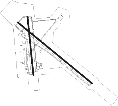
Longview - East Texas Rgnl
Airport details
| Country | United States of America |
| State | Texas |
| Region | K4 |
| Airspace | Ft Worth Ctr |
| Municipality | Gregg County |
| Elevation | 365ft (111m) |
| Timezone | GMT -6 |
| Coordinates | 32.38401, -94.71149 |
| Magnetic var | |
| Type | land |
| Available since | X-Plane v10.40 |
| ICAO code | KGGG |
| IATA code | GGG |
| FAA code | GGG |
Communication
| East Texas Rgnl ATIS | 119.650 |
| East Texas Rgnl CTAF | 119.200 |
| East Texas Rgnl Ground Control | 121.600 |
| East Texas Rgnl Tower | 119.200 |
| East Texas Rgnl LONGVIEW Approach/Departure WEST | 124.675 |
| East Texas Rgnl LONGVIEW Approach/Departure EAST | 124.275 |
Approach frequencies
| ILS-cat-I | RW13 | 109.5 | 18.00mi |
| 3° GS | RW13 | 109.5 | 18.00mi |
Nearby Points of Interest:
Henderson Commercial Historic District
-Arnot House
-Fry-Barry House
-James Turner House
-Sam B. Hall, Jr. Federal Building and United States Courthouse
-Old Harrison County Courthouse
-Ginocchio Historic District
-Hagerty House
-Florence Robinson Cottage
-Presbyterian Manse
-Old United States Post Office and Courts Building
-Jefferson Historic District
-Jefferson Ordnance Magazine
-The Grove
-Cotton Belt Depot Museum
-Ramey House
-Blackstone Building
-Elks Club Building
-People's National Bank Building
-Jenkins-Harvey Super Service Station and Garage
-Carnegie Public Library
-William M. Steger Federal Building and United States Courthouse
-Marvin Methodist Episcopal Church, South
-St. John's AF & AM Lodge
-Tyler City Hall

Nearby beacons
| code | identifier | dist | bearing | frequency |
|---|---|---|---|---|
| GGG | GREGG CO. (LONGVIEW) VORTAC | 2.9 | 309° | 112.90 |
| GG | VEELS (LONGVIEW) NDB | 6.1 | 310° | 410 |
| ABG | AMBASSADOR (BIG SANDY) NDB | 23.6 | 297° | 404 |
| RPF | CARTHAGE NDB | 24.3 | 116° | 332 |
| TYR | TYLER VOR/DME | 35.1 | 268° | 114.20 |
| CZJ | AMASON (CENTER) NDB | 43.5 | 135° | 341 |
| UIM | DME | 44.5 | 307° | 114 |
| FZT | FRANKSTON VOR/DME | 45.5 | 249° | 111.40 |
| ATA | ATLANTA NDB | 50.6 | 36° | 347 |
| EIC | BELCHER (SHREVEPORT) VORTAC | 51.2 | 67° | 117.40 |
| OC | NADOS (NACOGDOCHES) NDB | 53.9 | 181° | 253 |
| SLR | SULPHUR SPRINGS VOR/DME | 64.4 | 314° | 109 |
Instrument approach procedures
| runway | airway (heading) | route (dist, bearing) |
|---|---|---|
| RW13 | AWLAR (127°) | AWLAR BOSME (10mi, 125°) 2600ft |
| RW13 | GGG (129°) | GGG BOSME (10mi, 309°) 2600ft BOSME (turn) 2600ft |
| RW13 | GODHO (91°) | GODHO EYEPI (5mi, 352°) 2600ft BOSME (5mi, 49°) 2600ft |
| RW13 | NEVER (200°) | NEVER CAPSO (11mi, 258°) 2600ft BOSME (5mi, 229°) 2600ft |
| RNAV | BOSME 2600ft WALTS (6mi, 129°) 2300ft TOKUY (3mi, 129°) 1200ft KGGG (3mi, 130°) 400ft (5644mi, 109°) 612ft FANAL (5635mi, 289°) 3000ft FANAL (turn) | |
| RW18 | AWLAR (127°) | AWLAR APIRE (17mi, 98°) 2600ft |
| RW18 | GGG (129°) | GGG APIRE (11mi, 10°) 2600ft APIRE (turn) 2600ft |
| RW18 | WORKS (243°) | WORKS NEVER (15mi, 281°) 2600ft APIRE (6mi, 248°) 2600ft |
| RNAV | APIRE 2600ft EMODE (6mi, 179°) 2200ft ZITAB (3mi, 179°) 1100ft KGGG (3mi, 173°) 407ft (5644mi, 109°) 628ft AMUTE (5644mi, 289°) PIPES (6mi, 198°) 2400ft PIPES (turn) | |
| RW31 | ARMOR (1°) | ARMOR AROBE (33mi, 14°) 3000ft FANAL (5mi, 48°) 3000ft |
| RW31 | CARTH (296°) | CARTH FANAL (19mi, 287°) 3000ft |
| RW31 | GGG (129°) | GGG FANAL (16mi, 129°) 3000ft FANAL (turn) 3000ft |
| RW31 | GIDER (267°) | GIDER EDUDE (13mi, 243°) 3000ft FANAL (5mi, 228°) 3000ft |
| RNAV | FANAL 3000ft BETSE (6mi, 309°) 2200ft JUPAT (3mi, 309°) 1200ft KGGG (3mi, 308°) 404ft BOSME (13mi, 309°) 2600ft BOSME (turn) | |
| RW36 | GGG (129°) | GGG PIPES (14mi, 178°) 2400ft PIPES (turn) 2400ft |
| RW36 | GODHO (91°) | GODHO DIDRE (12mi, 150°) 2800ft PIPES (5mi, 103°) 2400ft |
| RW36 | SPOUT (294°) | SPOUT BITBE (11mi, 224°) 2400ft PIPES (5mi, 283°) 2400ft |
| RNAV | PIPES 2400ft AMUTE (6mi, 18°) 2200ft BOYAN (3mi, 359°) 1380ft KGGG (3mi, 4°) 417ft APIRE (13mi, 357°) 2600ft APIRE (turn) |
Disclaimer
The information on this website is not for real aviation. Use this data with the X-Plane flight simulator only! Data taken with kind consent from X-Plane 12 source code and data files. Content is subject to change without notice.