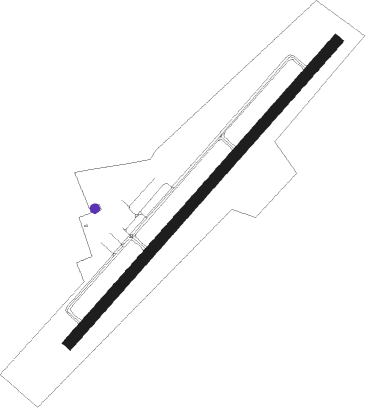
Marshfield - Marshfield Muni G Harlow Field
Airport details
| Country | United States of America |
| State | Massachusetts |
| Region | K6 |
| Airspace | Boston Ctr |
| Municipality | Marshfield |
| Elevation | 7ft (2m) |
| Timezone | GMT -5 |
| Coordinates | 42.09750, -70.67302 |
| Magnetic var | |
| Type | land |
| Available since | X-Plane v10.40 |
| ICAO code | KGHG |
| IATA code | GHG |
| FAA code | GHG |
Communication
| Marshfield Muni G Harlow Field AWOS 3 | 120.000 |
| Marshfield Muni G Harlow Field CTAF/UNICOM | 122.800 |
| Marshfield Muni G Harlow Field BOSTON Approach/Departure | 124.100 |
Nearby Points of Interest:
Thomas-Webster Estate
-Isaac Winslow House
-Pillsbury Summer House
-Cove Street Historic District
-Wright Memorial Library
-King Caesar House
-John and Priscilla Alden Family Sites
-Captain Daniel Bradford House
-Capt. Gamaliel Bradford House
-Capt. Gershom Bradford House
-Old Town Hall Historic District
-Hatch Homestead and Mill Historic District
-Tarkiln School
-Stetson-Ford House
-Alexander Standish House
-Pembroke Friends Meetinghouse
-The Tack Factory
-Bryant-Cushing House
-Frederic C. Adams Public Library
-Kingston Center Historic District
-Bradford House
-Stetson House
-Hanover Center Historic District
-Plymouth Antiquarian House
-Bartlett-Russell-Hedge House
Nearby beacons
| code | identifier | dist | bearing | frequency |
|---|---|---|---|---|
| PVC | PROVINCETOWN NDB | 20.1 | 94° | 389 |
| OW | STOGE (NORWOOD) NDB | 20.3 | 273° | 397 |
| BOS | BOSTON VOR/DME | 21 | 309° | 112.70 |
| FMH | OTIS (FALMOUTH) TACAN | 27.2 | 160° | 115.80 |
| LFV | MARCONI (NORTH TRURO) VOR/DME | 28.7 | 97° | 114.70 |
| HY | BOGEY (HYANNIS) NDB | 31 | 129° | 342 |
| CQX | NAUSET (CHATHAM) NDB | 39.1 | 121° | 279 |
| PVD | PROVIDENCE VOR/DME | 40.5 | 244° | 115.60 |
| MVY | MARTHA'S VINEYARD VOR/DME | 42.2 | 175° | 114.50 |
| LWM | DME | 42.9 | 327° | 112.50 |
| MHT | MANCHESTER VOR/DME | 55.6 | 318° | 114.40 |
| ACK | NANTUCKET VOR/DME | 56.9 | 142° | 116.20 |
| MJ | FITZY (MANCHESTER) NDB | 59.6 | 312° | 209 |
| PSM | (PORTSMOUTH) DME | 59.6 | 351° | 116.50 |
| SEY | SANDY POINT (BLOCK ISLAND VOR/DME | 69 | 224° | 117.80 |
Departure and arrival routes
| Transition altitude | 18000ft |
| Transition level | 18000ft |
| STAR starting points | distance | inbound heading | |
|---|---|---|---|
| ALL | |||
| WOONS2 | 67.6 | 68° | |
Instrument approach procedures
| runway | airway (heading) | route (dist, bearing) |
|---|---|---|
| RW06 | BOS (129°) | BOS JUDMU (23mi, 174°) 2000ft MONSO (5mi, 91°) 2000ft |
| RNAV | MONSO 2000ft HUDPO (5mi, 54°) 1700ft KGHG (5mi, 54°) 50ft (4551mi, 121°) 800ft JUDMU (4562mi, 301°) 2000ft JUDMU (turn) | |
| RW24 | BOS (129°) | BOS TONNI (17mi, 88°) 3300ft WUGNI (10mi, 138°) 2000ft |
| RW24 | GAILS (310°) | GAILS VUPBU (17mi, 2°) 2000ft WUGNI (6mi, 308°) 2000ft |
| RNAV | WUGNI 2000ft HUDAG (6mi, 234°) 1700ft KGHG (5mi, 234°) 44ft (4551mi, 121°) 359ft WUGLA (4553mi, 301°) JUDMU (11mi, 251°) 2000ft JUDMU (turn) |
Holding patterns
| STAR name | hold at | type | turn | heading* | altitude | leg | speed limit |
|---|---|---|---|---|---|---|---|
| WOONS2 | ORW | NDB | left | 238 (58)° | 2500ft - 17500ft | 1.0min timed | ICAO rules |
| WOONS2 | WOONS | VHF | left | 240 (60)° | < 17999ft | 1.0min timed | ICAO rules |
| *) magnetic outbound (inbound) holding course | |||||||
Disclaimer
The information on this website is not for real aviation. Use this data with the X-Plane flight simulator only! Data taken with kind consent from X-Plane 12 source code and data files. Content is subject to change without notice.