Glenwood - Glenwood Muni
Airport details
| Country | United States of America |
| State | Minnesota |
| Region | K3 |
| Airspace | Minneapolis Ctr |
| Municipality | Glenwood |
| Elevation | 1393ft (425m) |
| Timezone | GMT -6 |
| Coordinates | 45.64383, -95.32045 |
| Magnetic var | |
| Type | land |
| Available since | X-Plane v10.40 |
| ICAO code | KGHW |
| IATA code | n/a |
| FAA code | GHW |
Communication
| Glenwood Muni CTAF | 122.900 |
Nearby Points of Interest:
Pope County Courthouse
-Glenwood Public Library
-Fremad Association Building
-Northern Pacific Depot
-Daniel Pennie House
-Little Falls and Dakota Depot
-Urjans Iverson House
-Great Northern Passenger Depot
-Saint Cloud and Red River Valley Stage Road–Kandota Section
-Original Main Street Historic District
-Minnesota Home School for Girls Historic District
-Christopher Borgerding House
-Monson Lake State Park CCC/WPA/Rustic Style Historic Resources
-Church of St. Boniface
-Church of St. Francis Xavier
-Christ Episcopal Church
-Church of St. Bridget-Catholic
-Morris Industrial School for Indians
-Sabin S. Murdock House
-Swany White Flour Mills
-Church of the Sacred Heart
-Todd County Courthouse, Sheriff's House, and Jail
-Bank of Long Prairie
-Batcher Opera House Block
-Hotel Reichert
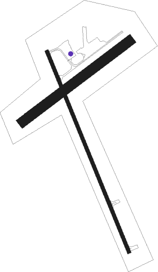
Runway info
Runway 15 / 33  | ||
| length | 1372m (4501ft) | |
| bearing | 155° / 335° | |
| width | 23m (75ft) | |
| surface | asphalt | |
| Runway 05 / 23 | ||
| length | 846m (2776ft) | |
| bearing | 66° / 246° | |
| width | 64m (209ft) | |
| surface | grass | |
Nearby beacons
| code | identifier | dist | bearing | frequency |
|---|---|---|---|---|
| AXN | ALEXANDRIA VOR/DME | 19.2 | 16° | 112.80 |
| MOX | MORRIS VOR/DME | 27.6 | 263° | 109.60 |
| BDH | WILLMAR VOR/DME | 32.6 | 160° | 113.70 |
| MVE | MONTEVIDEO VOR/DME | 43.5 | 210° | 111.60 |
| FF | HAMRE (FERGUS FALLS) NDB | 46.3 | 308° | 337 |
| XCR | RIPLEY NDB | 48.5 | 66° | 404 |
| DWN | DARWIN VORTAC | 49.5 | 123° | 109 |
| FFM | FERGUS FALLS VOR/DME | 52.1 | 308° | 110.40 |
Instrument approach procedures
| runway | airway (heading) | route (dist, bearing) |
|---|---|---|
| RW15 | ZALGU (155°) | ZALGU 3000ft |
| RNAV | ZALGU 3000ft WIVTA (8mi, 155°) 3000ft HUVGO (3mi, 155°) 1940ft KGHW (2mi, 155°) 1436ft (5628mi, 116°) 1641ft ITVOY (5625mi, 296°) 3000ft ITVOY (turn) | |
| RW33 | ITVOY (336°) | ITVOY 3000ft |
| RNAV | ITVOY 3000ft KODMY (8mi, 335°) 3000ft JUVCA (3mi, 335°) 1880ft KGHW (2mi, 336°) 1422ft (5628mi, 116°) 1627ft ZALGU (5632mi, 296°) 3000ft ZALGU (turn) |
Disclaimer
The information on this website is not for real aviation. Use this data with the X-Plane flight simulator only! Data taken with kind consent from X-Plane 12 source code and data files. Content is subject to change without notice.