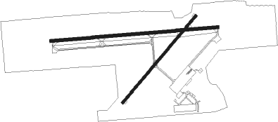
Three Rivers - Three Rivers Muni Dr Haines
Airport details
| Country | United States of America |
| State | Michigan |
| Region | K5 |
| Airspace | Chicago Ctr |
| Municipality | Three Rivers |
| Elevation | 824ft (251m) |
| Timezone | GMT -5 |
| Coordinates | 41.95975, -85.59306 |
| Magnetic var | |
| Type | land |
| Available since | X-Plane v10.40 |
| ICAO code | KHAI |
| IATA code | HAI |
| FAA code | HAI |
Communication
| THREE RIVERS MUNI DR HAINES AWOS 3 | 119.975 |
| THREE RIVERS MUNI DR HAINES CTAF/UNICOM | 122.800 |
| THREE RIVERS MUNI DR HAINES KALAMAZOO Approach/Departure | 121.200 |
Nearby Points of Interest:
Downtown Three Rivers Commercial Historic District
-Leverett and Amanda Clapp House
-St. Joseph County Courthouse
-Marantette House
-Governor John S. Barry House
-Constantine Historic Commercial District
-Art Gallery Building
-General Land Office
-Wahbememe Burial Site and Monument
-Fanckboner-Nichols Farmstead
-Carroll Jones House
-G. W. Jones House
-Star Milling and Electric Company Historic District
-John Badlam Howe Mansion
-Samuel P. Williams House
-Booth-Dunham Estate
-George Newton House
-Ezra E. and Florence (Holmes) Beardsley House
-St. John of the Cross Episcopal Church
-Andrew J. Stevens House
-Mason District Number 5 Schoolhouse
-Solomon Fowler Mansion
-Kalamazoo State Hospital Water Tower
-Portage Street Fire Station
-State Hospital Gatehouse

Nearby beacons
| code | identifier | dist | bearing | frequency |
|---|---|---|---|---|
| AZ | AUSTN (KALAMAZOO) NDB | 10.6 | 20° | 371 |
| IRS | STURGIS NDB | 11.3 | 133° | 382 |
| AZO | KALAMAZOO VOR/DME | 16.7 | 8° | 109 |
| ELX | KEELER VOR/DME | 26 | 289° | 116.60 |
| BT | BATOL (BATTLE CREEK) NDB | 30.2 | 45° | 272 |
| SB | MISHA (SOUTH BEND) NDB | 31.8 | 248° | 341 |
| GSH | GOSHEN VORTAC | 32.5 | 225° | 113.70 |
| GIJ | GIPPER (NILES) VORTAC | 34.4 | 255° | 115.40 |
| LFD | LITCHFIELD VOR/DME | 37.4 | 83° | 111.20 |
| PMM | PULLMAN VOR/DME | 37.9 | 315° | 112.10 |
| OLK | WEBSTER LAKE VOR | 43 | 172° | 110.40 |
| GW | SHENK (AUBURN) NDB | 48.7 | 135° | 227 |
| VIO | VICTORY VOR/DME | 49.8 | 7° | 115.95 |
| GR | KNOBS (GRAND RAPIDS) NDB | 57 | 13° | 263 |
| FWA | FORT WAYNE VORTAC | 61.6 | 158° | 117.80 |
Instrument approach procedures
| runway | airway (heading) | route (dist, bearing) |
|---|---|---|
| RW27 | IJYEP (270°) | IJYEP 3000ft |
| RW27 | LUPXA (250°) | LUPXA 3000ft IJYEP (5mi, 180°) 3000ft |
| RW27 | OBMUY (289°) | OBMUY 3000ft IJYEP (5mi, 360°) 3000ft |
| RNAV | IJYEP 3000ft ERZEH (5mi, 270°) 2500ft 15THR (4mi, 270°) 1320ft KHAI (2mi, 269°) 873ft (5208mi, 116°) 1224ft IJJUB (5219mi, 296°) 3000ft IJJUB (turn) |
Disclaimer
The information on this website is not for real aviation. Use this data with the X-Plane flight simulator only! Data taken with kind consent from X-Plane 12 source code and data files. Content is subject to change without notice.