Hampton - Hampton Muni
Airport details
| Country | United States of America |
| State | Iowa |
| Region | K3 |
| Airspace | Minneapolis Ctr |
| Municipality | Hampton |
| Elevation | 1174ft (358m) |
| Timezone | GMT -6 |
| Coordinates | 42.72369, -93.22633 |
| Magnetic var | |
| Type | land |
| Available since | X-Plane v10.40 |
| ICAO code | KHPT |
| IATA code | HPT |
| FAA code | HPT |
Communication
| Hampton Muni CTAF/UNICOM | 122.700 |
Nearby Points of Interest:
Dr. O.B. Harriman House
-Franklin County Courthouse
-Franklin County G. A. R. Soldiers' Memorial Hall
-Hampton Double Square Historic District
-Franklin County Sheriff's Residence and Jail
-Reeve Electric Association Plant
-Maysville Schoolhouse
-Leander Reeve House
-Herman Wood Round Barn
-Union Cemetery Gardener's Cottage
-Mills Tower Historic District
-Iowa Falls Union Depot
-Carnegie-Ellsworth Public Library
-United States Post Office
-Estes Park Band Shell
-Sentinel Block
-W.R.C. Hall
-Ellsworth-Jones Building
-First National Bank
-Princess Sweet Shop
-McClanahan Block
-Washington Avenue Bridge
-Glenn and Nell Kurtz Lustron Home and Garage
-Quasdorf Blacksmith and Wagon Shop
-Burlington, Cedar Rapids & Northern Passenger Depot-Dows
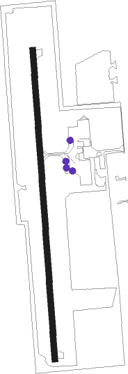
Runway info
| Runway 17 / 35 | ||
| length | 1227m (4026ft) | |
| bearing | 181° / 1° | |
| width | 23m (75ft) | |
| surface | concrete | |
Nearby beacons
| code | identifier | dist | bearing | frequency |
|---|---|---|---|---|
| MC | SURFF (MASON CITY) NDB | 20.2 | 343° | 348 |
| MCW | MASON CITY VOR/DME | 22.7 | 344° | 114.90 |
| IY | CHUKK (CHARLES CITY) NDB | 32.9 | 51° | 417 |
| ALO | WATERLOO VOR/DME | 37.9 | 101° | 112.20 |
| JWJ | ELMWOOD (MARSHALTOWN) VOR/DME | 39.3 | 153° | 109.40 |
| JAY | AUSTIN VOR/DME | 52.9 | 20° | 108.20 |
| TNU | NEWTON VOR/DME | 56.6 | 173° | 112.50 |
| AEL | ALBERT LEA VOR/DME | 57.8 | 351° | 109.80 |
Instrument approach procedures
| runway | airway (heading) | route (dist, bearing) |
|---|---|---|
| RW17 | WIBUD (181°) | WIBUD 4000ft |
| RNAV | WIBUD 4000ft JIKJE (4mi, 181°) 2800ft UDUXE (3mi, 181°) 1880ft KHPT (2mi, 181°) 1216ft (5547mi, 115°) 1426ft WURLU (5548mi, 295°) 4000ft WURLU (turn) | |
| RW35 | WURLU (1°) | WURLU 4000ft |
| RNAV | WURLU 4000ft HOXEM (4mi, 1°) 2800ft HUKUN (2mi, 1°) 2020ft KHPT (3mi, 1°) 1199ft (5547mi, 115°) 1409ft WIBUD (5547mi, 295°) 4000ft WIBUD (turn) |
Disclaimer
The information on this website is not for real aviation. Use this data with the X-Plane flight simulator only! Data taken with kind consent from X-Plane 12 source code and data files. Content is subject to change without notice.