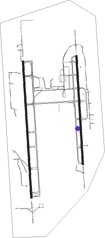
Huntsville - Huntsville Intl Carl T Jones Fld
Airport details
| Country | United States of America |
| State | Alabama |
| Region | K7 |
| Airspace | Memphis Ctr |
| Municipality | Huntsville |
| Elevation | 627ft (191m) |
| Timezone | GMT -6 |
| Coordinates | 34.63720, -86.77505 |
| Magnetic var | |
| Type | land |
| Available since | X-Plane v10.40 |
| ICAO code | KHSV |
| IATA code | HSV |
| FAA code | HSV |
Communication
| Huntsville Intl Carl T Jones Fld ATIS | 121.250 |
| Huntsville Intl Carl T Jones Fld CTAF | 127.600 |
| Huntsville Intl Carl T Jones Fld UNICOM | 122.950 |
| Huntsville Intl Carl T Jones Fld Clearance DEL | 120.350 |
| Huntsville Intl Carl T Jones Fld Ground Control | 121.900 |
| Huntsville Intl Carl T Jones Fld Tower | 127.600 |
| Huntsville Intl Carl T Jones Fld Approach | 118.750 |
| Huntsville Intl Carl T Jones Fld Approach | 118.050 |
| Huntsville Intl Carl T Jones Fld Approach | 125.600 |
| Huntsville Intl Carl T Jones Fld Departure | 118.050 |
| Huntsville Intl Carl T Jones Fld Departure | 125.600 |
Approach frequencies
| ILS-cat-II | RW18R | 109.3 | 18.00mi |
| ILS-cat-I | RW36L | 108.5 | 18.00mi |
| ILS-cat-I | RW36R | 109.55 | 18.00mi |
| ILS-cat-I | RW18L | 111.9 | 18.00mi |
| 3° GS | RW36L | 108.5 | 18.00mi |
| 3° GS | RW18R | 109.3 | 18.00mi |
| 3° GS | RW36R | 109.55 | 18.00mi |
| 3° GS | RW18L | 111.9 | 18.00mi |
Nearby Points of Interest:
James H. Bibb House
-Madison Station Historic District
-Wheeler National Wildlife Refuge Warden's Residence
-Neutral Buoyancy Simulator
-Belle Mina
-Saturn V Dynamic Test Stand
-Propulsion and Structural Test Facility
-William Lanford House
-Saturn V Dynamic Test Vehicle
-Pryor Field Regional Airport
-Merrimack Mill Village Historic District
-Lowe Mill
-Somerville Courthouse
-Green Pryor Rice House
-Rhea-McEntire House
-New Decatur–Albany Historic District
-Cotaco Opera House
-Shelta Cave
-Humphreys-Rodgers House
-Kelly Brothers and Rowe Building
-W. T. Hutchens Building
-Terry Hutchens Building
-Lombardo Building
-Beckers Block
-First National Bank
Nearby beacons
| code | identifier | dist | bearing | frequency |
|---|---|---|---|---|
| DCU | DME | 8.1 | 274° | 112.80 |
| RQZ | ROCKET (HUNTSVILLE) VORTAC | 11.8 | 41° | 112.20 |
| MSL | MUSCLE SHOALS VORTAC | 35.6 | 276° | 116.50 |
| GAD | GADSDEN VOR/DME | 52.4 | 134° | 112.30 |
| SYI | SHELBYVILLE VOR/DME | 57.9 | 20° | 113.55 |
| VUZ | VULCAN (BIRMINGHAM) VORTAC | 58.4 | 187° | 114.40 |
Instrument approach procedures
| runway | airway (heading) | route (dist, bearing) |
|---|---|---|
| RW18L | BISBE (184°) | BISBE 3000ft |
| RNAV | BISBE 3000ft COTIN (5mi, 181°) 2500ft DEBAY (2mi, 181°) 2100ft FEKSO (3mi, 181°) 1220ft KHSV (3mi, 193°) 664ft (5246mi, 112°) 809ft ENIKY (5245mi, 292°) 3000ft ENIKY (turn) | |
| RW18R | HAGUR (179°) | HAGUR 3000ft |
| RNAV | HAGUR 3000ft GETEC (5mi, 181°) 2500ft FEKER (2mi, 181°) 2100ft KHSV (5mi, 176°) 684ft (5246mi, 112°) 829ft BOSAC (5246mi, 292°) 3000ft BOSAC (turn) | |
| RW36L | BOSAC (3°) | BOSAC 2800ft |
| RNAV | BOSAC 2800ft CECAB (6mi, 1°) 2800ft HEREG (5mi, 1°) 1280ft KHSV (3mi, 9°) 664ft (5246mi, 112°) 815ft JASEX (5246mi, 292°) 3000ft JASEX (turn) | |
| RW36R | ENIKY (359°) | ENIKY 3000ft |
| RNAV | ENIKY 3000ft UJOTY (6mi, 1°) 2700ft NERTZ (4mi, 1°) 1280ft KHSV (3mi, 349°) 644ft (5246mi, 112°) 801ft BOLAY (5246mi, 292°) 3000ft BOLAY (turn) |
Disclaimer
The information on this website is not for real aviation. Use this data with the X-Plane flight simulator only! Data taken with kind consent from X-Plane 12 source code and data files. Content is subject to change without notice.

