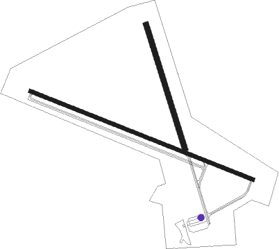
Hawthorne - Hawthorne Industrial
Airport details
| Country | United States of America |
| State | Nevada |
| Region | K2 |
| Airspace | Oakland Ctr |
| Municipality | Mineral County |
| Elevation | 4213ft (1284m) |
| Timezone | GMT -8 |
| Coordinates | 38.54508, -118.63240 |
| Magnetic var | |
| Type | land |
| Available since | X-Plane v10.40 |
| ICAO code | KHTH |
| IATA code | HTH |
| FAA code | HTH |
Communication
| Hawthorne Industrial CTAF/UNICOM | 122.800 |
Nearby Points of Interest:
Sixth Street School
-Hawthorne USO Building
-Mineral County Courthouse
-Aurora
Nearby beacons
| code | identifier | dist | bearing | frequency |
|---|---|---|---|---|
| MVA | MINA VORTAC | 28.1 | 88° | 115.10 |
| OAL | COALDALE VORTAC | 52 | 122° | 117.70 |
| NFL | FALLON TACAN | 52.4 | 355° | 113.50 |
| HZN | HAZEN VORTAC | 60.7 | 339° | 114.10 |
Instrument approach procedures
| runway | airway (heading) | route (dist, bearing) |
|---|---|---|
| RW28 | MVA (268°) | MVA KUWXU (6mi, 265°) 9800ft WUDIN (6mi, 262°) 7900ft |
| RNAV | WUDIN 7900ft OWILU (6mi, 242°) 7900ft YIYUR (3mi, 269°) 7500ft IGUVE (2mi, 291°) 6840ft PUBIW (3mi, 291°) 5580ft KHTH (4mi, 292°) 4279ft (6727mi, 108°) 4750ft ZICYO (6725mi, 288°) YERIN (13mi, 295°) 10000ft YERIN (turn) |
Disclaimer
The information on this website is not for real aviation. Use this data with the X-Plane flight simulator only! Data taken with kind consent from X-Plane 12 source code and data files. Content is subject to change without notice.

