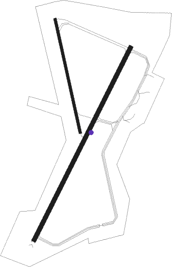
Houlton - Houlton Intl
Airport details
| Country | United States of America |
| State | Maine |
| Region | K6 |
| Airspace | Boston Ctr |
| Municipality | Houlton |
| Elevation | 485ft (148m) |
| Timezone | GMT -5 |
| Coordinates | 46.12461, -67.79236 |
| Magnetic var | |
| Type | land |
| Available since | X-Plane v10.40 |
| ICAO code | KHUL |
| IATA code | HUL |
| FAA code | HUL |
Communication
| Houlton Intl ASOS | 132.025 |
| Houlton Intl CTAF/UNICOM | 122.800 |
Nearby Points of Interest:
Unitarian Church of Houlton
-Cary Library
-Aroostook County Courthouse and Jail
-Market Square Historic District
-Walter P. Mansur House
-Blackhawk Putnam Tavern
-First National Bank of Houlton
-L. P. Fisher Public Library
-Meductic Indian Village / Fort Meductic
-Oakfield Grange, No. 414
-Oakfield Station
-William Sewall House
Nearby beacons
| code | identifier | dist | bearing | frequency |
|---|---|---|---|---|
| HUL | DME | 5.3 | 206° | 116.10 |
| PQI | PRESQUE ISLE VOR/DME | 40.9 | 335° | 116.40 |
| LNT | MILNOT (MILLINOCKET) NDB | 42.6 | 238° | 344 |
| MLT | MILLINOCKET VOR/DME | 44.2 | 233° | 117.90 |
| PNN | DME | 47.9 | 174° | 114.30 |
Instrument approach procedures
| runway | airway (heading) | route (dist, bearing) |
|---|---|---|
| RW05 | CIYEP (41°) | CIYEP 3000ft |
| RW05 | RUBOC (356°) | RUBOC CIYEP (10mi, 311°) 3000ft |
| RW05 | WATAN (72°) | WATAN CIYEP (10mi, 98°) 3000ft |
| RNAV | CIYEP 3000ft AHOLA (6mi, 41°) 1800ft KHUL (4mi, 40°) 526ft (4493mi, 124°) 1800ft CIYEP (4496mi, 304°) 3000ft CIYEP (turn) | |
| RWNVA | EDMOS (141°) | EDMOS 3200ft |
| RWNVA | PINLE (112°) | PINLE 5800ft EDMOS (8mi, 83°) 3200ft |
| RWNVA | ZUNOL (182°) | ZUNOL 3300ft EDMOS (8mi, 230°) 3200ft |
| RNAV | EDMOS 3200ft ARVEN (6mi, 140°) 1900ft VOXYO (4mi, 140°) 1080ft EDMOS (10mi, 320°) 3200ft EDMOS (turn) |
Disclaimer
The information on this website is not for real aviation. Use this data with the X-Plane flight simulator only! Data taken with kind consent from X-Plane 12 source code and data files. Content is subject to change without notice.

