Hayward - Hayward Executive
Airport details
| Country | United States of America |
| State | California |
| Region | K2 |
| Airspace | Oakland Ctr |
| Municipality | Hayward |
| Elevation | 50ft (15m) |
| Timezone | GMT -8 |
| Coordinates | 37.65732, -122.12232 |
| Magnetic var | |
| Type | land |
| Available since | X-Plane v10.40 |
| ICAO code | KHWD |
| IATA code | HWD |
| FAA code | HWD |
Communication
| Hayward Executive ATIS | 126.700 |
| Hayward Executive UNICOM | 122.950 |
| Hayward Executive CTAF | 120.200 |
| Hayward Executive Clearance DEL | 128.050 |
| Hayward Executive Ground Control | 121.400 |
| Hayward Executive Tower | 120.200 |
| Hayward Executive NORCAL Approach | 134.500 |
| Hayward Executive NORCAL Approach/Departure | 124.400 |
| Hayward Executive NORCAL Approach | 125.350 |
Approach frequencies
| LOC | RW28L | 111.5 | 18.00mi |
Nearby Points of Interest:
Meek Mansion
-Rancho San Antonio
-Peralta Home
-San Francisco Bay
-Masonic Temple and Lodge
-Park Street Historic Commercial District
-Alameda Free Library
-Croll Building
-Alameda High School
-Alameda Works Shipyard
-Heinold's First and Last Chance Saloon
-Women's Athletic Club of Alameda County
-Moraga Adobe
-Redwood City Historic Commercial Buildings
-Lathrop House (Redwood City, California)
-Danville station
-Ralston Hall
-Greek Orthodox Church of the Assumption
-Dunker House
-Holbrook-Palmer Estate
-Liberty Hall
-John Adam Squire House
-Wilson House
-Coyote Creek
-Maynard Buehler House
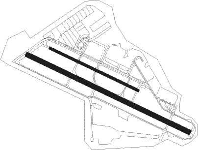
Runway info
Runway 10R / 28L  | ||
| length | 1734m (5689ft) | |
| bearing | 115° / 295° | |
| width | 46m (151ft) | |
| surface | asphalt | |
| displ threshold | 249m (817ft) / 206m (676ft) | |
| Runway 10L / 28R | ||
| length | 946m (3104ft) | |
| bearing | 115° / 295° | |
| width | 23m (75ft) | |
| surface | asphalt | |
Nearby beacons
| code | identifier | dist | bearing | frequency |
|---|---|---|---|---|
| OAK | OAKLAND VOR/DME | 6.3 | 304° | 116.80 |
| SFO | SAN FRANCISCO VOR/DME | 12.1 | 261° | 115.80 |
| NUQ | MOFFETT (MOUNTAIN VIEW) TACAN | 13.8 | 164° | 117.60 |
| OSI | WOODSIDE VOR/DME | 17.6 | 211° | 113.90 |
| SJC | SAN JOSE VOR/DME | 18.9 | 148° | 114.10 |
| LV | REIGA (LIVERMORE) NDB | 20.9 | 85° | 374 |
| SAU | SAUSALITO VOR/DME | 22.4 | 296° | 116.20 |
| CCR | CONCORD VOR/DME | 23.5 | 11° | 117 |
| SGD | SCAGGS ISLAND (NAPA) VORTAC | 33.5 | 334° | 112.10 |
| SUU | TRAVIS (FAIRFIELD) TACAN | 36.3 | 17° | 116.60 |
| PYE | POINT REYES VOR/DME | 43.5 | 300° | 113.70 |
| SAC | SACRAMENTO VORTAC | 54.3 | 36° | 115.20 |
| STS | ROSA DME | 60.5 | 321° | 116.15 |
| SNS | SALINAS VORTAC | 64.6 | 152° | 117.30 |
Departure and arrival routes
| Transition altitude | 18000ft |
| Transition level | 18000ft |
| STAR starting points | distance | inbound heading | |
|---|---|---|---|
| ALL | |||
| SHARR1 | 41.0 | 261° | |
| PXN6 | 85.6 | 305° | |
Instrument approach procedures
| runway | airway (heading) | route (dist, bearing) |
|---|---|---|
| RW28L | SJC (328°) | SJC JOBUS (11mi, 53°) 5700ft JOBUS (turn) 5700ft |
| RW28L | SUNOL (279°) | SUNOL JOBUS (6mi, 163°) 5700ft JOBUS (turn) 5700ft |
| RW28L | VINCO (305°) | VINCO JOBUS (8mi, 333°) 5700ft |
| RNAV | JOBUS 5700ft OKIVY (3mi, 295°) 4800ft WESCH (3mi, 295°) 3900ft SUDGE (3mi, 295°) 3200ft FENRA (3mi, 295°) 2120ft BOGRE (2mi, 295°) 1360ft HUZBY (turn) 1000ft KHWD (3mi, 293°) 85ft (6900mi, 107°) 600ft OAK (6903mi, 287°) 2100ft OAK (turn) |
Holding patterns
| STAR name | hold at | type | turn | heading* | altitude | leg | speed limit |
|---|---|---|---|---|---|---|---|
| SHARR1 | LOCKE | VHF | right | 52 (232)° | DME 7.0mi | ICAO rules | |
| SHARR1 | WRAPS | VHF | right | 72 (252)° | DME 11.0mi | ICAO rules | |
| *) magnetic outbound (inbound) holding course | |||||||
Disclaimer
The information on this website is not for real aviation. Use this data with the X-Plane flight simulator only! Data taken with kind consent from X-Plane 12 source code and data files. Content is subject to change without notice.