Hollywood - North Perry
Airport details
| Country | United States of America |
| State | Florida |
| Region | K7 |
| Airspace | Miami Oceanic Ctr |
| Municipality | Pembroke Pines |
| Elevation | 4ft (1m) |
| Timezone | GMT -5 |
| Coordinates | 26.00122, -80.24072 |
| Magnetic var | |
| Type | land |
| Available since | X-Plane v10.40 |
| ICAO code | KHWO |
| IATA code | HWO |
| FAA code | HWO |
Communication
| North Perry ATIS | 135.475 |
| North Perry CTAF | 132.100 |
| North Perry UNICOM | 122.950 |
| North Perry Ground Control | 120.450 |
| North Perry Tower | 132.100 |
| North Perry Tower | 134.300 |
| North Perry MIAMI Approach/Departure | 128.600 |
Nearby Points of Interest:
Hollywood Garden Club
-Sunshine State Arch
-Villa Providence
-Hollywood Boulevard Historic Business District
-Crouse House
-Lock No. 1, North New River Canal
-Hammerstein House
-Opa-locka Company administration building
-Opa-locka Thematic Resource Area
-Baird House
-Harry Hurt Building
-Nyberg-Swanson House
-Link Trainer Building
-Opa-locka Seaboard Air Line Railway Station
-Joseph Wesley Young House
-Sam Gilliam House
-Croissant Park Administration Building
-Williams House
-South Side School
-Miami Shores Thematic Resource
-Grand Concourse Apartments
-Alfred and Olive Thorpe Lustron House
-Hialeah Park Race Track
-Dr. Willard Van Orsdel King House
-North Shore Historic District
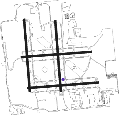
Runway info
Runway 1L / 19R  | ||
| length | 1023m (3356ft) | |
| bearing | 0° / 180° | |
| width | 30m (100ft) | |
| surface | asphalt | |
| displ threshold | 107m (351ft) / 107m (351ft) | |
| Runway 1R / 19L | ||
| length | 997m (3271ft) | |
| bearing | 0° / 180° | |
| width | 30m (100ft) | |
| surface | asphalt | |
| displ threshold | 57m (187ft) / 34m (112ft) | |
| Runway 10R / 28L | ||
| length | 990m (3248ft) | |
| bearing | 90° / 270° | |
| width | 30m (100ft) | |
| surface | asphalt | |
| displ threshold | 78m (256ft) / 63m (207ft) | |
| Runway 10L / 28R | ||
| length | 983m (3225ft) | |
| bearing | 90° / 270° | |
| width | 30m (100ft) | |
| surface | asphalt | |
| displ threshold | 55m (180ft) / 15m (49ft) | |
Nearby beacons
| code | identifier | dist | bearing | frequency |
|---|---|---|---|---|
| FLL | FORT LAUDERDALE VOR/DME | 5.9 | 46° | 114.40 |
| FX | PRAIZ (FT LAUDERDALE) NDB | 11.5 | 343° | 221 |
| DHP | DOLPHIN (MIAMI) VORTAC | 13.4 | 208° | 113.90 |
| VKZ | VIRGINIA KEY VOR/DME | 15.6 | 161° | 117.10 |
| HST | HOMESTEAD TACAN | 31.6 | 195° | 108.20 |
| PBI | PALM BEACH VORTAC | 41.6 | 13° | 115.70 |
| PHK | PAHOKEE VOR/DME | 52.8 | 330° | 115.40 |
| ZBV | BIMINI VORTAC | 54.1 | 107° | 116.70 |
| UTX | UNITED NDB | 54.7 | 354° | 405 |
Departure and arrival routes
| Transition altitude | 18000ft |
| Transition level | 18000ft |
| STAR starting points | distance | inbound heading | |
|---|---|---|---|
| ALL | |||
| FORTL9 | 62.7 | 105° | |
| BLUFI4 | 57.9 | 205° | |
| DEKAL7 | 34.1 | 284° | |
| KYAKS1 | 47.8 | 285° | |
Holding patterns
| STAR name | hold at | type | turn | heading* | altitude | leg | speed limit |
|---|---|---|---|---|---|---|---|
| BLUFI4 | LEBUR | VHF | left | 10 (190)° | < 17999ft | DME 8.0mi | ICAO rules |
| DEKAL7 | DEKAL | VHF | left | 121 (301)° | < 60000ft | DME 4.0mi | ICAO rules |
| DEKAL7 | MENDL | VHF | right | 160 (340)° | DME 10.0mi | ICAO rules | |
| DEKAL7 | RAJAY | VHF | left | 298 (118)° | DME 10.0mi | ICAO rules | |
| DEKAL7 | ZBV | NDB | right | 122 (302)° | < 60000ft | DME 8.0mi | ICAO rules |
| FORTL9 | BANTY | VHF | left | 282 (102)° | DME 8.0mi | ICAO rules | |
| FORTL9 | FORTL | VHF | left | 302 (122)° | DME 4.0mi | ICAO rules | |
| FORTL9 | RSW | NDB | right | 321 (141)° | 1.0min timed | ICAO rules | |
| *) magnetic outbound (inbound) holding course | |||||||
Disclaimer
The information on this website is not for real aviation. Use this data with the X-Plane flight simulator only! Data taken with kind consent from X-Plane 12 source code and data files. Content is subject to change without notice.