Niagara Falls - Niagra Falls Intl
Airport details
| Country | United States of America |
| State | New York |
| Region | K6 |
| Airspace | Cleveland Ctr |
| Municipality | Town of Niagara |
| Elevation | 586ft (179m) |
| Timezone | GMT -5 |
| Coordinates | 43.10756, -78.94585 |
| Magnetic var | |
| Type | land |
| Available since | X-Plane v10.40 |
| ICAO code | KIAG |
| IATA code | IAG |
| FAA code | IAG |
Communication
| Niagra Falls Intl ATIS | 120.800 |
| Niagra Falls Intl UNICOM | 122.950 |
| Niagra Falls Intl CTAF | 118.500 |
| Niagra Falls Intl Clearance DEL | 119.250 |
| Niagra Falls Intl Ground Control | 121.700 |
| Niagra Falls Intl Tower | 118.500 |
| Niagra Falls Intl BUFFALO Approach/Departure | 126.500 |
Approach frequencies
| ILS-cat-I | RW28R | 110.1 | 18.00mi |
| 2.5° GS | RW28R | 110.1 | 18.00mi |
Nearby Points of Interest:
Town of Niagara District School No. 2
-Johann Williams Farm
-Former Niagara Falls High School
-Holy Trinity Roman Catholic Church Complex (Niagara Falls, New York)
-Niagara Falls Public Library
-Niagara Falls Armory
-Chilton Avenue-Orchard Parkway Historic District
-Niagara Falls Station and Customhouse Interpretive Center
-Niagara Falls City Hall
-Park Place Historic District
-United States Post Office
-Tonawanda Armory
-Hazard H. Sheldon House
-Holley-Rankine House
-Jefferson Apartment Building
-Whitney Mansion (Niagara Falls, New York)
-First Presbyterian Manse
-James G. Marshall House
-Dick Block
-Carnegie Library
-Herschell–Spillman Motor Company Complex
-Willowbank Estate
-Kibler High School
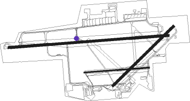
Runway info
Runway 10L / 28R  | ||
| length | 2991m (9813ft) | |
| bearing | 90° / 270° | |
| width | 46m (150ft) | |
| surface | asphalt | |
| displ threshold | 219m (719ft) / 0m (0ft) | |
| blast zone | 0m (0ft) / 255m (837ft) | |
| Runway 10R / 28L | ||
| length | 1211m (3973ft) | |
| bearing | 90° / 270° | |
| width | 24m (78ft) | |
| surface | asphalt | |
| Runway 6 / 24 | ||
| length | 1581m (5187ft) | |
| bearing | 59° / 239° | |
| width | 46m (150ft) | |
| surface | asphalt | |
| blast zone | 32m (105ft) / 0m (0ft) | |
Nearby beacons
| code | identifier | dist | bearing | frequency |
|---|---|---|---|---|
| IAG | NIAGARA FALLS TACAN | 0.6 | 289° | 111 |
| IA | KATHI (NIAGRA FALLS) NDB | 4.7 | 89° | 329 |
| SN | ST CATHARINES NDB | 13.7 | 277° | 408 |
| BU | KLUMP (BUFFALO) NDB | 14.4 | 110° | 231 |
| GB | PLAZZ (BUFFALO) NDB | 15.1 | 151° | 204 |
| BUF | BUFFALO VOR/DME | 16.9 | 121° | 116.40 |
| TZ | GIBRALTAR POINT NDB | 35.8 | 319° | 257 |
| ZHM | BINBROOK (HAMILTON) NDB | 37.2 | 272° | 266 |
| DKK | DME | 39.7 | 208° | 116.20 |
| ZYZ | QUEENSWAY (TORONTO) NDB | 40.4 | 310° | 368 |
| YYZ | TORONTO VOR/DME | 44.5 | 309° | 112.15 |
| YTP | PEARSON (TORONTO) VOR/DME | 46.1 | 308° | 116.55 |
| YO | DME-ILS | 48.7 | 4° | 111.35 |
| OO | OSHAWA NDB | 48.8 | 3° | 391 |
| ZTO | WOODHILL (TORONTO) NDB | 50.2 | 310° | 403 |
| KZ | BUTTONVILLE NDB | 52.3 | 335° | 248 |
| JHW | JAMESTOWN VOR/DME | 55.7 | 191° | 114.70 |
Instrument approach procedures
| runway | airway (heading) | route (dist, bearing) |
|---|---|---|
| RW06 | WOTGU (50°) | WOTGU 3300ft |
| RNAV | WOTGU 3300ft YULUC (7mi, 45°) 2300ft ZEXOD (4mi, 58°) 1180ft KIAG (2mi, 51°) 639ft (4922mi, 119°) 847ft ZUPUV (4913mi, 299°) 3600ft ZUPUV (turn) | |
| RW10L | WINUD (103°) | WINUD 3100ft |
| RNAV | WINUD 3100ft UGOCO (5mi, 105°) 2300ft WURSI (4mi, 105°) 1220ft ZUKDU (1mi, 105°) 784ft (4923mi, 119°) 1100ft DIONE (4911mi, 299°) 3600ft DIONE (turn) | |
| RW24-Y | ZUPUV (240°) | ZUPUV 3600ft |
| RNAV | ZUPUV 3600ft WUVBI (8mi, 239°) 2300ft KIAG (6mi, 241°) 640ft (4922mi, 119°) 1400ft ZUPUV (4913mi, 299°) 3600ft ZUPUV (turn) | |
| RW24-Z | ZUPUV (240°) | ZUPUV 3600ft |
| RNAV | ZUPUV 3600ft WUVBI (8mi, 239°) 2300ft YEPNU (4mi, 239°) 1180ft KIAG (2mi, 244°) 640ft (4922mi, 119°) 1400ft ZUPUV (4913mi, 299°) 3600ft ZUPUV (turn) | |
| RW28R | CUVTU (270°) | CUVTU 3100ft |
| RNAV | CUVTU 3100ft APIWO (7mi, 270°) 2300ft KIGUW (2mi, 270°) 1560ft KIAG (4mi, 269°) 643ft (4922mi, 119°) 1040ft ZUPUV (4913mi, 299°) 3600ft ZUPUV (turn) |
Disclaimer
The information on this website is not for real aviation. Use this data with the X-Plane flight simulator only! Data taken with kind consent from X-Plane 12 source code and data files. Content is subject to change without notice.