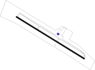
Washington - Washington-wilkes County
Airport details
| Country | United States of America |
| State | Georgia |
| Region | K7 |
| Airspace | Atlanta Ctr |
| Municipality | Wilkes County |
| Elevation | 645ft (197m) |
| Timezone | GMT -5 |
| Coordinates | 33.77942, -82.81583 |
| Magnetic var | |
| Type | land |
| Available since | X-Plane v10.40 |
| ICAO code | KIIY |
| IATA code | n/a |
| FAA code | IIY |
Communication
| Washington-Wilkes County AWOS 3 | 118.375 |
| Washington-Wilkes County CTAF/UNICOM | 122.700 |
| Washington-Wilkes County ATLANTA Approach/Departure | 127.500 |
Nearby Points of Interest:
Tupper-Barnett House
-Old Jail (Washington, Georgia)
-The Cedars
-Wilkes County Courthouse
-Mary Willis Library
-Campbell-Jordan House
-Holly Court
-Kettle Creek Battlefield
-Matthews House
-A. H. Stephens State Park
-Liberty Hall
-Jefferson Hall
-Lincoln County Courthouse
-Crawford Depot
-Siloam Historic District
-Elbert County Courthouse
-Elberton Depot
-Calhoun-Gibert House
-Guillebeau House
-John Albert Gibert M.D. House
-Old Rock House
-Greene County Courthouse
-Calhoun Mill
-James L. Hardaway House
-Thomas E. Watson House
Nearby beacons
| code | identifier | dist | bearing | frequency |
|---|---|---|---|---|
| VV | JUNNE (GREENSBORO) NDB | 13 | 237° | 353 |
| AA | CEDAR (THOMSON) NDB | 17.8 | 141° | 341 |
| AHN | ATHENS VOR/DME | 27.3 | 288° | 109.60 |
| IRQ | COLLIERS VORTAC | 32.9 | 96° | 113.90 |
| ELW | ELECTRIC CITY (ANDERSON) VORTAC | 38.4 | 3° | 108.60 |
| BMW | BARROW COUNTY (WINDER) NDB | 39.7 | 281° | 404 |
| UMB | CULVR (MILLEDGEVILLE) NDB | 41.4 | 209° | 380 |
| GRD | GREENWOOD VORTAC | 43.4 | 54° | 115.50 |
| EMR | EMORY (AUGUSTA) NDB | 45.1 | 111° | 385 |
| GIW | CORONACA (GREENWOOD) NDB | 46.1 | 57° | 239 |
| VOF | ALCOVY (COVINGTON) NDB | 49.1 | 261° | 370 |
| AG | BUSHE (AUGUSTA) NDB | 52.6 | 120° | 233 |
| GY | DYANA (GREENVILLE) NDB | 57.7 | 22° | 338 |
| ODF | FOOTHILLS (TOCCOA) VOR/DME | 60 | 332° | 113.40 |
Instrument approach procedures
| runway | airway (heading) | route (dist, bearing) |
|---|---|---|
| RW13 | AHN (108°) | AHN PACIY (16mi, 100°) 2300ft |
| RW13 | ELW (183°) | ELW CUVCA (29mi, 199°) 2300ft PACIY (5mi, 221°) 2300ft |
| RW13 | PENFI (86°) | PENFI OCIPA (11mi, 68°) 2300ft PACIY (5mi, 41°) 2300ft |
| RNAV | PACIY 2300ft HOXOD (6mi, 121°) 2300ft KIIY (5mi, 121°) 679ft (5047mi, 112°) 996ft NICIY (5042mi, 292°) GOLFR (16mi, 50°) 2400ft GOLFR (turn) | |
| RW31 | ANNAN (347°) | ANNAN EYUKU (9mi, 21°) 2500ft LUYIG (5mi, 41°) 2300ft |
| RW31 | GOLFR (246°) | GOLFR KANDY (9mi, 177°) 2500ft LUYIG (10mi, 231°) 2300ft |
| RNAV | LUYIG 2300ft NICIY (6mi, 301°) 2300ft KIIY (5mi, 301°) 664ft HOXOD (5mi, 301°) VESTO (7mi, 27°) 2500ft VESTO (turn) |
Disclaimer
The information on this website is not for real aviation. Use this data with the X-Plane flight simulator only! Data taken with kind consent from X-Plane 12 source code and data files. Content is subject to change without notice.
