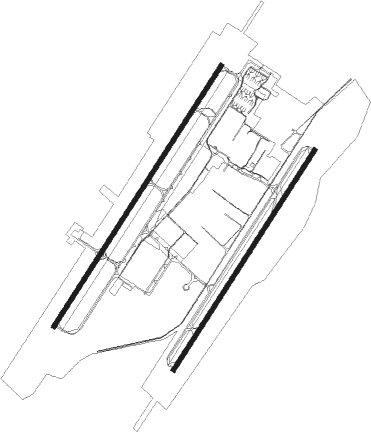
Wilmington - Wilmington Air Park
Airport details
| Country | United States of America |
| State | Ohio |
| Region | K5 |
| Airspace | Indianapolis Ctr |
| Municipality | Clinton County |
| Elevation | 1077ft (328m) |
| Timezone | GMT -5 |
| Coordinates | 39.42792, -83.79211 |
| Magnetic var | |
| Type | land |
| Available since | X-Plane v10.40 |
| ICAO code | KILN |
| IATA code | ILN |
| FAA code | ILN |
Communication
| Wilmington Air Park ATIS | 124.925 |
| Wilmington Air Park CTAF | 119.475 |
| Wilmington Air Park Clearance DEL | 125.600 |
| Wilmington Air Park Ground Control | 121.600 |
| Wilmington Air Park WILMINGTON Tower | 119.475 |
| Wilmington Air Park DAYTON Approach/Departure | 118.850 |
Approach frequencies
| ILS-cat-III | RW22R | 110.7 | 18.00mi |
| ILS-cat-II | RW22L | 109.35 | 18.00mi |
| ILS-cat-I | RW04L | 110.7 | 18.00mi |
| ILS-cat-I | RW04R | 109.35 | 18.00mi |
| 3° GS | RW04L | 110.7 | 18.00mi |
| 3° GS | RW22R | 110.7 | 18.00mi |
| 3° GS | RW04R | 109.35 | 18.00mi |
| 3° GS | RW22L | 109.35 | 18.00mi |
Nearby Points of Interest:
Doan House
-Rombach Place
-Clinton County Courthouse
-Beam Farm Woodland Archaeological District
-Cowan Creek Circular Enclosure
-Hillside Haven Mound
-Keiter Mound
-McDonald Farm
-Jamestown Opera House
-Crossed Keys Tavern
-Waynesville Main Street Historic District
-Bone Stone Graves
-Bone Mound II
-Highland County Courthouse
-Hollencamp House
-William Burnett House
-Alexander Conner House
-Bank of Xenia
-Millen-Schmidt House
-Samuel N. Patterson House
-Berryhill-Morris House
-Robinson-Pavey House
-Fayette County Courthouse
-Jacob Light House
-Rawlings-Brownell House
Nearby beacons
| code | identifier | dist | bearing | frequency |
|---|---|---|---|---|
| MXQ | MIDWEST (WILMINGTON) VOR/DME | 0.4 | 281° | 112.90 |
| IL | AIRBO (WILMINGTON) NDB | 4.6 | 40° | 407 |
| HW | CUBLA (WILMINGTON) NDB | 5.9 | 228° | 299 |
| CSS | COURT HOUSE (WASHINGTON) NDB | 21.2 | 67° | 414 |
| SGH | DME | 24.6 | 353° | 113.20 |
| XSF | SPRINGFIELD TACAN | 24.7 | 353° | 133.80 |
| MW | ONIDA (MIDDLETOWN) NDB | 26.2 | 286° | 223 |
| FFO | PATTERSON (DAYTON) TACAN | 26.4 | 326° | 115.20 |
| PWF | SPORTYS (BATAVIA) NDB | 28.8 | 230° | 245 |
| HKF | HOOK FIELD (MIDDLETOWN) NDB | 30.6 | 276° | 239 |
| AT | BRUNY (DAYTON) NDB | 35.5 | 308° | 315 |
| BU | BOUTN (COLUMBUS) NDB | 35.9 | 56° | 230 |
| XUB | YELLOW BUD (CIRCLEVILLE) VOR | 38.2 | 83° | 112.50 |
| DD | COBBS (COLUMBUS) NDB | 40.4 | 68° | 253 |
| EOP | WAVERLY NDB | 42.9 | 107° | 385 |
| DQN | DAYTON VOR/DME | 45 | 314° | 114.50 |
| LCK | RICKENBACKER (COLUMBUS) TACAN | 46 | 66° | 134.20 |
| OS | FULER (COLUMBUS) NDB | 47.4 | 43° | 515 |
| CVG | CINCINNATI VORTAC | 49 | 246° | 117.30 |
| LC | PICKL (COLUMBUS) NDB | 51.9 | 65° | 376 |
| FLM | FALMOUTH VOR/DME | 52.6 | 214° | 117 |
| ROD | ROSEWOOD VORTAC | 52.9 | 344° | 117.50 |
| YRK | YORK VORTAC | 60.4 | 134° | 112.80 |
Instrument approach procedures
| runway | airway (heading) | route (dist, bearing) |
|---|---|---|
| RW04L | CHMLE (46°) | CHMLE 3000ft |
| RW04L | FEIAT (21°) | FEIAT CHMLE (5mi, 301°) 3000ft |
| RW04L | GOLYI (67°) | GOLYI CHMLE (5mi, 121°) 3000ft |
| RNAV | CHMLE 3000ft LYMEE (6mi, 44°) 2800ft JAYEL (3mi, 44°) 1680ft KILN (3mi, 51°) 1104ft (5117mi, 115°) 1218ft WIZRD (5112mi, 295°) 3000ft WIZRD (turn) | |
| RW22R | AKOVY (194°) | AKOVY WIZRD (5mi, 121°) 3000ft |
| RW22R | ODORY (247°) | ODORY WIZRD (5mi, 301°) 3000ft |
| RW22R | WIZRD (223°) | WIZRD 3000ft |
| RNAV | WIZRD 3000ft MURGE (6mi, 225°) 2400ft KILN (5mi, 220°) 1132ft (5117mi, 115°) 1277ft LYMEE (5121mi, 295°) TIGRR (12mi, 309°) 3000ft TIGRR (turn) |
Disclaimer
The information on this website is not for real aviation. Use this data with the X-Plane flight simulator only! Data taken with kind consent from X-Plane 12 source code and data files. Content is subject to change without notice.

