Phoenix - Williams Gateway
Airport details
| Country | United States of America |
| State | Arizona |
| Region | K2 |
| Airspace | Albuquerque Ctr |
| Municipality | Mesa |
| Elevation | 1378ft (420m) |
| Timezone | GMT -7 |
| Coordinates | 33.30783, -111.65547 |
| Magnetic var | |
| Type | land |
| Available since | X-Plane v10.40 |
| ICAO code | KIWA |
| IATA code | AZA |
| FAA code | IWA |
Communication
| Williams Gateway ATIS | 133.500 |
| Williams Gateway GROUND | 128.250 |
| Williams Gateway TOWER WEST | 120.600 |
| Williams Gateway TOWER EAST | 124.750 |
Approach frequencies
| ILS-cat-I | RW30C | 110.15 | 18.00mi |
| 3° GS | RW30C | 110.15 | 18.00mi |
Nearby Points of Interest:
Rittenhouse Elementary School
-Wilbur Street Historic District
-Mesa Grande
-C.H. Cook Memorial Church
-Borden Milk Co. Creamery and Ice Factory
-President's House
-Administration/Science Building
-B. B. Moeur Activity Building
-Old Main
-Matthews Hall
-St. Mary's Church-Our Lady of Mount Carmel Catholic Church
-Industrial Arts Building
-Harrington-Birchett House
-Niels Petersen House
-Mill Avenue Bridges
-Rose Eisendrath House
-Double Butte Cemetery
-Webster Auditorium
-Little Red Schoolhouse
-Fountain Hills
-Louise Lincoln Kerr House and Studio
-Edward L. Jones House
-Roald Amundsen
-Rancho Joaquina House
-Bethlehem Baptist Church
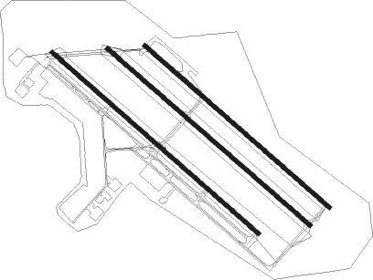
Runway info
Runway 12L / 30R  | ||
| length | 2834m (9298ft) | |
| bearing | 131° / 311° | |
| width | 46m (151ft) | |
| surface | concrete | |
| Runway 12C / 30C | ||
| length | 3108m (10197ft) | |
| bearing | 131° / 311° | |
| width | 46m (151ft) | |
| surface | concrete | |
| Runway 12R / 30L | ||
| length | 3173m (10410ft) | |
| bearing | 131° / 311° | |
| width | 46m (151ft) | |
| surface | concrete | |
Nearby beacons
| code | identifier | dist | bearing | frequency |
|---|---|---|---|---|
| IWA | WILLIE (PHOENIX) VORTAC | 0.3 | 139° | 113.30 |
| PXR | PHOENIX VORTAC | 17.4 | 292° | 115.60 |
| TFD | STANFIELD (CASA GRANDE) VORTAC | 28.3 | 211° | 114.80 |
| LUF | LUKE (GLENDALE) TACAN | 38.8 | 288° | 113 |
| AVQ | MARANA NDB | 58.2 | 154° | 245 |
| PAN | DME | 59 | 19° | 116.35 |
Departure and arrival routes
| Transition altitude | 18000ft |
| Transition level | 18000ft |
| SID end points | distance | outbound heading | |
|---|---|---|---|
| RW12 (ALL) | |||
| YOTES6, SNOBL6 | 153mi | 27° | |
| LALUZ6 | 142mi | 66° | |
| FTHLS6 | 256mi | 78° | |
| KATMN6 | 138mi | 111° | |
| BNYRD6 | 82mi | 149° | |
| JUDTH7 | 121mi | 257° | |
| IZZZO7 | 111mi | 283° | |
| PXR1 | 17mi | 292° | |
| MAYSA7 | 112mi | 316° | |
| RW30 (ALL) | |||
| SNOBL6, YOTES6 | 153mi | 27° | |
| LALUZ6 | 142mi | 66° | |
| FTHLS6 | 256mi | 78° | |
| KATMN6 | 138mi | 111° | |
| BNYRD6 | 82mi | 149° | |
| JUDTH7 | 121mi | 257° | |
| IZZZO7 | 111mi | 283° | |
| PXR1 | 17mi | 292° | |
| MAYSA7 | 112mi | 316° | |
| STAR starting points | distance | inbound heading | |
|---|---|---|---|
| ALL | |||
| ARLIN4, BLH5 | 51.7 | 89° | |
| DSERT2 | 68.2 | 179° | |
| HUUTY1 | 72.6 | 230° | |
| SUNSS8 | 43.0 | 314° | |
Instrument approach procedures
| runway | airway (heading) | route (dist, bearing) |
|---|---|---|
| RW12C | LAKEY (181°) | LAKEY NEVKE (6mi, 254°) 5000ft OCATU (5mi, 231°) 4200ft |
| RW12C | PXR (112°) | PXR OCATU (7mi, 79°) 4200ft |
| RW12C | TFD (31°) | TFD OCATU (35mi, 8°) 5000ft OCATU (turn) 4200ft |
| RNAV | OCATU 4200ft HICHI (6mi, 130°) 3300ft KIWA (7mi, 131°) 1398ft (6484mi, 107°) 1609ft PADPE (6480mi, 287°) RIYCO (15mi, 231°) 5000ft RIYCO (turn) | |
| RW12R | LAKEY (181°) | LAKEY GEJRI (11mi, 241°) 4800ft GEJRI (turn) 4300ft |
| RW12R | PXR (112°) | PXR GEJRI (7mi, 83°) 4300ft |
| RW12R | TFD (31°) | TFD GEJRI (34mi, 8°) 4300ft GEJRI (turn) 4300ft |
| RNAV | GEJRI 4300ft CEPIB (6mi, 130°) 3000ft KIWA (6mi, 129°) 1385ft (6484mi, 107°) 1800ft GEJRI (6491mi, 287°) 4300ft GEJRI (turn) | |
| RW30CY | GICGE (10°) | GICGE COMGU (9mi, 58°) 4300ft BOBRE (8mi, 35°) 3400ft |
| RNAV | BOBRE 3400ft OTRRR (6mi, 311°) 3000ft ORIYE (3mi, 311°) 2020ft KIWA (3mi, 310°) 1422ft (6484mi, 107°) 2800ft GICGE (6491mi, 286°) 5000ft GICGE (turn) | |
| RW30CZ | TYLIK (271°) | TYLIK GYANT (2mi, 180°) 3200ft |
| RNAV | GYANT 3200ft ALIEE (3mi, 218°) 3000ft OTRRR (3mi, 279°) 3000ft KIWA (6mi, 310°) 1422ft (6484mi, 107°) 2800ft GICGE (6491mi, 286°) 5000ft GICGE (turn) | |
| RW30L | TOTEC (358°) | TOTEC BBALL (11mi, 48°) 4000ft SEZUW (12mi, 358°) 4000ft |
| RNAV | SEZUW 4000ft AKYIV (6mi, 311°) 3000ft OPUYE (3mi, 311°) 2000ft KIWA (2mi, 315°) 1429ft (6484mi, 107°) 1782ft GEJRI (6491mi, 287°) 4300ft GEJRI (turn) | |
| RW30R | GICGE (10°) | GICGE COMGU (9mi, 58°) 4300ft WOGMA (8mi, 41°) 3500ft |
| RW30R | PEAKS (217°) | PEAKS BAYTA (8mi, 166°) 8000ft OMGOE (15mi, 175°) 7200ft WOGMA (8mi, 231°) 3500ft |
| RNAV | WOGMA 3500ft WUMIX (7mi, 311°) 3000ft YADUV (3mi, 311°) 2020ft KIWA (3mi, 307°) 1439ft (6484mi, 107°) 2800ft GICGE (6491mi, 286°) 5000ft GICGE (turn) |
Holding patterns
| STAR name | hold at | type | turn | heading* | altitude | leg | speed limit |
|---|---|---|---|---|---|---|---|
| ARLIN4 | ARLIN | VHF | right | 256 (76)° | 1.0min timed | ICAO rules | |
| ARLIN4 | HYDRR | VHF | right | 215 (35)° | 1.0min timed | ICAO rules | |
| BLH5 | ARLIN | VHF | right | 256 (76)° | 1.0min timed | ICAO rules | |
| BLH5 | HYDRR | VHF | right | 215 (35)° | 1.0min timed | ICAO rules | |
| DSERT2 | DSERT | VHF | left | 345 (165)° | DME 10.0mi | ICAO rules | |
| DSERT2 | SHOCK | VHF | left | 2 (182)° | DME 10.0mi | ICAO rules | |
| HUUTY1 | CHEKR | VHF | left | 16 (196)° | < 14000ft | DME 7.0mi | ICAO rules |
| HUUTY1 | INW | NDB | right | 248 (68)° | 1.0min timed | ICAO rules | |
| HUUTY1 | ROSEE | VHF | right | 39 (219)° | < 14000ft | DME 7.0mi | ICAO rules |
| HUUTY1 | ZUN | NDB | left | 73 (253)° | 18000ft - 45000ft | 1.5min timed | ICAO rules |
| SUNSS8 | BAYBI | VHF | left | 120 (300)° | DME 9.0mi | ICAO rules | |
| SUNSS8 | ITEMM | VHF | left | 93 (273)° | DME 10.0mi | ICAO rules | |
| SUNSS8 | SQUEZ | VHF | left | 120 (300)° | DME 7.0mi | ICAO rules | |
| *) magnetic outbound (inbound) holding course | |||||||
Disclaimer
The information on this website is not for real aviation. Use this data with the X-Plane flight simulator only! Data taken with kind consent from X-Plane 12 source code and data files. Content is subject to change without notice.