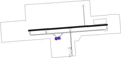
Ironwood - Gogebic Iron Co
Airport details
| Country | United States of America |
| State | Michigan |
| Region | K5 |
| Airspace | Minneapolis Ctr |
| Municipality | Ironwood Township |
| Elevation | 1229ft (375m) |
| Timezone | GMT -6 |
| Coordinates | 46.52747, -90.13139 |
| Magnetic var | |
| Type | land |
| Available since | X-Plane v10.40 |
| ICAO code | KIWD |
| IATA code | IWD |
| FAA code | IWD |
Communication
| Gogebic Iron Co AWOS 3 | 125.175 |
| Gogebic Iron Co CTAF/UNICOM | 122.800 |
Approach frequencies
| ILS-cat-I | RW27 | 111.5 | 18.00mi |
| 3° GS | RW27 | 111.5 | 18.00mi |
Nearby Points of Interest:
Gogebic County Courthouse
-Solomon S. Curry House
-Ironwood Memorial/Municipal Building
-Chicago and Northwestern Railroad Depot
-Ironwood Theatre
-Ironwood Carnegie Library
-Annala Round Barn
-Porcupine Mountains
-Marquette
-Copper Falls State Park
-Mellen City Hall
-Big Bay sloop
Runway info
| Runway 9 / 27 | ||
| length | 1985m (6512ft) | |
| bearing | 90° / 270° | |
| width | 37m (120ft) | |
| surface | asphalt | |
Nearby beacons
| code | identifier | dist | bearing | frequency |
|---|---|---|---|---|
| IWD | IRONWOOD VOR/DME | 0.3 | 49° | 108.80 |
| RXW | WATERSMEET NDB | 38.1 | 106° | 407 |
| DO | DOUGY (MINOCQUA WOODRUFF) NDB | 44.8 | 150° | 236 |
| RH | ARSHA (RHINELANDER) NDB | 58 | 150° | 272 |
| RHI | RHINELANDER VOR/DME | 60.5 | 143° | 109.20 |
Instrument approach procedures
| runway | airway (heading) | route (dist, bearing) |
|---|---|---|
| RW09 | CITOT (106°) | CITOT 3500ft GODSE (5mi, 180°) 3500ft |
| RW09 | FAVOD (74°) | FAVOD 3500ft GODSE (5mi, 360°) 3500ft |
| RW09 | GODSE (90°) | GODSE 3500ft |
| RNAV | GODSE 3500ft ELAZY (6mi, 90°) 3000ft KIWD (6mi, 90°) 1270ft HIRUN (12mi, 90°) 3500ft HIRUN (turn) | |
| RW27 | BIVBE (254°) | BIVBE 3500ft HIRUN (5mi, 181°) 3500ft |
| RW27 | DUPME (286°) | DUPME 3500ft HIRUN (5mi, 1°) 3500ft |
| RW27 | HIRUN (270°) | HIRUN 3500ft |
| RNAV | HIRUN 3500ft PETFI (2mi, 270°) 3300ft CRAAG (4mi, 270°) 3000ft BADVE (3mi, 270°) 2100ft KIWD (3mi, 270°) 1285ft GODSE (12mi, 270°) 3500ft GODSE (turn) |
Disclaimer
The information on this website is not for real aviation. Use this data with the X-Plane flight simulator only! Data taken with kind consent from X-Plane 12 source code and data files. Content is subject to change without notice.
