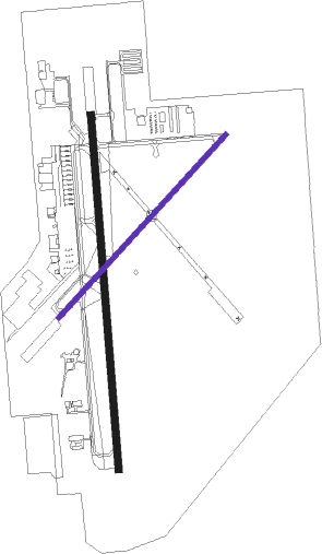
Olathe - New Century Aircenter
Airport details
| Country | United States of America |
| State | Kansas |
| Region | K3 |
| Airspace | Kansas City Ctr |
| Municipality | Johnson County |
| Elevation | 1085ft (331m) |
| Timezone | GMT -6 |
| Coordinates | 38.83092, -94.89030 |
| Magnetic var | |
| Type | land |
| Available since | X-Plane v10.40 |
| ICAO code | KIXD |
| IATA code | JCI |
| FAA code | IXD |
Communication
| New Century Aircenter ASOS | 135.325 |
| New Century Aircenter CTAF | 133.000 |
| New Century Aircenter UNICOM | 122.950 |
| New Century Aircenter Ground Control | 124.300 |
| New Century Aircenter Tower | 133.000 |
| New Century Aircenter KANSAS CITY Approach/Departure | 118.900 |
Approach frequencies
| ILS-cat-I | RW36 | 110.9 | 18.00mi |
| 3° GS | RW36 | 110.9 | 18.00mi |
Nearby Points of Interest:
William Thomas Turner Barn
-Martin Van Buren Parker House
-Franklin R. Lanter House
-I. O. Pickering House
-Albert Ott House
-Mahaffie House
-Vinland Grange Hall
-Vinland Presbyterian Church
-Miami County Courthouse
-Haskell-Baker Wetlands
-Harry S. Truman National Historic Site
-Wolcott House
-Bernard Corrigan House
-Seth E. Ward Homestead
-Granada Theater
-Argentine Carnegie Library
-Lawrence's Downtown Historic District
-United Presbyterian Center
-S.T. Zimmerman House
-Spooner Hall
-Strong Hall
-House at 54 E. 53rd Terrace
-Sauer Castle
-Kelly's Westport Inn
-Loretto Academy

Nearby beacons
| code | identifier | dist | bearing | frequency |
|---|---|---|---|---|
| PK | HERBB (OLATHE) NDB | 8.5 | 117° | 420 |
| JZ | NEWBN (LAWRENCE) NDB | 13.2 | 287° | 338 |
| OWI | OTTAWA NDB | 24.3 | 232° | 251 |
| MCI | KANSAS CITY VORTAC | 28.2 | 19° | 113.25 |
| RN | HUGGY (KANSAS CITY) NDB | 28.3 | 5° | 416 |
| TOP | TOPEKA VORTAC | 35.8 | 295° | 117.80 |
| FOE | FORBES (TOPEKA) TACAN | 36.7 | 279° | 111.60 |
| BUM | BUTLER VORTAC | 38.5 | 144° | 115.90 |
| ANX | NAPOLEON VORTAC | 38.9 | 71° | 114 |
| TO | BILOY (TOPEKA) NDB | 41 | 290° | 521 |
| ST | TARIO (ST JOSEPH) NDB | 50.7 | 359° | 260 |
Departure and arrival routes
| Transition altitude | 18000ft |
| Transition level | 18000ft |
| SID end points | distance | outbound heading | |
|---|---|---|---|
| ALL | |||
| ROYAL9 | 88mi | 10° | |
| WLDCT5 | 128mi | 272° | |
| TIFTO6 | 66mi | 308° | |
| RW04 | |||
| LAKES3 | 168mi | 76° | |
| RACER7 | 115mi | 133° | |
| CHIEF7 | 68mi | 358° | |
| RW18 | |||
| LAKES3 | 168mi | 76° | |
| RACER7 | 115mi | 133° | |
| CHIEF7 | 68mi | 358° | |
| RW22 | |||
| LAKES3 | 168mi | 76° | |
| RACER7 | 115mi | 133° | |
| CHIEF7 | 68mi | 358° | |
| RW36 | |||
| LAKES3 | 168mi | 76° | |
| RACER7 | 115mi | 133° | |
| CHIEF7 | 68mi | 358° | |
| STAR starting points | distance | inbound heading | |
|---|---|---|---|
| ALL | |||
| JHAWK6 | 24.8 | 87° | |
| BQS7 | 67.3 | 232° | |
| TYGER6 | 38.8 | 280° | |
Instrument approach procedures
| runway | airway (heading) | route (dist, bearing) |
|---|---|---|
| RW04 | AXUXE (54°) | AXUXE 3100ft |
| RW04 | JONUL (79°) | JONUL AXUXE (7mi, 130°) 3100ft |
| RW04 | WAMUS (23°) | WAMUS AXUXE (7mi, 310°) 3100ft |
| RNAV | AXUXE 3100ft ORAVE (7mi, 54°) 2700ft KIXD (5mi, 54°) 1102ft (5634mi, 112°) 1330ft FALOV (5624mi, 292°) 3100ft FALOV (turn) | |
| RW18 | MIFEV (209°) | MIFEV 3100ft ZODPU (5mi, 270°) 3100ft |
| RW18 | OGUCO (150°) | OGUCO 3100ft ZODPU (5mi, 90°) 3100ft |
| RW18 | ZODPU (180°) | ZODPU 3100ft |
| RNAV | ZODPU 3100ft KEZNU (6mi, 180°) 2700ft KIXD (5mi, 179°) 1131ft (5634mi, 112°) 1487ft ANQUM (5635mi, 292°) 3100ft ANQUM (turn) | |
| RW22 | AYOBU (203°) | AYOBU FALOV (7mi, 130°) 3100ft |
| RW22 | FALOV (234°) | FALOV 3100ft |
| RW22 | SIPSE (258°) | SIPSE FALOV (7mi, 310°) 3100ft |
| RNAV | FALOV 3100ft CALVU (7mi, 234°) 2700ft KIXD (5mi, 234°) 1132ft (5634mi, 112°) 1337ft AXUXE (5644mi, 292°) 3100ft AXUXE (turn) | |
| RW36 | ANQUM (0°) | ANQUM 3100ft |
| RW36 | NAPVY (332°) | NAPVY 3100ft ANQUM (5mi, 270°) 3100ft |
| RW36 | UNOXY (29°) | UNOXY 3100ft ANQUM (5mi, 90°) 3100ft |
| RNAV | ANQUM 3100ft JIKLA (6mi, 0°) 2700ft KIXD (6mi, 1°) 1102ft (5634mi, 112°) 1316ft ZODPU (5633mi, 292°) 3100ft ZODPU (turn) |
Holding patterns
| STAR name | hold at | type | turn | heading* | altitude | leg | speed limit |
|---|---|---|---|---|---|---|---|
| BQS7 | BQS | NDB | right | 54 (234)° | 1.0min timed | ICAO rules | |
| BQS7 | FONIX | VHF | right | 57 (237)° | 1.0min timed | ICAO rules | |
| JHAWK6 | JHAWK | VHF | left | 223 (43)° | < 17999ft | 1.0min timed | ICAO rules |
| TYGER6 | TYGER | VHF | left | 135 (315)° | < 17999ft | 1.0min timed | ICAO rules |
| *) magnetic outbound (inbound) holding course | |||||||
Disclaimer
The information on this website is not for real aviation. Use this data with the X-Plane flight simulator only! Data taken with kind consent from X-Plane 12 source code and data files. Content is subject to change without notice.