Johnstown - John Murtha Johnstown Cambria Co
Airport details
| Country | United States of America |
| State | Pennsylvania |
| Region | K6 |
| Airspace | Cleveland Ctr |
| Municipality | Richland Township |
| Elevation | 2284ft (696m) |
| Timezone | GMT -5 |
| Coordinates | 40.31556, -78.83466 |
| Magnetic var | |
| Type | land |
| Available since | X-Plane v10.40 |
| ICAO code | KJST |
| IATA code | JST |
| FAA code | JST |
Communication
| JOHN MURTHA JOHNSTOWN CAMBRIA CO ATIS | 118.325 |
| JOHN MURTHA JOHNSTOWN CAMBRIA CO UNICOM | 122.950 |
| JOHN MURTHA JOHNSTOWN CAMBRIA CO Clearance/DEL | 126.850 |
| JOHN MURTHA JOHNSTOWN CAMBRIA CO Ground Control | 121.600 |
| JOHN MURTHA JOHNSTOWN CAMBRIA CO Tower | 125.750 |
| JOHN MURTHA JOHNSTOWN CAMBRIA CO Approach | 135.975 |
| JOHN MURTHA JOHNSTOWN CAMBRIA CO Departure | 135.975 |
Approach frequencies
| ILS-cat-I | RW33 | 110.1 | 18.00mi |
| 3° GS | RW33 | 110.1 | 18.00mi |
Nearby Points of Interest:
Staple Bend Tunnel
-South Fork Fishing and Hunting Club Clubhouse
-Moxham Historic District
-Old Conemaugh Borough Historic District
-Cathedral of Saint John Gualbert
-Downtown Johnstown Historic District
-Grand Army of the Republic Hall
-Nathan's Department Store
-Inclined Plane Bridge
-Cambria Iron Company
-Johnstown Inclined Plane
-Windber Historic District
-Westmont Historic District
-Portage Historic District
-Shade Furnace Archaeological District
-Bridge in Portage Township
-Laurel Hill Furnace
-Ghost Town Trail
-Berwind-White Mine 40 Historic District
-Revloc Historic District
-Matthew Hair Farm
-Cambria County Courthouse
-Philip Noon House
-Cairnbrook Historic District
-Ross Furnace
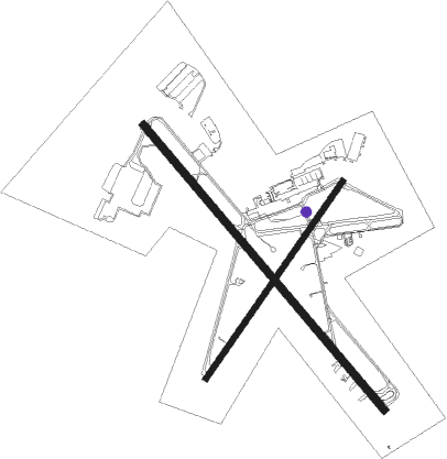
Runway info
Runway 15 / 33  | ||
| length | 2135m (7005ft) | |
| bearing | 137° / 317° | |
| width | 46m (150ft) | |
| surface | concrete | |
| Runway 5 / 23 | ||
| length | 1373m (4505ft) | |
| bearing | 47° / 227° | |
| width | 30m (100ft) | |
| surface | asphalt | |
| displ threshold | 0m (0ft) / 40m (131ft) | |
Nearby beacons
| code | identifier | dist | bearing | frequency |
|---|---|---|---|---|
| JST | JOHNSTOWN VOR/DME | 0 | 23° | 113 |
| SYS | STOYSTOWN (SOMERSET) NDB | 14.3 | 200° | 209 |
| REC | REVLOC VOR/DME | 14.4 | 21° | 110.60 |
| IHD | INDIAN HEAD VORTAC | 31.5 | 237° | 108.20 |
| GRV | DME | 42 | 198° | 112.30 |
| THS | SAINT THOMAS VORTAC | 46.6 | 113° | 115 |
| VV | CAMOR (CONNELLSVILLE) NDB | 49.2 | 245° | 299 |
| PSB | PHILIPSBURG VORTAC | 52.6 | 54° | 115.50 |
| CIP | DME | 57.3 | 323° | 112.90 |
| HGR | HAGERSTOWN VOR | 58.3 | 122° | 109.80 |
| ETG | KEATING VORTAC | 62.5 | 38° | 116 |
| MRB | MARTINSBURG VORTAC | 72 | 133° | 112.10 |
Departure and arrival routes
| Transition altitude | 18000ft |
| Transition level | 18000ft |
| SID end points | distance | outbound heading | |
|---|---|---|---|
| RW05 | |||
| LILLI4 | 12mi | 50° | |
| JENER4 | 16mi | 223° | |
| RW15 | |||
| LILLI4 | 12mi | 50° | |
| JENER4 | 16mi | 223° | |
| RW23 | |||
| LILLI4 | 12mi | 50° | |
| JENER4 | 16mi | 223° | |
| RW33 | |||
| LILLI4 | 12mi | 50° | |
| JENER4 | 16mi | 223° | |
Instrument approach procedures
| runway | airway (heading) | route (dist, bearing) |
|---|---|---|
| RW05 | GAKDE (13°) | GAKDE 4900ft WUBOG (9mi, 322°) 4900ft |
| RW05 | JANDU (73°) | JANDU 4900ft WUBOG (9mi, 105°) 4900ft |
| RW05 | WUBOG (47°) | WUBOG 4900ft |
| RNAV | WUBOG 4900ft BOTSE (7mi, 47°) 3900ft KJST (5mi, 47°) 2309ft (4895mi, 117°) 2520ft REPTE (4889mi, 297°) 4900ft REPTE (turn) | |
| RW15 | LEDBE (137°) | LEDBE 4800ft |
| RW15 | MASDE (164°) | MASDE LEDBE (5mi, 241°) 4800ft |
| RW15 | NADNE (114°) | NADNE LEDBE (5mi, 61°) 4800ft |
| RNAV | LEDBE 4800ft STRNS (6mi, 137°) 3900ft KJST (5mi, 137°) 2322ft (4895mi, 117°) 2526ft COTSO (4886mi, 297°) 4900ft COTSO (turn) | |
| RW23 | DAPQO (253°) | DAPQO 4900ft REPTE (9mi, 285°) 4900ft |
| RW23 | REPTE (227°) | REPTE 4900ft |
| RW23 | TESDE (194°) | TESDE 4900ft REPTE (9mi, 142°) 4900ft |
| RNAV | REPTE 4900ft GURKE (7mi, 227°) 3900ft KJST (5mi, 227°) 2325ft (4895mi, 117°) 2530ft WUBOG (4902mi, 297°) 4900ft WUBOG (turn) | |
| RW33 | COTSO (317°) | COTSO 4900ft |
| RW33 | ESUTE (297°) | ESUTE COTSO (5mi, 241°) 4900ft |
| RW33 | FOMTI (340°) | FOMTI COTSO (5mi, 61°) 4900ft |
| RNAV | COTSO 4900ft CETIX (6mi, 317°) 4600ft WASDO (4mi, 317°) 3200ft KJST (3mi, 317°) 2318ft (4895mi, 117°) 2481ft LEDBE (4903mi, 297°) 4800ft LEDBE (turn) |
Disclaimer
The information on this website is not for real aviation. Use this data with the X-Plane flight simulator only! Data taken with kind consent from X-Plane 12 source code and data files. Content is subject to change without notice.