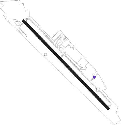
Kelso - Southwest Washington Regional
Airport details
| Country | United States of America |
| State | Washington |
| Region | K1 |
| Airspace | Seattle Ctr |
| Municipality | Kelso |
| Elevation | 20ft (6m) |
| Timezone | GMT -8 |
| Coordinates | 46.11800, -122.89839 |
| Magnetic var | |
| Type | land |
| Available since | X-Plane v10.40 |
| ICAO code | KKLS |
| IATA code | KLS |
| FAA code | KLS |
Communication
| Southwest Washington Regional AWOS 3 | 135.075 |
| Southwest Washington Regional CTAF/UNICOM | 122.800 |
Nearby Points of Interest:
Longview Community Church-Saint Helen's Addition
-Caples House Museum
-Cox–Williams House
-Judge Columbia Lancaster House
-Portland and Southwestern Railroad Tunnel
-United States Post Office
-Arndt Prune Dryer
-Amboy United Brethren Church
-Lewisville Park
-Skamokawa
Nearby beacons
| code | identifier | dist | bearing | frequency |
|---|---|---|---|---|
| BTG | BATTLE GROUND VORTAC | 25.6 | 140° | 116.60 |
| PND | BANKS (PORTLAND) NDB | 29.9 | 197° | 356 |
| CBU | COLUMBIA (PORTLAND) TACAN | 33.9 | 152° | 109.20 |
| AST | ASTORIA VOR/DME | 40.9 | 273° | 114 |
| UBG | NEWBERG VOR/DME | 46 | 186° | 117.40 |
| OLM | OLYMPIA VORTAC | 51.2 | 360° | 113.40 |
Instrument approach procedures
| runway | airway (heading) | route (dist, bearing) |
|---|---|---|
| RW12 | LOATH (57°) | LOATH AMAVE (11mi, 321°) 4000ft YAPEC (5mi, 42°) 4000ft |
| RW12 | ONALS (204°) | ONALS KLCUP (24mi, 239°) 4000ft YAPEC (8mi, 185°) 4000ft |
| RW12 | WINLO (149°) | WINLO KLCUP (5mi, 185°) 4000ft YAPEC (8mi, 185°) 4000ft |
| RNAV | YAPEC 4000ft COSRA (2mi, 105°) 3300ft UXALE (3mi, 105°) 2700ft ANIGE (3mi, 130°) 1900ft SOWAL (1mi, 130°) 1420ft KKLS (4mi, 130°) 70ft (6733mi, 111°) 800ft AMAVE (6743mi, 291°) 4000ft AMAVE (turn) 4000ft |
Disclaimer
The information on this website is not for real aviation. Use this data with the X-Plane flight simulator only! Data taken with kind consent from X-Plane 12 source code and data files. Content is subject to change without notice.
