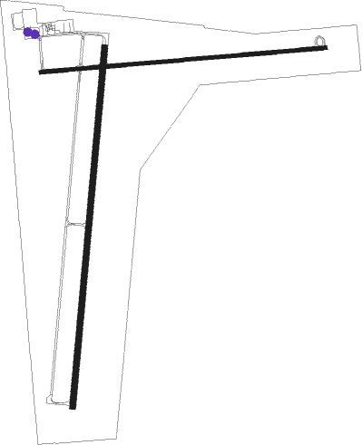
Lamar - Lamar Muni
Airport details
| Country | United States of America |
| State | Colorado |
| Region | K2 |
| Airspace | Denver Ctr |
| Municipality | Prowers County |
| Elevation | 3706ft (1130m) |
| Timezone | GMT -7 |
| Coordinates | 38.06969, -102.68850 |
| Magnetic var | |
| Type | land |
| Available since | X-Plane v10.40 |
| ICAO code | KLAA |
| IATA code | LAA |
| FAA code | LAA |
Communication
| Lamar Muni ASOS | 135.625 |
| Lamar Muni CTAF/UNICOM | 122.800 |
Nearby Points of Interest:
Prowers County Courthouse
-Granada Bridge (Granada, Colorado)
-Fort Lyon
-Eads Community Church
-Crow–Hightower House
-Eads School Gymnasium
-Bent County Courthouse and Jail
-Las Animas Post Office
-American Legion Hall
-Bent County High School
-Douglas Crossing Bridge
-Sand Creek Massacre National Historic Site
Nearby beacons
| code | identifier | dist | bearing | frequency |
|---|---|---|---|---|
| LAA | LAMAR VOR/DME | 7.6 | 0° | 116.90 |
| HGO | HUGO VOR/DME | 62.7 | 309° | 112.10 |
| TBE | TOBE VOR/DME | 65.1 | 228° | 114.05 |
Instrument approach procedures
| runway | airway (heading) | route (dist, bearing) |
|---|---|---|
| RW08 | HADOD (91°) | HADOD 6000ft |
| RW08 | KOWTO (61°) | KOWTO HADOD (10mi, 6°) 6000ft |
| RW08 | ZANON (139°) | ZANON WOSUR (10mi, 191°) 6900ft HADOD (9mi, 164°) 6000ft |
| RNAV | HADOD 6000ft FABAP (7mi, 90°) 5400ft SEVGE (3mi, 90°) 4480ft KLAA (3mi, 94°) 3728ft (6003mi, 110°) 4700ft HADOD (6016mi, 290°) 6000ft HADOD (turn) | |
| RW18 | OBOZU (192°) | OBOZU 6000ft |
| RW18 | WEYYI (149°) | WEYYI OBOZU (8mi, 97°) 6000ft |
| RW18 | WIZGE (231°) | WIZGE OBOZU (8mi, 278°) 6000ft |
| RNAV | OBOZU 6000ft LOLME (6mi, 192°) 5500ft KLAA (6mi, 191°) 3720ft (6003mi, 110°) 3945ft IHIYO (6007mi, 290°) 6200ft IHIYO (turn) | |
| RW26 | LAA (180°) | LAA ODURE (14mi, 117°) 6000ft ODURE (turn) 6000ft |
| RW26 | NARNE (234°) | NARNE ODURE (10mi, 180°) 6000ft |
| RNAV | ODURE 6000ft RINDE (6mi, 270°) 5300ft KLAA (5mi, 268°) 3734ft (6003mi, 110°) 4106ft ODURE (5992mi, 290°) 6000ft ODURE (turn) | |
| RW36 | KOWTO (61°) | KOWTO IHIYO (11mi, 102°) 6200ft IHIYO (turn) 6200ft |
| RW36 | WIZGE (231°) | WIZGE KUSKY (25mi, 202°) 6200ft IHIYO (5mi, 278°) 6200ft |
| RNAV | IHIYO 6200ft LAMZY (6mi, 12°) 5700ft KLAA (7mi, 13°) 3756ft (6003mi, 110°) 3956ft LOVIY (6003mi, 290°) LAA (5mi, 357°) 6000ft LAA (turn) |
Disclaimer
The information on this website is not for real aviation. Use this data with the X-Plane flight simulator only! Data taken with kind consent from X-Plane 12 source code and data files. Content is subject to change without notice.

