Logan - Logan Cache
Airport details
| Country | United States of America |
| State | Utah |
| Region | K2 |
| Airspace | Salt Lake City Ctr |
| Municipality | Cache County |
| Elevation | 4457ft (1358m) |
| Timezone | GMT -7 |
| Coordinates | 41.79128, -111.85161 |
| Magnetic var | |
| Type | land |
| Available since | X-Plane v10.40 |
| ICAO code | KLGU |
| IATA code | LGU |
| FAA code | LGU |
Communication
| Logan Cache ASOS | 135.275 |
| Logan Cache WX AWOS @ BMC | 135.075 |
| Logan Cache CTAF/UNICOM | 122.800 |
Approach frequencies
| ILS-cat-I | RW17 | 109.15 | 18.00mi |
| 3° GS | RW17 | 109.15 | 18.00mi |
Nearby Points of Interest:
John E. Lee House
-Samuel and Lana Ewing House
-Smithfield Tithing Office
-Logan LDS Sixth Ward Church
-River Heights Sinclair Station
-George Washington Baker House
-Richmond Tithing Office
-Elite Hall
-Soren Hanson House
-Hyrum First Ward Meetinghouse
-George Bradshaw House and Joshua Salisbury/George Bradshaw Barn
-Heber K. and Rachel H. Bankhead House
-Hampton's Ford Stage Stop and Barn
-Clarkston Tithing Granary
-Franklin City Hall
-Franklin Historic Properties
-Tony Grove Ranger Station Historic District
-Garland Carnegie Library
-Matthias Cowley House
-Thompson-Hansen House
-William L. and Mary Watkins House
-Franklin County Courthouse
-Martin Anderson House
-Brigham City Carnegie Library
-Box Elder County Courthouse
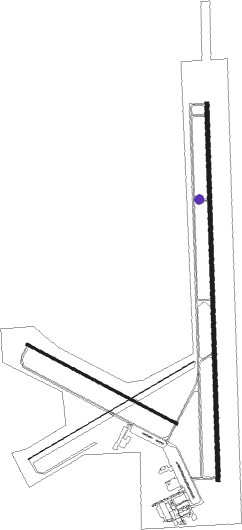
Runway info
Runway 17 / 35  | ||
| length | 2752m (9029ft) | |
| bearing | 184° / 4° | |
| width | 30m (100ft) | |
| surface | asphalt | |
| blast zone | 60m (197ft) / 61m (200ft) | |
| Runway 5 / 23 | ||
| length | 1411m (4629ft) | |
| bearing | 70° / 250° | |
| width | 1m (3ft) | |
| surface | asphalt | |
| Runway 10 / 28 | ||
| length | 1241m (4072ft) | |
| bearing | 115° / 295° | |
| width | 18m (60ft) | |
| surface | asphalt | |
| blast zone | 0m (0ft) / 149m (489ft) | |
Nearby beacons
| code | identifier | dist | bearing | frequency |
|---|---|---|---|---|
| LHO | BRIGHAM CITY (LOGAN) VOR/DME | 7 | 271° | 112.90 |
| OGD | OGDEN VORTAC | 35.8 | 204° | 115.70 |
| MLD | MALAD CITY VOR/DME | 36.3 | 304° | 117.40 |
| HIF | HILL (OGDEN) TACAN | 40.5 | 189° | 111.20 |
| EVW | EVANSTON VOR/DME | 47.7 | 123° | 109.60 |
| TCH | WASATCH VORTAC | 56.8 | 188° | 116.80 |
Instrument approach procedures
| runway | airway (heading) | route (dist, bearing) |
|---|---|---|
| RW17 | CORIN (58°) | CORIN FILOB (36mi, 28°) 10400ft FILOB (turn) 10400ft |
| RW17 | HODNI (207°) | HODNI FILOB (10mi, 279°) 10400ft FILOB (turn) 10400ft |
| RW17 | ORNEY (168°) | ORNEY FILOB (8mi, 346°) 10400ft FILOB (turn) 10400ft |
| RW17 | TINRE (141°) | TINRE FILOB (10mi, 99°) 10400ft |
| RNAV | FILOB 10400ft ORNEY (8mi, 166°) 7900ft ACACO (5mi, 148°) 6300ft KLGU (7mi, 185°) 4507ft (6373mi, 110°) 4857ft PIMIE (6392mi, 290°) 10000ft PIMIE (turn) | |
| RW35 | BYBEE (337°) | BYBEE JIPOS (11mi, 288°) 11400ft |
| RW35 | JIPOS (3°) | JIPOS 11400ft |
| RW35 | OGD (24°) | OGD JIPOS (15mi, 51°) 11400ft |
| RNAV | JIPOS 11400ft EPSAC (7mi, 4°) 9200ft OBNUE (4mi, 4°) 8100ft UHINE (4mi, 4°) 7000ft COVNU (5mi, 4°) 5360ft KLGU (3mi, 0°) 4502ft (6373mi, 110°) 4900ft PIMIE (6392mi, 290°) 10000ft PIMIE (turn) |
Disclaimer
The information on this website is not for real aviation. Use this data with the X-Plane flight simulator only! Data taken with kind consent from X-Plane 12 source code and data files. Content is subject to change without notice.