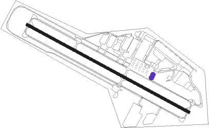
Longmont - Vance Brand
Airport details
| Country | United States of America |
| State | Colorado |
| Region | K2 |
| Airspace | Denver Ctr |
| Municipality | Longmont |
| Elevation | 5048ft (1539m) |
| Timezone | GMT -7 |
| Coordinates | 40.16439, -105.16364 |
| Magnetic var | |
| Type | land |
| Available since | X-Plane v10.40 |
| ICAO code | KLMO |
| IATA code | n/a |
| FAA code | LMO |
Communication
| Vance Brand AWOS 3 | 120.000 |
| Vance Brand CTAF/UNICOM | 122.975 |
| Vance Brand DENVER Approach/Departure | 126.100 |
Nearby Points of Interest:
Longmont Fire Department
-St. Stephen's Episcopal Church
-Longmont College
-Boulder County Poor Farm
-Boulder Valley Grange No. 131
-McKenzie Well
-United Church of Christ of Highlandlake
-Bimson Blacksmith Shop
-Carnegie Library
-Little Church in the Pines
-Salina School
-Wall Street Assay Office
-First United Presbyterian Church
-William H. McCreery House
-Walker Ranch
-Rocky Flats Plant
-Ward Congregational Church
-Twin Sisters Lookout
-Wild Basin House
-Wild Basin Ranger Station
-Thede Farmhouse
-William J. Gregory House
-Park Theatre
-Bowles House
-Harris Park School
Nearby beacons
| code | identifier | dist | bearing | frequency |
|---|---|---|---|---|
| FN | COLLN (FT COLLINS-LOVELAND) NDB | 14.8 | 44° | 400 |
| BJC | JEFFCO (DENVER) VOR/DME | 15.1 | 174° | 115.40 |
| DVV | MILE HIGH (DENVER) VORTAC | 29.6 | 117° | 114.70 |
| DEN | DENVER VOR/DME | 31.3 | 125° | 117.90 |
| BKF | BUCKLEY (AURORA) TACAN | 33.3 | 138° | 109.60 |
| GLL | GILL VOR/DME | 34.5 | 61° | 114.20 |
| FQF | FALCON (DENVER) VORTAC | 37.8 | 131° | 116.30 |
Departure and arrival routes
| Transition altitude | 18000ft |
| Transition level | 18000ft |
| SID end points | distance | outbound heading | |
|---|---|---|---|
| ALL | |||
| ECHOO1 | 174mi | 90° | |
| SKYEE1 | 190mi | 150° | |
| WNGSS1 | 79mi | 248° | |
| MRSHH2 | 79mi | 351° | |
| STAR starting points | distance | inbound heading | |
|---|---|---|---|
| ALL | |||
| PINNR3 | 29.5 | 173° | |
| BRNKO2 | 55.4 | 248° | |
Instrument approach procedures
| runway | airway (heading) | route (dist, bearing) |
|---|---|---|
| RW29 | FIPSS (313°) | FIPSS FIMUR (6mi, 7°) 7300ft |
| RW29 | WOLTS (287°) | WOLTS FIMUR (7mi, 271°) 7300ft |
| RNAV | FIMUR 7300ft MELVN (6mi, 296°) 7000ft KLMO (6mi, 296°) 5066ft (6098mi, 111°) 5540ft NIWOT (6089mi, 291°) 7400ft NIWOT (turn) 7400ft |
Disclaimer
The information on this website is not for real aviation. Use this data with the X-Plane flight simulator only! Data taken with kind consent from X-Plane 12 source code and data files. Content is subject to change without notice.