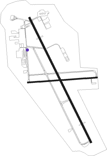
Klamath Falls
Airport details
| Country | United States of America |
| State | Oregon |
| Region | K1 |
| Airspace | Seattle Ctr |
| Municipality | Klamath Falls |
| Elevation | 4095ft (1248m) |
| Timezone | GMT -8 |
| Coordinates | 42.15614, -121.73319 |
| Magnetic var | |
| Type | land |
| Available since | X-Plane v10.40 |
| ICAO code | KLMT |
| IATA code | LMT |
| FAA code | LMT |
Communication
| Klamath Falls ATIS | 126.500 |
| Klamath Falls CTAF | 118.200 |
| Klamath Falls UNICOM | 122.950 |
| Klamath Falls Ground Control | 121.900 |
| Klamath Falls KINGSLEY Tower | 118.200 |
| Klamath Falls KINGSLEY Approach/Departure | 123.675 |
Approach frequencies
| ILS-cat-I | RW32 | 109.5 | 18.00mi |
| 3° GS | RW32 | 109.5 | 18.00mi |
Nearby Points of Interest:
Klamath Falls City Hall
-Judge Henry L. Benson House
-Richardson–Ulrich House
-Blackburn Sanitarium
-Captain Jack's Stronghold
-Lake of the Woods Ranger Station
Nearby beacons
| code | identifier | dist | bearing | frequency |
|---|---|---|---|---|
| LMT | KLAMATH FALLS VORTAC | 0.3 | 118° | 115.90 |
| MOG | MONTAGUE NDB | 42.2 | 240° | 404 |
Instrument approach procedures
| runway | airway (heading) | route (dist, bearing) |
|---|---|---|
| RW14 | MIXUP (144°) | MIXUP PIKYI (9mi, 132°) 8300ft |
| RW14 | SPRAG (192°) | SPRAG PIKYI (12mi, 238°) 8300ft |
| RNAV | PIKYI 8300ft CUTOK (6mi, 152°) 7000ft FOVMI (2mi, 152°) 6480ft HOKBI (1mi, 152°) 6000ft WILLK (turn) 5680ft KLMT (6mi, 152°) 4141ft LAGYI (2mi, 152°) MUREX (16mi, 183°) 9300ft MUREX (turn) | |
| RW32 | LEESR (49°) | LEESR MUREX (11mi, 114°) 8600ft ZOOMI (6mi, 69°) 8300ft |
| RW32 | TULIP (320°) | TULIP ZOOMI (4mi, 276°) 8300ft |
| RNAV | ZOOMI 8300ft MZAMA (8mi, 332°) 6300ft SRCUS (3mi, 332°) 5360ft KLMT (5mi, 332°) 4150ft YUPUS (3mi, 332°) FEXAV (9mi, 267°) LEESR (14mi, 175°) 8600ft LEESR (turn) |
Disclaimer
The information on this website is not for real aviation. Use this data with the X-Plane flight simulator only! Data taken with kind consent from X-Plane 12 source code and data files. Content is subject to change without notice.

