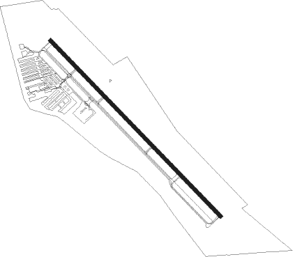
Lancaster - Lancaster Rgnl
Airport details
| Country | United States of America |
| State | Texas |
| Region | K4 |
| Airspace | Ft Worth Ctr |
| Municipality | Lancaster |
| Elevation | 500ft (152m) |
| Timezone | GMT -6 |
| Coordinates | 32.57761, -96.71751 |
| Magnetic var | |
| Type | land |
| Available since | X-Plane v10.40 |
| ICAO code | KLNC |
| IATA code | n/a |
| FAA code | LNC |
Communication
| Lancaster Rgnl AWOS 3 | 118.975 |
| Lancaster Rgnl CTAF/UNICOM | 122.700 |
| Lancaster Rgnl RGNL Approach/Departure | 125.200 |
Nearby Points of Interest:
W. A. Strain Farm-Strain House
-Randlett House
-Medical Dental Building
-Wheatley Place, Dallas
-North Bishop Avenue Commercial Historic District
-South Boulevard–Park Row Historic District
-Lake Cliff
-Kings Highway Conservation District, Dallas
-Houston Street Viaduct
-Fair Park
-Kessler Park Historic District
-William Lewis House
-Chevrolet Motor Company Building
-Santa Fe Terminal Complex
-Dallas Downtown Historic District
-Dallas Municipal Building
-Adolphus Hotel
-Wilson Building
-Titche-Goettinger Building
-Kirby Building
-Davis Building
-Grand Lodge of the Colored Knights of Pythias
-Dallas County Courthouse
-One Main Place
-Sanger Harris department store building
Nearby beacons
| code | identifier | dist | bearing | frequency |
|---|---|---|---|---|
| PQF | MESQUITE NDB | 16.8 | 39° | 248 |
| CVE | COWBOY (DALLAS) VOR/DME | 21 | 329° | 116.20 |
| TTT | MAVERICK VOR/DME | 23.9 | 312° | 113.10 |
| FUZ | RANGER (DALLAS-FORT WORTH VORTAC | 29.9 | 304° | 115.70 |
| CGQ | POWELL (CORSICANA) NDB | 34.1 | 150° | 344 |
| CQY | CEDAR CREEK VORTAC | 34.5 | 128° | 114.80 |
| CRS | CORSICANA NDB | 36.8 | 150° | 396 |
| FT | MUFIN (FORT WORTH) NDB | 38.1 | 296° | 365 |
| NFW | NAS JRB FORT WORTH (FT WO TACAN | 38.3 | 285° | 108.70 |
| MJF | ARVILLA (GREENVILLE) TACAN | 44.2 | 53° | 109.60 |
| GV | MAJOR (GREENVILLE) NDB | 47.9 | 48° | 201 |
| DT | PINCK (DENTON) NDB | 48.7 | 326° | 257 |
| CSZ | CROSSROADS NDB | 49.4 | 124° | 215 |
| LXY | MEXIA NDB | 57.2 | 168° | 329 |
| GNL | GROESBECK (MEXIA) VOR/DME | 60.4 | 170° | 108.80 |
| ACT | WACO VORTAC | 61.7 | 211° | 115.30 |
| BYP | BONHAM VORTAC | 62.5 | 27° | 114.60 |
Departure and arrival routes
| Transition altitude | 18000ft |
| Transition level | 18000ft |
| SID end points | distance | outbound heading | |
|---|---|---|---|
| ALL | |||
| DALL8 | 145mi | 71° | |
| KUSSO8 | 166mi | 96° | |
| GARL1 | 68mi | 100° | |
| JPOOL3 | 66mi | 199° | |
| SWABR8 | 132mi | 269° | |
| TEX1 | 109mi | 351° | |
| STAR starting points | distance | inbound heading | |
|---|---|---|---|
| ALL | |||
| SWVAY4 | 42.8 | 69° | |
| GREGS9, HERBZ1, JFRYE4 | 64.5 | 139° | |
| FINGR7, SLANT3 | 45.4 | 209° | |
| DODJE6, REEKO3 | 18.8 | 335° | |
Holding patterns
| STAR name | hold at | type | turn | heading* | altitude | leg | speed limit |
|---|---|---|---|---|---|---|---|
| DODJE6 | CAPTI | VHF | left | 73 (253)° | 1.0min timed | ICAO rules | |
| DODJE6 | CQY | NDB | left | 95 (275)° | < 60000ft | 1.0min timed | ICAO rules |
| DODJE6 | GGG | NDB | right | 114 (294)° | < 17999ft | 1.0min timed | ICAO rules |
| DODJE6 | HERRI | VHF | left | 101 (281)° | 1.0min timed | ICAO rules | |
| DODJE6 | WEIRS | VHF | left | 128 (308)° | < 17999ft | 1.0min timed | ICAO rules |
| FINGR7 | BIRLE | VHF | right | 35 (215)° | 1.5min timed | ICAO rules | |
| FINGR7 | BYP | NDB | right | 45 (225)° | < 60000ft | 1.0min timed | ICAO rules |
| FINGR7 | GAATZ | VHF | right | 35 (215)° | 1.0min timed | ICAO rules | |
| FINGR7 | GLOVE | VHF | right | 64 (244)° | 18000ft - 45000ft | 1.5min timed | ICAO rules |
| GREGS9 | ACKME | VHF | right | 15 (195)° | 1.0min timed | ICAO rules | |
| GREGS9 | HEATR | VHF | left | 299 (119)° | 1.5min timed | ICAO rules | |
| GREGS9 | KAJAY | VHF | right | 283 (103)° | 1.5min timed | ICAO rules | |
| GREGS9 | MOOSE | VHF | left | 15 (195)° | 1.0min timed | ICAO rules | |
| GREGS9 | PLEBS | VHF | left | 283 (103)° | 1.0min timed | ICAO rules | |
| GREGS9 | SPS | NDB | left | 348 (168)° | 1.0min timed | ICAO rules | |
| GREGS9 | TURKI | VHF | right | 266 (86)° | 1.5min timed | ICAO rules | |
| GREGS9 | UKW | NDB | left | 283 (103)° | 1.0min timed | ICAO rules | |
| GREGS9 | ZANTO | VHF | left | 283 (103)° | 1.5min timed | ICAO rules | |
| HERBZ1 | BELYY | VHF | left | 316 (136)° | DME 10.0mi | ICAO rules | |
| HERBZ1 | DEDWT | VHF | left | 279 (99)° | DME 10.0mi | ICAO rules | |
| HERBZ1 | HNKER | VHF | right | 274 (94)° | DME 10.0mi | ICAO rules | |
| HERBZ1 | LNDUS | VHF | left | 297 (117)° | DME 10.0mi | ICAO rules | |
| HERBZ1 | POTZY | VHF | left | 356 (176)° | DME 10.0mi | ICAO rules | |
| HERBZ1 | TURKI | VHF | right | 266 (86)° | 1.5min timed | ICAO rules | |
| JFRYE4 | BELYY | VHF | left | 316 (136)° | DME 10.0mi | ICAO rules | |
| JFRYE4 | DEDWT | VHF | left | 279 (99)° | DME 10.0mi | ICAO rules | |
| JFRYE4 | HNKER | VHF | right | 274 (94)° | DME 10.0mi | ICAO rules | |
| JFRYE4 | LNDUS | VHF | left | 297 (117)° | DME 10.0mi | ICAO rules | |
| JFRYE4 | POTZY | VHF | left | 356 (176)° | DME 10.0mi | ICAO rules | |
| JFRYE4 | TURKI | VHF | right | 266 (86)° | 1.5min timed | ICAO rules | |
| REEKO3 | PURRS | VHF | left | 136 (316)° | DME 10.0mi | ICAO rules | |
| REEKO3 | VDUBB | VHF | left | 83 (263)° | DME 10.0mi | ICAO rules | |
| SLANT3 | CUBAN | VHF | right | 64 (244)° | DME 10.0mi | ICAO rules | |
| SLANT3 | JETTT | VHF | right | 66 (246)° | DME 10.0mi | ICAO rules | |
| SLANT3 | KIDDD | VHF | right | 65 (245)° | DME 10.0mi | ICAO rules | |
| SLANT3 | SEEVR | VHF | right | 45 (225)° | DME 10.0mi | ICAO rules | |
| SWVAY4 | AGAIN | VHF | right | 195 (15)° | DME 10.0mi | ICAO rules | |
| SWVAY4 | FRSTI | VHF | right | 207 (27)° | DME 10.0mi | ICAO rules | |
| SWVAY4 | PUNKY | VHF | right | 259 (79)° | DME 10.0mi | ICAO rules | |
| SWVAY4 | SHLLY | VHF | right | 268 (88)° | DME 10.0mi | ICAO rules | |
| *) magnetic outbound (inbound) holding course | |||||||
Disclaimer
The information on this website is not for real aviation. Use this data with the X-Plane flight simulator only! Data taken with kind consent from X-Plane 12 source code and data files. Content is subject to change without notice.