Las Vegas - Nellis Afb
Airport details
| Country | United States of America |
| State | Nevada |
| Region | K2 |
| Airspace | Los Angeles Ctr |
| Municipality | Clark County |
| Elevation | 1870ft (570m) |
| Timezone | GMT -8 |
| Coordinates | 36.23620, -115.03426 |
| Magnetic var | |
| Type | land |
| Available since | X-Plane v10.40 |
| ICAO code | KLSV |
| IATA code | LSV |
| FAA code | LSV |
Communication
| Nellis AFB Clearance DEL | 120.900 |
| Nellis AFB Ground Control | 121.800 |
| Nellis AFB Tower | 132.550 |
| Nellis AFB Approach | 118.125 |
| Nellis AFB Approach | 124.950 |
| Nellis AFB Departure | 135.100 |
Approach frequencies
| ILS-cat-I | RW21L | 109.1 | 18.00mi |
| 3° GS | RW21L | 109.1 | 18.00mi |
Nearby Points of Interest:
Kyle Ranch
-Old Las Vegas Mormon Fort State Historic Park
-The Green Shack
-Las Vegas Grammar School
-Clark Avenue Railroad Underpass
-Harrison's Guest House
-Morelli House
-Las Vegas High School Academic Building and Gymnasium
-Las Vegas High School Neighborhood Historic District
-Huntridge Theatre
-Jay Dayton Smith House
-Railroad Cottage Historic District
-Las Vegas Springs
-Eureka
-Tule Springs Ranch
-Boulder City Historic District
-Boulder City Hospital
-Sandstone Ranch
-Willow Beach Gauging Station
-Goodsprings Schoolhouse
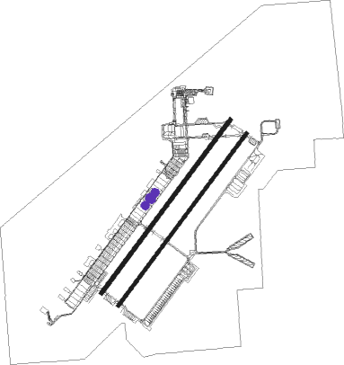
Runway info
Runway 3L / 21R  | ||
| length | 3085m (10121ft) | |
| bearing | 47° / 227° | |
| width | 61m (200ft) | |
| surface | concrete | |
| blast zone | 255m (837ft) / 255m (837ft) | |
| Runway 3R / 21L | ||
| length | 3064m (10052ft) | |
| bearing | 47° / 227° | |
| width | 46m (150ft) | |
| surface | concrete | |
| blast zone | 255m (837ft) / 255m (837ft) | |
Nearby beacons
| code | identifier | dist | bearing | frequency |
|---|---|---|---|---|
| LSV | NELLIS (LAS VEGAS) TACAN | 0.6 | 47° | 135.50 |
| LAS | LAS VEGAS VORTAC | 11.1 | 219° | 116.90 |
| BLD | BOULDER CITY VORTAC | 16.6 | 145° | 116.70 |
| GOG | DME | 30.4 | 233° | 112.05 |
| INS | INDIAN SPRINGS TACAN | 37.1 | 299° | 114 |
| MMM | MORMON MESA VORTAC | 48.5 | 55° | 114.30 |
Disclaimer
The information on this website is not for real aviation. Use this data with the X-Plane flight simulator only! Data taken with kind consent from X-Plane 12 source code and data files. Content is subject to change without notice.