Wells - Wells Muni Harriet Fld
Airport details
| Country | United States of America |
| State | Nevada |
| Region | K2 |
| Airspace | Salt Lake City Ctr |
| Municipality | Wells |
| Elevation | 5770ft (1759m) |
| Timezone | GMT -8 |
| Coordinates | 41.11711, -114.92214 |
| Magnetic var | |
| Type | land |
| Available since | X-Plane v10.40 |
| ICAO code | KLWL |
| IATA code | LWL |
| FAA code | LWL |
Communication
| Wells Muni Harriet Fld CTAF/UNICOM | 122.800 |
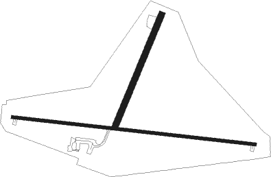
Runway info
Runway 01 / 19  | ||
| length | 818m (2684ft) | |
| bearing | 34° / 214° | |
| width | 43m (140ft) | |
| surface | gravel | |
| Runway 8 / 26 | ||
| length | 1681m (5515ft) | |
| bearing | 98° / 278° | |
| width | 23m (75ft) | |
| surface | asphalt | |
Nearby beacons
| code | identifier | dist | bearing | frequency |
|---|---|---|---|---|
| LWL | WELLS VOR/DME | 3 | 297° | 114.20 |
| BQU | BULLION (ELKO) VOR/DME | 43.7 | 247° | 114.50 |
Disclaimer
The information on this website is not for real aviation. Use this data with the X-Plane flight simulator only! Data taken with kind consent from X-Plane 12 source code and data files. Content is subject to change without notice.