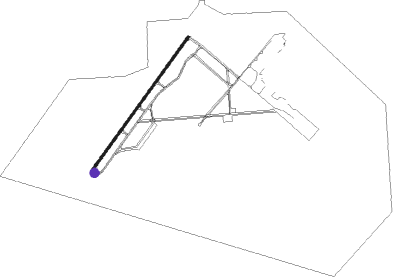
Tampa - Macdill Afb
Airport details
| Country | United States of America |
| State | Florida |
| Region | K7 |
| Airspace | Miami Oceanic Ctr |
| Municipality | Tampa |
| Elevation | 14ft (4m) |
| Timezone | GMT -5 |
| Coordinates | 27.84934, -82.52122 |
| Magnetic var | |
| Type | land |
| Available since | X-Plane v10.40 |
| ICAO code | KMCF |
| IATA code | MCF |
| FAA code | MCF |
Communication
| MacDILL AFB ATIS | 133.825 |
| MacDILL AFB Ground Control | 118.575 |
| MacDILL AFB Tower | 123.700 |
| MacDILL AFB TAMPA Approach | 124.950 |
| MacDILL AFB TAMPA Departure | 119.650 |
| MacDILL AFB TAMPA Departure | 119.900 |
Approach frequencies
| ILS-cat-I | RW23 | 111.7 | 18.00mi |
| ILS-cat-I | RW05 | 109.5 | 18.00mi |
| 3° GS | RW23 | 111.7 | 18.00mi |
| 3° GS | RW05 | 109.5 | 18.00mi |
Nearby Points of Interest:
Johnson-Wolff House
-Stovall House
-LeClaire Apartments
-House at 418 Blanca Avenue
-House at 301 Caspian Street
-House at 220 Blanca Avenue
-House at 202 Blanca Avenue
-House at 190 Bosporous Avenue
-House at 161 Bosporous Avenue
-House at 131 West Davis Boulevard
-Leiman House
-Hyde Park Historic Districts
-House at 116 West Davis Boulevard
-Bay Isle Commercial Building
-Tampania House
-House at 124 Baltic Circle
-House at 132 Baltic Circle
-House at 84 Adalia Avenue
-House at 125 Baltic Circle
-House at 97 Adriatic Avenue
-House at 100 West Davis Boulevard
-House at 59 Aegean Avenue
-House at 53 Aegean Avenue
-House at 36 Aegean Avenue
-Spanish Apartments
Nearby beacons
| code | identifier | dist | bearing | frequency |
|---|---|---|---|---|
| MCF | MACDILL (TAMPA) TACAN | 0.8 | 33° | 111 |
| PIE | SAINT PETERSBURG VORTAC | 9.3 | 290° | 116.40 |
| PI | CAPOK(ST PETERSBURG-CLEARWATER NDB | 13 | 309° | 360 |
| TP | COSME (TAMPA) NDB | 14.1 | 359° | 368 |
| SRQ | SARASOTA VOR/DME | 26.6 | 185° | 117 |
| LAL | LAKELAND VORTAC | 28.1 | 75° | 116 |
| PGD | PUNTA GORDA VOR | 62.7 | 150° | 110.20 |
Departure and arrival routes
| Transition altitude | 18000ft |
| Transition level | 18000ft |
| STAR starting points | distance | inbound heading | |
|---|---|---|---|
| ALL | |||
| RAYZZ2 | 34.5 | 96° | |
| DARBS3 | 27.8 | 135° | |
| MAATY2 | 42.6 | 140° | |
| LZARD6 | 29.2 | 205° | |
| DADES8 | 33.9 | 208° | |
| BRDGE8 | 31.4 | 316° | |
| RW05 | |||
| BLFRG1 | 31.5 | 318° | |
| RW23 | |||
| BLFRG1 | 31.5 | 318° | |
Instrument approach procedures
| runway | airway (heading) | route (dist, bearing) |
|---|---|---|
| RW05 | MILNE (41°) | MILNE 1600ft |
| RNAV | MILNE 1600ft EMASE (8mi, 41°) 1600ft KMCF (6mi, 42°) 63ft (5008mi, 109°) 1700ft AGUSE (4988mi, 289°) 2700ft AGUSE (turn) 4000ft | |
| RW23 | OZONA (231°) | OZONA 1700ft |
| RNAV | OZONA 1700ft MOBUE (6mi, 236°) 1600ft KMCF (6mi, 226°) 68ft (5008mi, 109°) 1600ft MILNE (5016mi, 288°) 1600ft MILNE (turn) 4000ft |
Holding patterns
| STAR name | hold at | type | turn | heading* | altitude | leg | speed limit |
|---|---|---|---|---|---|---|---|
| BLFRG1 | BLFRG | VHF | right | 137 (317)° | DME 10.0mi | ICAO rules | |
| BLFRG1 | COSAR | VHF | left | 148 (328)° | DME 10.0mi | ICAO rules | |
| BRDGE8 | BRDGE | VHF | right | 138 (318)° | < 17999ft | 1.0min timed | ICAO rules |
| DADES8 | EDISN | VHF | left | 359 (179)° | DME 10.0mi | ICAO rules | |
| DADES8 | OLENE | VHF | left | 3 (183)° | < 17999ft | 1.0min timed | ICAO rules |
| DADES8 | ZINGR | VHF | left | 75 (255)° | DME 10.0mi | ICAO rules | |
| DARBS3 | TABIR | VHF | right | 336 (156)° | < 17999ft | 1.0min timed | ICAO rules |
| LZARD6 | LZARD | VHF | right | 45 (225)° | < 17999ft | 1.0min timed | ICAO rules |
| LZARD6 | OLENE | VHF | left | 3 (183)° | < 17999ft | 1.0min timed | ICAO rules |
| MAATY2 | HEVVN | VHF | left | 336 (156)° | DME 10.0mi | ICAO rules | |
| MAATY2 | MAATY | VHF | right | 336 (156)° | DME 8.0mi | ICAO rules | |
| RAYZZ2 | DAAWG | VHF | right | 272 (92)° | DME 10.0mi | ICAO rules | |
| RAYZZ2 | RAYZZ | VHF | right | 270 (90)° | DME 10.0mi | ICAO rules | |
| *) magnetic outbound (inbound) holding course | |||||||
Disclaimer
The information on this website is not for real aviation. Use this data with the X-Plane flight simulator only! Data taken with kind consent from X-Plane 12 source code and data files. Content is subject to change without notice.