Carbondale/murphysboro - Southern Illinois
Airport details
| Country | United States of America |
| State | Illinois |
| Region | K5 |
| Airspace | Kansas City Ctr |
| Municipality | Jackson County |
| Elevation | 411ft (125m) |
| Timezone | GMT -6 |
| Coordinates | 37.77690, -89.24999 |
| Magnetic var | |
| Type | land |
| Available since | X-Plane v10.40 |
| ICAO code | KMDH |
| IATA code | MDH |
| FAA code | MDH |
Communication
| Southern Illinois ATIS | 119.850 |
| Southern Illinois CTAF | 125.350 |
| Southern Illinois UNICOM | 122.950 |
| Southern Illinois Ground Control | 121.800 |
| Southern Illinois CARBONDALE Tower | 126.250 |
| Southern Illinois CARBONDALE Tower | 125.350 |
Approach frequencies
| ILS-cat-I | RW18L | 110.9 | 18.00mi |
| 3° GS | RW18L | 110.9 | 18.00mi |
Nearby Points of Interest:
Illinois Central Railroad Passenger Depot
-R. Buckminster Fuller and Anne Hewlett Dome Home
-Reef House
-Jackson County Courthouse
-Cornelius Hennessy Building
-Murphysboro Elks Lodge
-Robert W. Hamilton House
-Liberty Theater
-Somerset Grange Hall
-William H. Hull House
-Mobile and Ohio Railroad Depot
-Little Grand Canyon
-Grand Tower Mining, Manufacturing and Transportation Company Site
-Cleiman Mound and Village Site
-Du Quoin State Fairgrounds
-Marion Veterans Affairs Medical Center
-Ed M. Stotlar House
-Goddard Chapel
-Williamson County Jail
-Willis Allen House
-West Frankfort City Hall
-Union Lookout
-Concordia Log Cabin College (Altenburg, Missouri)
-Saxon Lutheran Memorial (Frohna, Missouri)
-Stinson Memorial Library
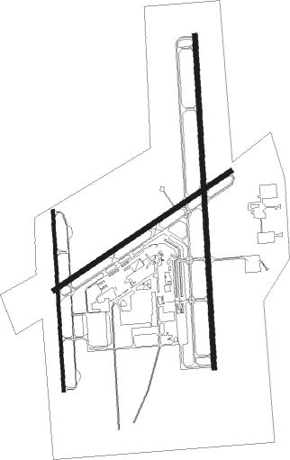
Runway info
Runway 18L / 36R  | ||
| length | 1985m (6512ft) | |
| bearing | 182° / 2° | |
| width | 30m (100ft) | |
| surface | asphalt | |
| Runway 6 / 24 | ||
| length | 1267m (4157ft) | |
| bearing | 66° / 246° | |
| width | 30m (100ft) | |
| surface | asphalt | |
| Runway 18R / 36L | ||
| length | 1075m (3527ft) | |
| bearing | 181° / 1° | |
| width | 18m (60ft) | |
| surface | asphalt | |
Nearby beacons
| code | identifier | dist | bearing | frequency |
|---|---|---|---|---|
| MD | CABBI (CARBONDALE-MURPHYSBORO) NDB | 5.6 | 3° | 388 |
| MWA | DME | 11.3 | 95° | 110.40 |
| MW | JONNY (MARION) NDB | 13.7 | 77° | 382 |
| CGI | GIRARDEAU DME | 36.3 | 210° | 112.90 |
| CG | DUTCH (CAPE GIRARDEAU) NDB | 38 | 221° | 248 |
| ENL | CENTRALIA VORTAC | 38.8 | 8° | 115 |
| VNN | VERNON DME | 40.8 | 37° | 113.80 |
| CIR | CAIRO NDB | 43 | 178° | 397 |
| FAM | FARMINGTON VORTAC | 47.1 | 264° | 115.70 |
| JD | GOOEY (BELLEVILLE) NDB | 48 | 325° | 385 |
| CNG | CUNNINGHAM (PADUCAH) VOR/DME | 50.1 | 152° | 113.10 |
| FWC | WAYNE CO (FAIRFIELD) NDB | 53.7 | 54° | 257 |
| SKE | SCOTT (BELLEVILLE) TACAN | 54.1 | 322° | 112.20 |
| CP | ACORE (CAHOKIA/ST LOUIS) NDB | 58.7 | 313° | 350 |
| TOY | TROY VORTAC | 65.8 | 325° | 116 |
Instrument approach procedures
| runway | airway (heading) | route (dist, bearing) |
|---|---|---|
| RW18L | ELUME (154°) | ELUME HEMPA (5mi, 91°) 2700ft |
| RW18L | FOGBO (210°) | FOGBO HEMPA (5mi, 271°) 2700ft |
| RW18L | HEMPA (182°) | HEMPA 2700ft |
| RNAV | HEMPA 2700ft JOROB (6mi, 182°) 2100ft KMDH (6mi, 183°) 459ft (5370mi, 113°) 800ft SOPAW (5370mi, 293°) 2700ft SOPAW (turn) | |
| RW36R | HENAN (332°) | HENAN SOPAW (5mi, 271°) 2700ft |
| RW36R | JESHE (30°) | JESHE SOPAW (5mi, 91°) 2700ft |
| RW36R | SOPAW (1°) | SOPAW 2700ft |
| RNAV | SOPAW 2700ft RYMAN (6mi, 2°) 2100ft ZAGDA (3mi, 2°) 1200ft KMDH (3mi, 359°) 452ft (5370mi, 113°) 811ft HEMPA (5369mi, 293°) 2700ft HEMPA (turn) |
Disclaimer
The information on this website is not for real aviation. Use this data with the X-Plane flight simulator only! Data taken with kind consent from X-Plane 12 source code and data files. Content is subject to change without notice.