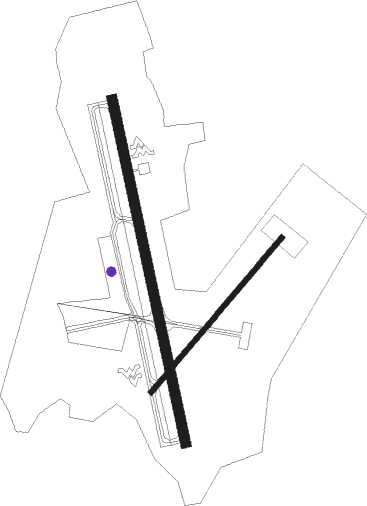
Morgantown - Morgantown Muni Walter L Bill Hart Fld
Airport details
| Country | United States of America |
| State | West Virginia |
| Region | K6 |
| Airspace | Cleveland Ctr |
| Municipality | Morgantown |
| Elevation | 1248ft (380m) |
| Timezone | GMT -5 |
| Coordinates | 39.64359, -79.91755 |
| Magnetic var | |
| Type | land |
| Available since | X-Plane v10.40 |
| ICAO code | KMGW |
| IATA code | MGW |
| FAA code | MGW |
Communication
| MORGANTOWN MUNI WALTER L BILL HART FLD ASOS | 120.675 |
| MORGANTOWN MUNI WALTER L BILL HART FLD CTAF | 125.100 |
| MORGANTOWN MUNI WALTER L BILL HART FLD UNICOM | 122.950 |
| MORGANTOWN MUNI WALTER L BILL HART FLD Ground Control | 121.700 |
| MORGANTOWN MUNI WALTER L BILL HART FLD Tower | 125.100 |
| MORGANTOWN MUNI WALTER L BILL HART FLD CLARKSBURG Approach/Departure | 121.150 |
Approach frequencies
| ILS-cat-I | RW18 | 108.5 | 18.00mi |
| 3° GS | RW18 | 108.5 | 18.00mi |
Nearby beacons
| code | identifier | dist | bearing | frequency |
|---|---|---|---|---|
| MGW | MORGANTOWN VOR/DME | 5.8 | 147° | 111.60 |
| VV | CAMOR (CONNELLSVILLE) NDB | 16.4 | 36° | 299 |
| CKB | CLARKSBURG VOR/DME | 28.5 | 222° | 112.60 |
| IHD | INDIAN HEAD VORTAC | 32.5 | 59° | 108.20 |
| AGC | ALLEGHENY (PITTSBURGH) VOR/DME | 38.5 | 349° | 110 |
| GRV | DME | 40.1 | 91° | 112.30 |
| EKN | ELKINS VORTAC | 44.5 | 194° | 114.20 |
| RQY | RANDOLPH CO. (ELKINS) NDB | 45.1 | 176° | 284 |
| AIR | BELLAIRE VOR/DME | 47.1 | 293° | 117.10 |
| HLG | WHEELING VOR/DME | 47.6 | 313° | 112.20 |
| ESL | KESSEL VOR/DME | 49.8 | 114° | 110.80 |
| MMJ | (PITTSBURGH) DME | 52.2 | 342° | 112 |
Instrument approach procedures
| runway | airway (heading) | route (dist, bearing) |
|---|---|---|
| RW18-Y | MGW (327°) | MGW JOHNB (18mi, 342°) 4000ft JOHNB (turn) 3000ft |
| RW18-Y | OTOWN (209°) | OTOWN JOHNB (8mi, 257°) 3000ft |
| RW18-Y | TEDDS (89°) | TEDDS OBEID (16mi, 48°) 4000ft JOHNB (5mi, 87°) 3000ft |
| RNAV | JOHNB 3000ft BSTAF (7mi, 170°) 2800ft ACIKI (3mi, 170°) 1920ft KMGW (2mi, 170°) 1296ft (4940mi, 116°) 1644ft OBEID (4948mi, 296°) 4000ft OBEID (turn) | |
| RW18-Z | MGW (327°) | MGW JOHNB (18mi, 342°) 4000ft JOHNB (turn) 3000ft |
| RW18-Z | OTOWN (209°) | OTOWN JOHNB (8mi, 257°) 3000ft |
| RW18-Z | TEDDS (89°) | TEDDS OBEID (16mi, 48°) 4000ft JOHNB (5mi, 87°) 3000ft |
| RNAV | JOHNB 3000ft BSTAF (7mi, 170°) 2800ft KMGW (5mi, 170°) 1295ft (4940mi, 116°) 1446ft BAGVE (4939mi, 296°) AFXAD (7mi, 223°) TEDDS (15mi, 295°) 4000ft TEDDS (turn) | |
| RW36 | DOCAY (27°) | DOCAY 4000ft |
| RW36 | TEDDS (89°) | TEDDS CEBAY (12mi, 147°) 4200ft DOCAY (7mi, 83°) 4000ft |
| RNAV | DOCAY 4000ft DOUBT (4mi, 44°) 3200ft KIRGE (2mi, 44°) 3000ft FEGOV (2mi, 10°) 2240ft GIVVE (2mi, 10°) 1464ft (4940mi, 116°) 1700ft TEDDS (4956mi, 296°) 4000ft TEDDS (turn) |
Disclaimer
The information on this website is not for real aviation. Use this data with the X-Plane flight simulator only! Data taken with kind consent from X-Plane 12 source code and data files. Content is subject to change without notice.

