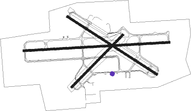
Moline - Quad City Intl
Airport details
| Country | United States of America |
| State | Illinois |
| Region | K5 |
| Airspace | Chicago Ctr |
| Municipality | Rock Island County |
| Elevation | 586ft (179m) |
| Timezone | GMT -6 |
| Coordinates | 41.44828, -90.50753 |
| Magnetic var | |
| Type | land |
| Available since | X-Plane v10.40 |
| ICAO code | KMLI |
| IATA code | MLI |
| FAA code | MLI |
Communication
| Quad City Intl ATIS | 121.200 |
| Quad City Intl UNICOM | 122.950 |
| Quad City Intl CTAF | 119.400 |
| Quad City Intl Clearance DEL | 123.950 |
| Quad City Intl Ground Control | 121.900 |
| Quad City Intl Tower | 119.400 |
| Quad City Intl Approach/Departure | 125.950 |
| Quad City Intl Approach/Departure | 133.275 |
Approach frequencies
| ILS-cat-I | RW27 | 110.5 | 18.00mi |
| ILS-cat-I | RW09 | 110.5 | 18.00mi |
| 3° GS | RW27 | 110.5 | 18.00mi |
| 3° GS | RW09 | 110.5 | 18.00mi |
Nearby Points of Interest:
Black Hawk Museum and Lodge
-John Deere House
-Moline Downtown Commercial Historic District
-Denkmann-Hauberg House
-Stauduhar House
-Villa de Chantal Historic District
-Rock Island Lines Passenger Station
-Robert Wagner House
-Rock Island Arsenal
-Lincoln School
-Connor House
-Potter House (Rock Island, Illinois)
-Sala Apartment Building
-Fort Armstrong Theatre
-Peoples National Bank Building-Fries Building
-Joseph F. Bettendorf House
-Best Building
-Regina Coeli Monastery
-Sainte Genevieve
-Henry Ebeling House
-Shields Woolen Mill
-Diedrich Busch House
-E.A. Shaw House
-Hose Station No. 1
-Davenport Motor Row and Industrial Historic District
Runway info
Nearby beacons
| code | identifier | dist | bearing | frequency |
|---|---|---|---|---|
| MZV | MOLINE VOR/DME | 9.6 | 226° | 114.40 |
| CVA | DAVENPORT VORTAC | 15.6 | 5° | 113.80 |
| FN | HILLZ (CLINTON) NDB | 18.9 | 21° | 517 |
| DDD | CITY DME | 29.3 | 263° | 116.50 |
| GBG | DME | 30.8 | 172° | 109.80 |
| BDF | BRADFORD VORTAC | 44.9 | 107° | 114.70 |
| BRL | BURLINGTON VOR/DME | 47.4 | 210° | 111.40 |
| DB | ZILOM (DUBUQUE) NDB | 52.6 | 354° | 341 |
| PLL | POLO VOR/DME | 53.9 | 62° | 111.20 |
| BR | BURNS (BURLINGTON) NDB | 55.2 | 218° | 390 |
| JZY | MACOMB NDB | 55.9 | 183° | 251 |
| PIA | PEORIA VORTAC | 56.3 | 137° | 115.20 |
| DBQ | DUBUQUE VORTAC | 57.9 | 348° | 115.80 |
| PI | TUNGG (PEORIA) NDB | 65.3 | 133° | 356 |
| EOK | KEOKUK NDB | 72.4 | 223° | 366 |
Instrument approach procedures
| runway | airway (heading) | route (dist, bearing) |
|---|---|---|
| RW09 | CVA (185°) | CVA TOCKY (20mi, 229°) 2400ft TOCKY (turn) 2300ft |
| RW09 | MZV (46°) | MZV TOCKY (10mi, 314°) 2400ft TOCKY (turn) 2300ft |
| RW09 | POCIN (69°) | POCIN BUFAL (8mi, 50°) 2300ft TOCKY (6mi, 41°) 2300ft |
| RW09 | ZELMI (108°) | ZELMI CIROD (9mi, 110°) 2700ft TOCKY (7mi, 142°) 2300ft |
| RNAV | TOCKY 2300ft SKRAP (7mi, 91°) 2000ft MERBE (2mi, 91°) 1220ft KMLI (3mi, 91°) 628ft (5428mi, 115°) 787ft TATNE (5415mi, 295°) 2500ft TATNE (turn) | |
| RW13 | IDOPE (120°) | IDOPE 2500ft |
| RW13 | NAYIL (144°) | NAYIL IDOPE (6mi, 225°) 2500ft |
| RW13 | NEBIC (101°) | NEBIC IDOPE (6mi, 45°) 2500ft |
| RNAV | IDOPE 2500ft FIRPA (8mi, 120°) 2300ft ALECU (3mi, 120°) 1460ft KMLI (3mi, 122°) 633ft (5428mi, 115°) 908ft ARACI (5426mi, 295°) MIGNE (7mi, 201°) MZV (6mi, 274°) 3000ft MZV (turn) | |
| RW27 | CVA (185°) | CVA TATNE (20mi, 135°) 2700ft TATNE (turn) 2500ft |
| RW27 | MZV (46°) | MZV TATNE (20mi, 74°) 2500ft TATNE (turn) 2500ft |
| RW27 | WAKDI (294°) | WAKDI ZARGI (10mi, 321°) 2500ft TATNE (7mi, 307°) 2500ft |
| RW27 | YOBUV (244°) | YOBUV JEDAG (15mi, 223°) 2500ft TATNE (7mi, 233°) 2500ft |
| RNAV | TATNE 2500ft OTTEN (7mi, 271°) 2300ft AUDIE (3mi, 271°) 1220ft KMLI (3mi, 270°) 626ft (5428mi, 115°) 781ft TOCKY (5440mi, 295°) 2300ft TOCKY (turn) | |
| RW31 | PCITY (300°) | PCITY 2500ft |
| RW31 | SABCO (322°) | SABCO PCITY (6mi, 46°) 2500ft |
| RW31 | SILTE (281°) | SILTE PCITY (6mi, 226°) 2500ft |
| RNAV | PCITY 2500ft FIKOS (9mi, 300°) 2300ft ARACI (3mi, 300°) 1380ft KMLI (3mi, 298°) 628ft (5428mi, 115°) 990ft ALECU (5430mi, 295°) MUTME (6mi, 243°) MZV (6mi, 162°) 3000ft MZV (turn) |
Disclaimer
The information on this website is not for real aviation. Use this data with the X-Plane flight simulator only! Data taken with kind consent from X-Plane 12 source code and data files. Content is subject to change without notice.

