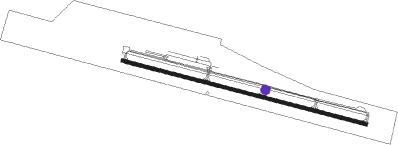
Mammoth Lakes - Mammoth Yosemite
Airport details
| Country | United States of America |
| State | California |
| Region | K2 |
| Airspace | Oakland Ctr |
| Municipality | Mammoth Lakes |
| Elevation | 7125ft (2172m) |
| Timezone | GMT -8 |
| Coordinates | 37.62405, -118.83875 |
| Magnetic var | |
| Type | land |
| Available since | X-Plane v10.40 |
| ICAO code | KMMH |
| IATA code | MMH |
| FAA code | MMH |
Communication
| Mammoth Yosemite AWOS 3 | 118.050 |
| Mammoth Yosemite CTAF/UNICOM | 122.800 |
| Mammoth Yosemite Oakland Center | 125.750 |
Nearby Points of Interest:
Devils Postpile National Monument Ranger Cabin
-Vogelsang High Sierra Camp
-Tioga Pass Entrance Station
-Great Sierra Mine Historic Site
-Tuolumne Meadows Ranger Stations and Comfort Stations
-Soda Springs Cabin
-McCauley Cabin
-Parsons Memorial Lodge
-Buck Camp Patrol Cabin
-John Muir Memorial Shelter
Nearby beacons
| code | identifier | dist | bearing | frequency |
|---|---|---|---|---|
| BIH | BISHOP VOR/DME | 26.9 | 118° | 109.60 |
| FRA | FRIANT VORTAC | 47.7 | 236° | 115.60 |
| CZQ | CLOVIS (FRESNO) VORTAC | 64.4 | 233° | 112.90 |
| MVA | MINA VORTAC | 68.1 | 41° | 115.10 |
Departure and arrival routes
| Transition altitude | 18000ft |
| Transition level | 18000ft |
| SID end points | distance | outbound heading | |
|---|---|---|---|
| RW09 | |||
| NIKOL2 | 22mi | 24° | |
| RW27 | |||
| NIKOL2 | 22mi | 24° | |
Instrument approach procedures
| runway | airway (heading) | route (dist, bearing) |
|---|---|---|
| RW27 | NIKOL (204°) | NIKOL EVERR (16mi, 152°) 13000ft JASAT (5mi, 152°) 11000ft |
| RW27 | WALLE (305°) | WALLE BIH (5mi, 12°) 12000ft JASAT (17mi, 332°) 11000ft |
| RNAV | JASAT 11000ft FEBAT (9mi, 263°) 9100ft KMMH (7mi, 274°) 7106ft (6754mi, 108°) 7535ft TEPRE (6747mi, 288°) EVERR (8mi, 65°) NIKOL (16mi, 332°) 13000ft NIKOL (turn) |
Disclaimer
The information on this website is not for real aviation. Use this data with the X-Plane flight simulator only! Data taken with kind consent from X-Plane 12 source code and data files. Content is subject to change without notice.
