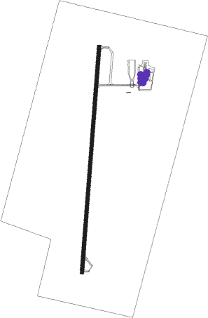
Hamilton - Hamilton Muni
Airport details
| Country | United States of America |
| State | Texas |
| Region | K4 |
| Airspace | Ft Worth Ctr |
| Municipality | Hamilton |
| Elevation | 1296ft (395m) |
| Timezone | GMT -6 |
| Coordinates | 31.66592, -98.14864 |
| Magnetic var | |
| Type | land |
| Available since | X-Plane v10.40 |
| ICAO code | KMNZ |
| IATA code | n/a |
| FAA code | MNZ |
Communication
| Hamilton Muni CTAF/UNICOM | 122.700 |
| Hamilton Muni GRAY Approach/Departure | 120.075 |
Nearby Points of Interest:
Hamilton County Courthouse
-Coryell County Courthouse
-Mills County Courthouse
-St. Louis and San Francisco Railway Depot
-Bosque County Courthouse
-Dawson Saloon
-First National Bank Building
-Erath County Courthouse
-Stephenville Downtown Historic District
-US 190 Bridge at the Colorado River
Runway info
| Runway 18 / 36 | ||
| length | 1525m (5003ft) | |
| bearing | 190° / 10° | |
| width | 23m (75ft) | |
| surface | asphalt | |
Nearby beacons
| code | identifier | dist | bearing | frequency |
|---|---|---|---|---|
| AGJ | GOOCH SPRINGS VORTAC | 28.8 | 179° | 112.50 |
| JEN | GLEN ROSE TACAN | 32.7 | 29° | 115 |
| GRK | GRAY (FORT HOOD) VOR/DME | 41.7 | 152° | 111.80 |
| BWD | BROWNWOOD VOR/DME | 43.4 | 286° | 108.60 |
| IL | IRESH (KILLEEN) NDB | 44.6 | 146° | 278 |
| ACT | WACO VORTAC | 44.9 | 90° | 115.30 |
| TPL | DME | 46.1 | 122° | 110.40 |
| LLO | LLANO VORTAC | 61.6 | 216° | 108.20 |
Instrument approach procedures
| runway | airway (heading) | route (dist, bearing) |
|---|---|---|
| RW18 | BUILT (93°) | BUILT ULIGY (14mi, 45°) 3600ft ULIGY (turn) 3600ft |
| RW18 | SONET (265°) | SONET MEZXI (22mi, 286°) 3600ft ULIGY (5mi, 278°) 3600ft |
| RNAV | ULIGY 3600ft FENIV (7mi, 191°) 2500ft KUYNU (1mi, 191°) 2040ft KMNZ (3mi, 190°) 1340ft (5821mi, 108°) 1555ft USXEL (5824mi, 288°) 3100ft USXEL (turn) | |
| RW36 | AGJ (359°) | AGJ USXEL (19mi, 353°) 3100ft |
| RW36 | BUILT (93°) | BUILT USXEL (12mi, 149°) 3100ft USXEL (turn) 3100ft |
| RNAV | USXEL 3100ft UDOBY (6mi, 10°) 2600ft ZUBVA (2mi, 10°) 2040ft KMNZ (3mi, 10°) 1340ft (5821mi, 108°) 1554ft ULIGY (5819mi, 288°) 3600ft ULIGY (turn) |
Disclaimer
The information on this website is not for real aviation. Use this data with the X-Plane flight simulator only! Data taken with kind consent from X-Plane 12 source code and data files. Content is subject to change without notice.
