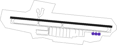
Mariposa - Mariposa-yosemite Airport
Airport details
| Country | United States of America |
| State | California |
| Region | K2 |
| Airspace | Oakland Ctr |
| Municipality | Mariposa County |
| Elevation | 2252ft (686m) |
| Timezone | GMT -8 |
| Coordinates | 37.50952, -120.03535 |
| Magnetic var | |
| Type | land |
| Available since | X-Plane v10.40 |
| ICAO code | KMPI |
| IATA code | RMY |
| FAA code | MPI |
Communication
| Mariposa-Yosemite Airport AWOS 3 | 135.600 |
| Mariposa-Yosemite Airport CTAF/UNICOM | 122.700 |
| Mariposa-Yosemite Airport OAKLAND CNTR | 121.250 |
Nearby Points of Interest:
Hornitos Masonic Hall No. 98
-Bower Cave
-El Portal Old Schoolhouse
-Bagby Stationhouse, Water Tanks and Turntable
-McCauley and Meyer Barns
-Chris Jorgensen Studio
-Hodgdon Homestead Cabin
-Yosemite Transportation Company Office
-Acting Superintendent's Headquarters
-The Wawona Hotel and Studio
-Pohono Bridge
-Great Sierra Wagon Road
-McGurk Cabin
-Old La Grange Schoolhouse
-Old Adobe Barn
-Odd Fellows Hall
-Yosemite Valley
-El Capitan Bridge
-Kaehler-Rector House
-Leggett House
-Maj. George Beecher Cook House
-Thomas H. Leggett House
-Merced County High School
-United States Post Office (Merced, California)
-Bank of Italy
Nearby beacons
| code | identifier | dist | bearing | frequency |
|---|---|---|---|---|
| HYP | EL NIDO (MERCED) VOR/DME | 24.6 | 232° | 114.20 |
| FRA | FRIANT VORTAC | 32.1 | 133° | 115.60 |
| CZQ | CLOVIS (FRESNO) VORTAC | 38.9 | 161° | 112.90 |
| MOD | MODESTO VOR/DME | 44.4 | 277° | 114.60 |
| LIN | LINDEN VOR/DME | 57.1 | 300° | 114.80 |
| PXN | PANOCHE VORTAC | 59.5 | 223° | 112.60 |
Instrument approach procedures
| runway | airway (heading) | route (dist, bearing) |
|---|---|---|
| RWNVA | COGOL (313°) | COGOL WOSMA (7mi, 331°) 5700ft |
| RNAV | WOSMA 5700ft TOTVE (6mi, 305°) 4600ft SUCOL (5mi, 299°) 3900ft (6810mi, 107°) 3900ft COGOL (6804mi, 287°) 7000ft COGOL (turn) | |
| RWNVB | HOFED (123°) | HOFED RICOD (13mi, 136°) 5100ft |
| RNAV | RICOD 5100ft SURAE (6mi, 114°) 4300ft WOSOD (6mi, 109°) 4180ft (6811mi, 107°) 4180ft TOTOY (6809mi, 287°) COGOL (16mi, 136°) 7000ft COGOL (turn) |
Disclaimer
The information on this website is not for real aviation. Use this data with the X-Plane flight simulator only! Data taken with kind consent from X-Plane 12 source code and data files. Content is subject to change without notice.
