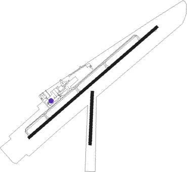
Columbia/mount Pleasant - Maury Co.
Airport details
| Country | United States of America |
| State | Tennessee |
| Region | K7 |
| Airspace | Memphis Ctr |
| Municipality | Mount Pleasant |
| Elevation | 681ft (208m) |
| Timezone | GMT -6 |
| Coordinates | 35.55439, -87.17914 |
| Magnetic var | |
| Type | land |
| Available since | X-Plane v10.40 |
| ICAO code | KMRC |
| IATA code | MRC |
| FAA code | MRC |
Communication
| Maury Co. AWOS 3 | 128.625 |
| Maury Co. CTAF/UNICOM | 122.800 |
Approach frequencies
| SDF | RW24 | 108.7 | 18.00mi |
Nearby beacons
| code | identifier | dist | bearing | frequency |
|---|---|---|---|---|
| GHM | (CENTERVILLE) DME | 21.4 | 316° | 111.60 |
| SYI | SHELBYVILLE VOR/DME | 36.1 | 89° | 113.55 |
| BNA | NASHVILLE VORTAC | 42.4 | 40° | 114.10 |
| FQW | WALTER HILL (MURFREESBORO) NDB | 46.3 | 63° | 371 |
| RQZ | ROCKET (HUNTSVILLE) VORTAC | 52.7 | 144° | 112.20 |
| MSL | MUSCLE SHOALS VORTAC | 53.1 | 200° | 116.50 |
| DCU | DME | 55.6 | 165° | 112.80 |
| CK | SNUFF(FT CAMPBELL (CLARKSVILLE NDB | 59.2 | 348° | 335 |
Instrument approach procedures
| runway | airway (heading) | route (dist, bearing) |
|---|---|---|
| RW06 | CEMVU (59°) | CEMVU 3000ft |
| RW06 | DOXGU (37°) | DOXGU 3000ft CEMVU (5mi, 318°) 3000ft |
| RW06 | IJAPU (79°) | IJAPU 3000ft CEMVU (5mi, 138°) 3000ft |
| RNAV | CEMVU 3000ft ALWUB (6mi, 59°) 2500ft KMRC (6mi, 59°) 704ft URSAW (12mi, 59°) 3000ft URSAW (turn) | |
| RW24 | FACDA (216°) | FACDA 3000ft URSAW (5mi, 138°) 3000ft |
| RW24 | MOKXE (259°) | MOKXE 3000ft URSAW (5mi, 318°) 3000ft |
| RW24 | URSAW (239°) | URSAW 3000ft |
| RNAV | URSAW 3000ft PUKBE (6mi, 239°) 2500ft KMRC (6mi, 239°) 721ft CEMVU (12mi, 239°) 3000ft CEMVU (turn) |
Disclaimer
The information on this website is not for real aviation. Use this data with the X-Plane flight simulator only! Data taken with kind consent from X-Plane 12 source code and data files. Content is subject to change without notice.

