Mount Vernon
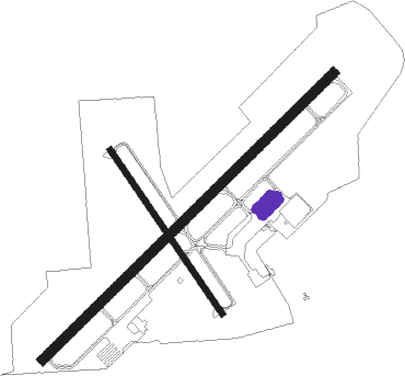
Airport details
| Country | United States of America |
| State | Illinois |
| Region | K5 |
| Airspace | Kansas City Ctr |
| Municipality | Mount Vernon |
| Elevation | 479ft (146m) |
| Timezone | GMT -6 |
| Coordinates | 38.31955, -88.85194 |
| Magnetic var | |
| Type | land |
| Available since | X-Plane v10.40 |
| ICAO code | KMVN |
| IATA code | n/a |
| FAA code | MVN |
Communication
| Mount Vernon CTAF/UNICOM | 123.000 |
Approach frequencies
| ILS-cat-I | RW23 | 111.7 | 18.00mi |
| 3° GS | RW23 | 111.7 | 18.00mi |
Nearby Points of Interest:
5th District Appellate Court
-C. H. Judd House
-Mayberry Mound and Village Site
-Sesser Opera House
-Sentinel Building
-Centralia Elks Lodge
-Centralia Commercial Historic District
-William Jennings Bryan Boyhood Home
-Badollet House
-Charles and Naomi Bachmann House
-Franklin County Jail
-Cloud State Bank
-Aaron G. Cloud House
-Chalon Guard and Emma Blades Cloud House
-Paine House (Xenia, Illinois)
-G.J. George House
-Louisville and Nashville Depot (Nashville, Illinois)
-West Frankfort City Hall
-Du Quoin State Fairgrounds
-Baltimore and Ohio Railroad Depot
-Calendar Rohrbough House
-Shriver House
-Pearl and Bess Meyer House
-Old Morrison Mill
-Perry County Jail

Nearby beacons
| code | identifier | dist | bearing | frequency |
|---|---|---|---|---|
| VNN | VERNON DME | 3.3 | 46° | 113.80 |
| ENL | CENTRALIA VORTAC | 15.6 | 288° | 115 |
| FWC | WAYNE CO (FAIRFIELD) NDB | 21.1 | 82° | 257 |
| MW | JONNY (MARION) NDB | 29.3 | 194° | 382 |
| MD | CABBI (CARBONDALE-MURPHYSBORO) NDB | 32.7 | 221° | 388 |
| MWA | DME | 34.7 | 196° | 110.40 |
| SAM | SAMSVILLE VOR/DME | 37.4 | 78° | 116.60 |
| GRE | GREENVILLE NDB | 39.3 | 315° | 233 |
| OLY | OLNEY NDB | 39.9 | 60° | 272 |
| BIB | BIBLE GROVE VORTAC | 40 | 32° | 109 |
| JD | GOOEY (BELLEVILLE) NDB | 42.7 | 280° | 385 |
| VLA | VANDALIA VOR/DME | 48.7 | 338° | 114.30 |
| SKE | SCOTT (BELLEVILLE) TACAN | 48.9 | 283° | 112.20 |
Instrument approach procedures
| runway | airway (heading) | route (dist, bearing) |
|---|---|---|
| RW05 | AYAZE (77°) | AYAZE GEJTO (5mi, 124°) 3000ft |
| RW05 | CRATS (210°) | CRATS GEJTO (27mi, 222°) 3000ft GEJTO (turn) 3000ft |
| RW05 | EWING (18°) | EWING GEJTO (9mi, 320°) 3000ft |
| RNAV | GEJTO 3000ft YOPZU (6mi, 56°) 2100ft HESUR (2mi, 57°) 1320ft KMVN (3mi, 63°) 522ft OFEND (16mi, 55°) 2400ft OFEND (turn) | |
| RW23 | CRATS (210°) | CRATS OFEND (7mi, 124°) 2400ft |
| RW23 | ENL (108°) | ENL OFEND (27mi, 82°) 2400ft OFEND (turn) 2400ft |
| RNAV | OFEND 2400ft YUCBI (10mi, 237°) 2400ft CUGOX (3mi, 237°) 1580ft KMVN (4mi, 231°) 520ft GEJTO (11mi, 238°) 3000ft GEJTO (turn) |
Disclaimer
The information on this website is not for real aviation. Use this data with the X-Plane flight simulator only! Data taken with kind consent from X-Plane 12 source code and data files. Content is subject to change without notice.