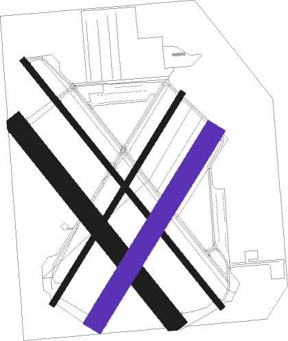
Milwaukee - Lawrence J. Timmerman
Airport details
| Country | United States of America |
| State | Wisconsin |
| Region | K5 |
| Airspace | Chicago Ctr |
| Municipality | Milwaukee |
| Elevation | 745ft (227m) |
| Timezone | GMT -6 |
| Coordinates | 43.11039, -88.03442 |
| Magnetic var | |
| Type | land |
| Available since | X-Plane v10.40 |
| ICAO code | KMWC |
| IATA code | MWC |
| FAA code | MWC |
Communication
| Lawrence J. Timmerman ATIS | 128.300 |
| Lawrence J. Timmerman CTAF | 120.500 |
| Lawrence J. Timmerman UNICOM | 122.950 |
| Lawrence J. Timmerman TIMMERMAN Ground Control | 121.700 |
| Lawrence J. Timmerman Tower | 120.500 |
| Lawrence J. Timmerman MILWAUKEE Approach | 125.350 |
| Lawrence J. Timmerman MILWAUKEE Departure | 125.350 |
Approach frequencies
| LOC | RW15L | 108.5 | 18.00mi |
Nearby Points of Interest:
George Lawrence Clarke Jr. House
-Dr. Fisk Holbrook Day House
-Wauwatosa Woman's Club Clubhouse
-North Sherman Boulevard Historic District
-Church Street Historic District
-Garden Homes Historic District
-Town of Milwaukee Town Hall
-Main Street Historic District
-Second Church of Christ, Scientist
-Edward J. Dahinden House
-Abraham H. Esbenshade House
-David W. Howie House
-Ward Memorial Hall
-West Allis Post Office
-Alexander Herschel and Pauline G. McMicken House
-Grand Avenue Congregational Church
-Greenfield School
-St. George Melkite Catholic Church
-Milwaukee Girls' Trade and Technical High School
-Wadham's Oil and Grease Company of Milwaukee
-Thomas Cook House
-Benjamin Church House
-Herman Uihlein House
-Pabst Brewery Complex
-Albert and Edith Adelman House
Runway info
Nearby beacons
| code | identifier | dist | bearing | frequency |
|---|---|---|---|---|
| LJT | (MILWAUKEE) DME | 0.1 | 258° | 115.65 |
| BAE | BADGER (MILWAUKEE) VOR/DME | 10.9 | 271° | 116.40 |
| BJB | WEST BEND VOR | 19.1 | 344° | 109.80 |
| HRK | (RACINE) DME | 23 | 148° | 117.70 |
| RA | PASER (RACINE) NDB | 26.3 | 162° | 206 |
| BUU | (BURLINGTON) DME | 27.8 | 212° | 114.50 |
| RYV | ROCK RIVER (WATERTOWN) NDB | 30.5 | 275° | 371 |
| ENW | DME | 31 | 169° | 109.20 |
| UNU | JUNEAU NDB | 34.9 | 296° | 344 |
| UG | WAUKE (CHICAGO/WAUKEGAN) NDB | 40.1 | 160° | 379 |
| FAH | (SHEBOYGAN) DME | 40.3 | 16° | 110 |
| OS | POBER (OSHKOSH) NDB | 51.2 | 326° | 395 |
| OBK | NORTHBROOK VOR/DME | 53.5 | 175° | 113 |
| OSH | OSHKOSH VORTAC | 57.5 | 329° | 116.75 |
Departure and arrival routes
| Transition altitude | 18000ft |
| Transition level | 18000ft |
| SID end points | distance | outbound heading | |
|---|---|---|---|
| ALL | |||
| UECKR6 | 72mi | 153° | |
| ACCRA5 | 71mi | 179° | |
| STAR starting points | distance | inbound heading | |
|---|---|---|---|
| ALL | |||
| GOPAC2 | 24.3 | 52° | |
Instrument approach procedures
| runway | airway (heading) | route (dist, bearing) |
|---|---|---|
| RW04L | BAE (91°) | BAE IVALY (11mi, 149°) 2600ft IVALY (turn) 2600ft |
| RW04L | BONOT (33°) | BONOT IVALY (5mi, 2°) 2600ft |
| RW04L | GREAS (72°) | GREAS IVALY (16mi, 88°) 2600ft |
| RNAV | IVALY 2600ft OWYAL (7mi, 45°) 2300ft OTEPY (3mi, 45°) 1340ft KMWC (2mi, 45°) 781ft (5319mi, 116°) 1145ft HAWKN (5330mi, 296°) 3000ft HAWKN (turn) | |
| RW15L | CYNDI (202°) | CYNDI HAXEP (21mi, 237°) 2800ft IZAHO (7mi, 189°) 2800ft |
| RW15L | EWAWI (107°) | EWAWI JEDEM (14mi, 86°) 2800ft IZAHO (7mi, 104°) 2800ft |
| RW15L | IZAHO (137°) | IZAHO 2800ft |
| RNAV | IZAHO 2800ft YIKUS (6mi, 137°) 2700ft NUHLE (4mi, 137°) 1500ft KMWC (3mi, 138°) 785ft (5319mi, 116°) 1300ft HAWKN (5330mi, 296°) 3000ft HAWKN (turn) | |
| RW22R | HAWKN (128°) | HAWKN OLIGY (18mi, 94°) 2700ft OLIGY (turn) 2700ft |
| RW22R | PROOT (266°) | PROOT WEGOM (6mi, 352°) 2700ft OLIGY (7mi, 282°) 2700ft |
| RW22R | WOKNO (214°) | WOKNO FITSA (7mi, 208°) 2700ft OLIGY (6mi, 196°) 2700ft |
| RNAV | OLIGY 2700ft ZOBIR (6mi, 225°) 2500ft WIKPI (4mi, 225°) 1300ft KMWC (2mi, 225°) 774ft (5319mi, 116°) 1145ft HAWKN (5330mi, 296°) 3000ft HAWKN (turn) |
Holding patterns
| STAR name | hold at | type | turn | heading* | altitude | leg | speed limit |
|---|---|---|---|---|---|---|---|
| GOPAC2 | LEEDN | VHF | right | 181 (1)° | DME 10.0mi | ICAO rules | |
| GOPAC2 | ZOWRO | VHF | right | 273 (93)° | DME 10.0mi | ICAO rules | |
| *) magnetic outbound (inbound) holding course | |||||||
Disclaimer
The information on this website is not for real aviation. Use this data with the X-Plane flight simulator only! Data taken with kind consent from X-Plane 12 source code and data files. Content is subject to change without notice.

