El Centro - El Centro Naf
Airport details
| Country | United States of America |
| State | California |
| Region | K2 |
| Airspace | Los Angeles Ctr |
| Municipality | CAL Fire San Diego Unit |
| Elevation | -41ft (-12m) |
| Timezone | GMT -8 |
| Coordinates | 32.82663, -115.66856 |
| Magnetic var | |
| Type | land |
| Available since | X-Plane v10.40 |
| ICAO code | KNJK |
| IATA code | NJK |
| FAA code | NJK |
Communication
| El Centro NAF El Centro ground | 121.900 |
| El Centro NAF El Centro Tower | 119.100 |
Nearby Points of Interest:
El Centro Main Post Office
-Calexico Carnegie Library
-Desert View Tower
-Algodones Dunes
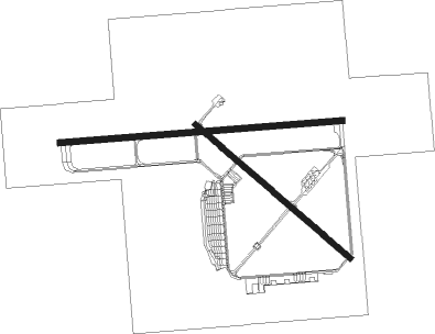
Runway info
Runway 12 / 30  | ||
| length | 2082m (6831ft) | |
| bearing | 130° / 310° | |
| width | 61m (200ft) | |
| surface | asphalt | |
| Runway 8 / 26 | ||
| length | 2891m (9485ft) | |
| bearing | 90° / 270° | |
| width | 61m (200ft) | |
| surface | concrete | |
Nearby beacons
| code | identifier | dist | bearing | frequency |
|---|---|---|---|---|
| NJK | EL CENTRO TACAN | 0.7 | 292° | 111 |
| IPL | IMPERIAL VORTAC | 9.3 | 116° | 115.90 |
| MXL | MEXICALI VOR/DME | 24.7 | 114° | 115 |
| JLI | JULIAN VORTAC | 49.9 | 289° | 114 |
| TRM | THERMAL VORTAC | 54.1 | 328° | 116.20 |
| BLH | BLYTHE VORTAC | 64.9 | 50° | 117.40 |
Instrument approach procedures
| runway | airway (heading) | route (dist, bearing) |
|---|---|---|
| RW26 | ARGUS (282°) | ARGUS 3600ft BEENY (3mi, 269°) 2100ft |
| RW26 | BEENY (284°) | BEENY 2100ft |
| RNAV | BEENY 2100ft BAGSE (8mi, 303°) 1700ft CUNSA (5mi, 270°) 1100ft KNJK (4mi, 268°) 4ft (6687mi, 106°) 500ft BEENY (6674mi, 286°) 2100ft BEENY (turn) 4000ft | |
| RW30 | ARGUS (282°) | ARGUS 3600ft BEENY (3mi, 269°) 2100ft |
| RW30 | BEENY (284°) | BEENY 2100ft |
| RNAV | BEENY 2100ft IPL (7mi, 269°) 1500ft LAMAW (5mi, 285°) 1100ft KNJK (4mi, 310°) 8ft (6687mi, 106°) 500ft BEENY (6674mi, 286°) 2100ft BEENY (turn) 4000ft |
Disclaimer
The information on this website is not for real aviation. Use this data with the X-Plane flight simulator only! Data taken with kind consent from X-Plane 12 source code and data files. Content is subject to change without notice.