San Diego - San Diego North Island Nas
Airport details
| Country | United States of America |
| State | California |
| Region | K2 |
| Airspace | Los Angeles Ctr |
| Municipality | Coronado |
| Elevation | 24ft (7m) |
| Timezone | GMT -8 |
| Coordinates | 32.70016, -117.22353 |
| Magnetic var | |
| Type | land |
| Available since | X-Plane v10.40 |
| ICAO code | KNZY |
| IATA code | NZY |
| FAA code | NZY |
Communication
| San Diego North Island NAS Clearance DEL | 128.400 |
| San Diego North Island NAS Ground Control | 118.000 |
| San Diego North Island NAS Tower | 135.100 |
| San Diego North Island NAS SOCAL Approach/Departure | 125.150 |
Nearby Points of Interest:
Naval Air Station North Island
-Rosecroft
-Rockwell Field
-Naval Training Center San Diego
-Heilman Villas
-Old Police Headquarters
-Pilot
-Marine Corps Recruit Depot San Diego
-Jacob Weinberger United States Courthouse
-Mission Brewery
-Independent Order of Odd Fellows Building
-San Diego Trust and Savings Bank Building
-San Diego Athletic Club
-Eagles Hall
-Casa de Estudillo
-Cosmopolitan Hotel and Restaurant
-Spruce Street Suspension Bridge
-Presidio of San Diego
-Ford Building
-Park Place Methodist Episcopal Church South
-California Quadrangle
-El Prado Complex
-Granger Hall
-Aztec Bowl
-Hepner Hall
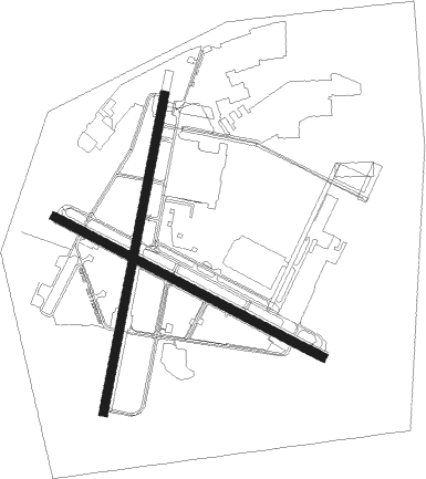
Runway info
Runway 18 / 36  | ||
| length | 2445m (8022ft) | |
| bearing | 198° / 18° | |
| width | 61m (200ft) | |
| surface | asphalt | |
| blast zone | 187m (614ft) / 183m (600ft) | |
| Runway 11 / 29 | ||
| length | 2287m (7503ft) | |
| bearing | 118° / 298° | |
| width | 63m (207ft) | |
| surface | asphalt | |
| blast zone | 60m (197ft) / 0m (0ft) | |
Nearby beacons
| code | identifier | dist | bearing | frequency |
|---|---|---|---|---|
| NZY | NORTH ISLAND (SAN DIEGO) TACAN | 0.3 | 72° | 117 |
| MZB | MISSION BAY (SAN DIEGO) VORTAC | 4.9 | 359° | 117.80 |
| NRS | IMPERIAL BEACH TACAN | 9.9 | 140° | 109.20 |
| NKX | MIRAMAR (SAN DIEGO) TACAN | 10.7 | 22° | 109.60 |
| PGY | POGGI (SAN DIEGO) VORTAC | 13.4 | 110° | 116.45 |
| TIJ | TIJUANA VOR/DME | 16.7 | 121° | 116.50 |
| OCN | OCEANSIDE VORTAC | 33.9 | 340° | 115.30 |
| NFG | CAMP PENDLETON (OCEANSIDE TACAN | 35.4 | 344° | 111.80 |
| JLI | JULIAN VORTAC | 41.6 | 55° | 114 |
| ENS | ENSENADA NDB | 62.6 | 146° | 400 |
| ELB | EL TORO (SANTA ANA) VOR/DME | 63.9 | 333° | 117.20 |
Departure and arrival routes
| Transition altitude | 18000ft |
| Transition level | 18000ft |
| STAR starting points | distance | inbound heading | |
|---|---|---|---|
| ALL | |||
| BARET5 | 27.9 | 262° | |
| CHASR2 | 32.8 | 275° | |
Instrument approach procedures
| runway | airway (heading) | route (dist, bearing) |
|---|---|---|
| RW36 | MZB (179°) | MZB 3000ft SKATE (18mi, 212°) 3000ft SKATE (turn) 3000ft |
| RW36 | OCN (160°) | OCN 3000ft SKATE (43mi, 178°) 3000ft SKATE (turn) 3000ft |
| RW36 | PGY (290°) | PGY 3000ft SKATE (21mi, 258°) 3000ft SKATE (turn) 3000ft |
| RNAV | SKATE 3000ft GASME (6mi, 87°) 3000ft CATCC (5mi, 22°) 1600ft ZOBAN (5mi, 10°) 136ft (6765mi, 106°) 426ft SKATE (6776mi, 285°) 2000ft SKATE (turn) 12000ft |
Holding patterns
| STAR name | hold at | type | turn | heading* | altitude | leg | speed limit |
|---|---|---|---|---|---|---|---|
| BARET5 | SALTN | VHF | right | 40 (220)° | DME 10.0mi | 210 | |
| CHASR2 | DSURT | VHF | left | 44 (224)° | DME 10.0mi | ICAO rules | |
| CHASR2 | IPL | NDB | right | 74 (254)° | 1.5min timed | ICAO rules | |
| *) magnetic outbound (inbound) holding course | |||||||
Disclaimer
The information on this website is not for real aviation. Use this data with the X-Plane flight simulator only! Data taken with kind consent from X-Plane 12 source code and data files. Content is subject to change without notice.