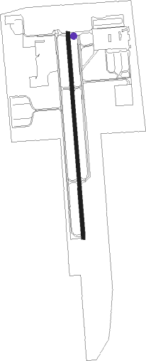
Olathe - Olathe - Johnson Co Exec
Airport details
| Country | United States of America |
| State | Kansas |
| Region | K3 |
| Airspace | Kansas City Ctr |
| Municipality | Olathe |
| Elevation | 1096ft (334m) |
| Timezone | GMT -6 |
| Coordinates | 38.84760, -94.73759 |
| Magnetic var | |
| Type | land |
| Available since | X-Plane v10.40 |
| ICAO code | KOJC |
| IATA code | OJC |
| FAA code | OJC |
Communication
| Olathe - Johnson Co Exec ATIS | 119.350 |
| Olathe - Johnson Co Exec CTAF | 126.000 |
| Olathe - Johnson Co Exec UNICOM | 122.950 |
| Olathe - Johnson Co Exec Ground Control | 121.600 |
| Olathe - Johnson Co Exec EXECUTIVE Tower | 126.000 |
| Olathe - Johnson Co Exec KANSAS CITY Approach/Departure | 118.900 |
Approach frequencies
| LOC | RW18 | 111.1 | 18.00mi |
| LOC | RW36 | 108.3 | 18.00mi |
Nearby Points of Interest:
Mahaffie House
-Albert Ott House
-I. O. Pickering House
-Franklin R. Lanter House
-Martin Van Buren Parker House
-William Thomas Turner Barn
-Harry S. Truman National Historic Site
-Wolcott House
-Bernard Corrigan House
-Seth E. Ward Homestead
-House at 54 E. 53rd Terrace
-Mineral Hall
-Argentine Carnegie Library
-Kelly's Westport Inn
-Sauer Castle
-Mutual Ice Company Building
-Loretto Academy
-Pilgrim Lutheran Church for the Deaf of Greater Kansas City and Parsonage
-Thomas Hart Benton Home and Studio State Historic Site
-Knickerbocker Apartments
-Westminister Congregational Church
-BMA Tower
-Rice-Tremonti House
-Kansas City Athenaeum
-Sacred Heart Church, School and Rectory
Nearby beacons
| code | identifier | dist | bearing | frequency |
|---|---|---|---|---|
| PK | HERBB (OLATHE) NDB | 5.6 | 180° | 420 |
| JZ | NEWBN (LAWRENCE) NDB | 19.8 | 279° | 338 |
| MCI | KANSAS CITY VORTAC | 26.2 | 0° | 113.25 |
| RN | HUGGY (KANSAS CITY) NDB | 27.7 | 346° | 416 |
| OWI | OTTAWA NDB | 30.3 | 239° | 251 |
| ANX | NAPOLEON VORTAC | 32 | 68° | 114 |
| BUM | BUTLER VORTAC | 36.4 | 157° | 115.90 |
| TOP | TOPEKA VORTAC | 41.6 | 290° | 117.80 |
| FOE | FORBES (TOPEKA) TACAN | 43.5 | 276° | 111.60 |
| TO | BILOY (TOPEKA) NDB | 47.2 | 286° | 521 |
| ST | TARIO (ST JOSEPH) NDB | 50.3 | 348° | 260 |
| BQS | BRAYMER VOR/DME | 61.8 | 48° | 115.35 |
Departure and arrival routes
| Transition altitude | 18000ft |
| Transition level | 18000ft |
| SID end points | distance | outbound heading | |
|---|---|---|---|
| ALL | |||
| ROYAL9 | 86mi | 5° | |
| WLDCT5 | 135mi | 272° | |
| TIFTO6 | 70mi | 303° | |
| RW18 | |||
| LAKES3 | 161mi | 76° | |
| RACER7 | 111mi | 137° | |
| CHIEF7 | 67mi | 350° | |
| RW36 | |||
| LAKES3 | 161mi | 76° | |
| RACER7 | 111mi | 137° | |
| CHIEF7 | 67mi | 350° | |
| STAR starting points | distance | inbound heading | |
|---|---|---|---|
| ALL | |||
| JHAWK6 | 32.0 | 86° | |
| BQS7 | 61.8 | 228° | |
| TYGER6 | 32.1 | 284° | |
Instrument approach procedures
| runway | airway (heading) | route (dist, bearing) |
|---|---|---|
| RW18 | EXIBY (151°) | EXIBY 3100ft ILLOW (5mi, 90°) 3100ft |
| RW18 | GOLNY (210°) | GOLNY 3100ft ILLOW (5mi, 270°) 3100ft |
| RW18 | ILLOW (180°) | ILLOW 3100ft |
| RNAV | ILLOW 3100ft CBLUM (6mi, 180°) 2700ft KOJC (5mi, 180°) 1136ft (5627mi, 112°) 1496ft MAREH (5627mi, 292°) 3000ft MAREH (turn) | |
| RW36 | LOLCU (331°) | LOLCU 3100ft MAREH (5mi, 270°) 3000ft |
| RW36 | MAREH (0°) | MAREH 3000ft |
| RW36 | OCUDE (29°) | OCUDE 3000ft MAREH (5mi, 90°) 3000ft |
| RNAV | MAREH 3000ft REXMY (6mi, 0°) 2700ft KOJC (5mi, 0°) 1090ft (5627mi, 112°) 1336ft ILLOW (5626mi, 292°) 3100ft ILLOW (turn) |
Holding patterns
| STAR name | hold at | type | turn | heading* | altitude | leg | speed limit |
|---|---|---|---|---|---|---|---|
| BQS7 | BQS | NDB | right | 54 (234)° | 1.0min timed | ICAO rules | |
| BQS7 | FONIX | VHF | right | 57 (237)° | 1.0min timed | ICAO rules | |
| JHAWK6 | JHAWK | VHF | left | 223 (43)° | < 17999ft | 1.0min timed | ICAO rules |
| TYGER6 | TYGER | VHF | left | 135 (315)° | < 17999ft | 1.0min timed | ICAO rules |
| *) magnetic outbound (inbound) holding course | |||||||
Disclaimer
The information on this website is not for real aviation. Use this data with the X-Plane flight simulator only! Data taken with kind consent from X-Plane 12 source code and data files. Content is subject to change without notice.