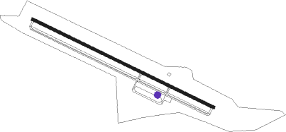
Sandersville - Kaolin Field
Airport details
| Country | United States of America |
| State | Georgia |
| Region | K7 |
| Airspace | Atlanta Ctr |
| Municipality | Sandersville |
| Elevation | 437ft (133m) |
| Timezone | GMT -5 |
| Coordinates | 32.96672, -82.83817 |
| Magnetic var | |
| Type | land |
| Available since | X-Plane v10.40 |
| ICAO code | KOKZ |
| IATA code | n/a |
| FAA code | OKZ |
Communication
| Kaolin Field AWOS 3 | 120.575 |
| Kaolin Field CTAF/UNICOM | 123.000 |
| Kaolin Field ATLANTA Approach/Departure | 119.600 |
| Kaolin Field ATLANTA Approach/Departure | 124.200 |
Runway info
| Runway 13 / 31 | ||
| length | 1531m (5023ft) | |
| bearing | 116° / 296° | |
| width | 23m (75ft) | |
| surface | asphalt | |
| blast zone | 0m (0ft) / 89m (292ft) | |
Nearby beacons
| code | identifier | dist | bearing | frequency |
|---|---|---|---|---|
| UMB | CULVR (MILLEDGEVILLE) NDB | 19.6 | 300° | 380 |
| DBN | DUBLIN VORTAC | 24.2 | 179° | 113.10 |
| EEX | EMANUEL COUNTY (SWAINSBORO) NDB | 26.5 | 128° | 309 |
| DB | CREKE (DUBLIN) NDB | 30.2 | 200° | 251 |
| AA | CEDAR (THOMSON) NDB | 35.8 | 22° | 341 |
| VV | JUNNE (GREENSBORO) NDB | 41.8 | 345° | 353 |
| WRB | ROBINS (WARNER ROBINS) TACAN | 42.7 | 247° | 135.30 |
| MCN | MACON VORTAC | 44 | 251° | 114.20 |
| AG | BUSHE (AUGUSTA) NDB | 48.7 | 70° | 233 |
| EMR | EMORY (AUGUSTA) NDB | 51.7 | 59° | 385 |
| MQW | MC RAE NDB | 52.3 | 183° | 280 |
| UQN | ONYUN (VIDALIA) NDB | 52.3 | 144° | 372 |
| EZM | EASTMAN NDB | 52.6 | 201° | 366 |
| IRQ | COLLIERS VORTAC | 55.9 | 42° | 113.90 |
| VNA | VIENNA VORTAC | 56.2 | 221° | 116.50 |
| VOF | ALCOVY (COVINGTON) NDB | 61.8 | 305° | 370 |
| AHN | ATHENS VOR/DME | 63.7 | 334° | 109.60 |
| BMW | BARROW COUNTY (WINDER) NDB | 69.2 | 322° | 404 |
Instrument approach procedures
| runway | airway (heading) | route (dist, bearing) |
|---|---|---|
| RW13 | BEYVA (116°) | BEYVA 2900ft |
| RNAV | BEYVA 2900ft AYORU (7mi, 116°) 2100ft ZUBMO (3mi, 116°) 1280ft KOKZ (3mi, 116°) 452ft (5045mi, 112°) 1100ft BEYVA (5056mi, 292°) 2900ft BEYVA (turn) | |
| RW31 | CUTUN (296°) | CUTUN 3000ft |
| RNAV | CUTUN 3000ft DICVA (7mi, 296°) 2100ft WISEN (3mi, 296°) 1260ft KOKZ (3mi, 296°) 482ft (5045mi, 112°) 738ft BEYVA (5056mi, 292°) 2900ft BEYVA (turn) |
Disclaimer
The information on this website is not for real aviation. Use this data with the X-Plane flight simulator only! Data taken with kind consent from X-Plane 12 source code and data files. Content is subject to change without notice.
