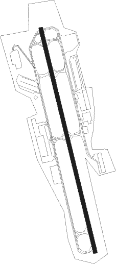
Oxford - Waterbury Oxford
Airport details
| Country | United States of America |
| State | Connecticut |
| Region | K6 |
| Airspace | Boston Ctr |
| Municipality | Oxford |
| Elevation | 726ft (221m) |
| Timezone | GMT -5 |
| Coordinates | 41.47855, -73.13525 |
| Magnetic var | |
| Type | land |
| Available since | X-Plane v10.40 |
| ICAO code | KOXC |
| IATA code | OXC |
| FAA code | OXC |
Communication
| Waterbury Oxford AWOS 3 | 132.975 |
| Waterbury Oxford CTAF | 118.475 |
| Waterbury Oxford UNICOM | 122.700 |
| Waterbury Oxford NEW YORK Clearance DEL | 135.100 |
| Waterbury Oxford Ground Control | 121.650 |
| Waterbury Oxford OXFORD Tower | 118.475 |
| Waterbury Oxford NEW YORK Approach/Departure | 135.100 |
| Waterbury Oxford NEW YORK Approach/Departure | 124.075 |
Approach frequencies
| ILS-cat-I | RW36 | 109.55 | 18.00mi |
| 3° GS | RW36 | 109.55 | 18.00mi |
Nearby Points of Interest:
Hurley Road Historic District
-Reuben Curtiss House
-Aaron Bronson House
-William Hurd House
-United States Post Office–Naugatuck Main
-Bronson B. Tuttle House
-Woodbury Historic District No. 2
-Depot Street Bridge
-Josiah Bronson House
-David Sherman House
-Jabez Bacon House
-Woodbury Historic District No. 1
-Downtown Seymour Historic District
-Leroy Anderson House
-Seymour High School
-Stevenson Dam Hydroelectric Plant
-Waterbury Municipal Center Complex
-Enoch Hibbard House and George Granniss House
-John Kendrick House
-Downtown Waterbury Historic District
-Southbury Training School
-Hotchkissville Historic District
-George S. Abbott Building
-Benedict-Miller House
-Sanford-Curtis-Thurber House
Nearby beacons
| code | identifier | dist | bearing | frequency |
|---|---|---|---|---|
| HVN | HAVEN DME | 17.1 | 131° | 109.80 |
| BDR | BRIDGEPORT VOR/DME | 19 | 178° | 108.80 |
| MAD | MADISON VOR/DME | 22.2 | 110° | 110.40 |
| CMK | CARMEL VOR/DME | 23.3 | 246° | 116.60 |
| PWL | PAWLING (POUGHKEEPSIE) VOR/DME | 27.2 | 302° | 114.30 |
| HFD | HARTFORD VOR/DME | 28.1 | 75° | 114.90 |
| IGN | KINGSTON VOR/DME | 32.8 | 285° | 117.60 |
| CCC | CALVERTON VOR/DME | 36.3 | 149° | 117.20 |
| SKU | STANWYCK (NEWBURGH) NDB | 41 | 273° | 261 |
| DPK | DEER PARK VOR/DME | 41.9 | 194° | 117.70 |
| FOK | SUFFOLK CO (WESTHAMPTON B TACAN | 44.7 | 142° | 111 |
| FR | FRIKK (FARMINGDALE) NDB | 44.9 | 206° | 407 |
| BAF | BARNES (WESTFIELD/SPRINGF VORTAC | 45.1 | 32° | 113 |
| CTR | CHESTER VOR/DME | 49.5 | 13° | 115.10 |
| HTO | HAMPTON (EAST HAMPTON) VORTAC | 49.9 | 124° | 113.60 |
| CEF | WESTOVER(SPRINGFIELD/CHIC TACAN | 51 | 40° | 114 |
| LGA | LA GUARDIA (NEW YORK) VOR/DME | 53.3 | 227° | 113.10 |
| PFH | PHILMONT (HUDSON) NDB | 53.4 | 323° | 272 |
| TEB | TETERBORO VOR/DME | 56.4 | 236° | 108.40 |
| JFK | KENNEDY (NEW YORK) VOR/DME | 58.3 | 217° | 115.90 |
| TE | TORBY (TETERBORO) NDB | 60.6 | 236° | 214 |
| CRI | CANARSIE VOR/DME | 62.3 | 221° | 112.30 |
Departure and arrival routes
| Transition altitude | 18000ft |
| Transition level | 18000ft |
| STAR starting points | distance | inbound heading | |
|---|---|---|---|
| ALL | |||
| BDR1, DENNA2 | 27.2 | 122° | |
Instrument approach procedures
| runway | airway (heading) | route (dist, bearing) |
|---|---|---|
| RW18 | BISCO (208°) | BISCO WEXNO (7mi, 259°) 3000ft |
| RW18 | PWL (122°) | PWL MOONI (15mi, 116°) 3000ft WEXNO (7mi, 83°) 3000ft |
| RW18 | WEXNO (168°) | WEXNO 6000ft WEXNO (turn) 3000ft |
| RNAV | WEXNO 3000ft ARQEB (5mi, 168°) 2200ft GICEN (2mi, 168°) 1580ft KOXC (3mi, 168°) 777ft (4651mi, 120°) 1130ft CUTMA (4647mi, 299°) 2500ft CUTMA (turn) | |
| RW36 | BDR (358°) | BDR CUTMA (7mi, 15°) 2500ft |
| RW36 | MUVGE (314°) | MUVGE CUTMA (9mi, 280°) 2500ft |
| RW36 | ZATMI (168°) | ZATMI CUTMA (16mi, 168°) 2500ft CUTMA (turn) 2500ft |
| RNAV | CUTMA 2500ft DAAVY (6mi, 348°) 2500ft HUMOM (4mi, 348°) 1300ft KOXC (2mi, 348°) 742ft (4651mi, 120°) 971ft ZATMI (4653mi, 300°) 3000ft ZATMI (turn) 3000ft |
Holding patterns
| STAR name | hold at | type | turn | heading* | altitude | leg | speed limit |
|---|---|---|---|---|---|---|---|
| BDR1 | LOVES | VHF | left | 336 (156)° | 1.0min timed | ICAO rules | |
| DENNA2 | LOVES | VHF | left | 336 (156)° | 1.0min timed | ICAO rules | |
| *) magnetic outbound (inbound) holding course | |||||||
Disclaimer
The information on this website is not for real aviation. Use this data with the X-Plane flight simulator only! Data taken with kind consent from X-Plane 12 source code and data files. Content is subject to change without notice.
