St Petersburg-clearwater - St Pete Clearwater Intl
Airport details
| Country | United States of America |
| State | Florida |
| Region | K7 |
| Airspace | Miami Oceanic Ctr |
| Municipality | Feather Sound |
| Elevation | 3ft (1m) |
| Timezone | GMT -5 |
| Coordinates | 27.90869, -82.68649 |
| Magnetic var | |
| Type | land |
| Available since | X-Plane v10.40 |
| ICAO code | KPIE |
| IATA code | PIE |
| FAA code | PIE |
Communication
| St Pete Clearwater Intl ATIS | 134.500 |
| St Pete Clearwater Intl UNICOM | 122.950 |
| St Pete Clearwater Intl CTAF | 118.300 |
| St Pete Clearwater Intl Clearance DEL | 120.600 |
| St Pete Clearwater Intl Ground Control | 121.900 |
| St Pete Clearwater Intl Tower | 118.300 |
| St Pete Clearwater Intl Tower | 128.400 |
| St Pete Clearwater Intl TAMPA Approach | 125.300 |
| St Pete Clearwater Intl TAMPA Departure | 125.300 |
Approach frequencies
| ILS-cat-II | RW18 | 109.1 | 18.00mi |
| ILS-cat-I | RW36 | 108.7 | 18.00mi |
| 3° GS | RW36 | 108.7 | 18.00mi |
| 3° GS | RW18 | 109.1 | 18.00mi |
Nearby Points of Interest:
Ingleside
-Louis Johnson Building
-Safety Harbor Site
-Louis Ducros House
-Old Belleair Town Hall
-Cleveland Street United States Post Office
-Harbor Oaks Residential District
-Old Pinellas County Courthouse
-Donald Roebling Estate
-Mount Olive African Methodist Episcopal Church
-Bay Pines Veterans Administration Home and Hospital Historic District
-St. Petersburg Woman's Club
-Huggins-Stengel Field
-Kenwood Historic District
-North Shore Historic District
-Casa De Muchas Flores
-Boone House
-J. O. Douglas House
-Veillard House
-St. Petersburg Lawn Bowling Club
-Downtown St. Petersburg Historic District
-Mirror Lake Library
-Casa Coe da Sol
-Willis S. Blatchley House
-John C. Williams House
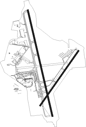
Runway info
Runway 18 / 36  | ||
| length | 2976m (9764ft) | |
| bearing | 170° / 350° | |
| width | 46m (150ft) | |
| surface | asphalt | |
| displ threshold | 0m (0ft) / 283m (928ft) | |
| blast zone | 46m (151ft) / 122m (400ft) | |
| Runway 4 / 22 | ||
| length | 1831m (6007ft) | |
| bearing | 43° / 223° | |
| width | 46m (150ft) | |
| surface | asphalt | |
| blast zone | 8m (26ft) / 68m (223ft) | |
Nearby beacons
| code | identifier | dist | bearing | frequency |
|---|---|---|---|---|
| PIE | SAINT PETERSBURG VORTAC | 0.1 | 113° | 116.40 |
| PI | CAPOK(ST PETERSBURG-CLEARWATER NDB | 5.2 | 349° | 360 |
| MCF | MACDILL (TAMPA) TACAN | 9.6 | 105° | 111 |
| TP | COSME (TAMPA) NDB | 13.6 | 42° | 368 |
| SRQ | SARASOTA VOR/DME | 30.8 | 166° | 117 |
| LAL | LAKELAND VORTAC | 35.9 | 83° | 116 |
| PGD | PUNTA GORDA VOR | 70.1 | 145° | 110.20 |
Departure and arrival routes
| Transition altitude | 18000ft |
| Transition level | 18000ft |
| SID end points | distance | outbound heading | |
|---|---|---|---|
| RW04 | |||
| MAEKO1 | 91mi | 360° | |
| RW18 | |||
| ENDED1 | 41mi | 349° | |
| BAYPO1, MAEKO1 | 91mi | 360° | |
| RW22 | |||
| MAEKO1 | 91mi | 360° | |
| RW36 | |||
| ENDED1 | 41mi | 349° | |
| BAYPO1, MAEKO1 | 91mi | 360° | |
| STAR starting points | distance | inbound heading | |
|---|---|---|---|
| ALL | |||
| RAYZZ2 | 25.5 | 91° | |
| TEEGN3 | 31.1 | 122° | |
| DARBS3 | 19.9 | 148° | |
| DADES8 | 35.6 | 224° | |
| LZARD6 | 30.7 | 224° | |
| BRDGE8 | 40.1 | 310° | |
| RW04 | |||
| BLFRG1 | 40.0 | 311° | |
| RW18 | |||
| BLFRG1 | 40.0 | 311° | |
| RW22 | |||
| BLFRG1 | 40.0 | 311° | |
| RW36 | |||
| BLFRG1 | 40.0 | 311° | |
Instrument approach procedures
| runway | airway (heading) | route (dist, bearing) |
|---|---|---|
| RW18 | DONHU (169°) | DONHU DETSE (4mi, 168°) 2600ft |
| RW18 | PIE (293°) | PIE DETSE (12mi, 349°) 2600ft DETSE (turn) 2600ft |
| RNAV | DETSE 2600ft SAUND (6mi, 170°) 1600ft WIGUS (3mi, 170°) 560ft KPIE (3mi, 168°) 60ft (5017mi, 109°) 207ft RONXI (5015mi, 289°) 2600ft RONXI (turn) | |
| RW36 | PIE (293°) | PIE RONXI (13mi, 171°) 2000ft RONXI (turn) 2000ft |
| RW36 | SRQ (346°) | SRQ RONXI (18mi, 343°) 2000ft |
| RNAV | RONXI 2000ft SONES (6mi, 350°) 2000ft SAWGA (4mi, 350°) 720ft KPIE (3mi, 352°) 65ft (5017mi, 109°) 210ft DETSE (5020mi, 289°) 2600ft DETSE (turn) |
Holding patterns
| STAR name | hold at | type | turn | heading* | altitude | leg | speed limit |
|---|---|---|---|---|---|---|---|
| BLFRG1 | BLFRG | VHF | right | 137 (317)° | DME 10.0mi | ICAO rules | |
| BLFRG1 | COSAR | VHF | left | 148 (328)° | DME 10.0mi | ICAO rules | |
| BRDGE8 | BRDGE | VHF | right | 138 (318)° | < 17999ft | 1.0min timed | ICAO rules |
| DADES8 | EDISN | VHF | left | 359 (179)° | DME 10.0mi | ICAO rules | |
| DADES8 | OLENE | VHF | left | 3 (183)° | < 17999ft | 1.0min timed | ICAO rules |
| DADES8 | ZINGR | VHF | left | 75 (255)° | DME 10.0mi | ICAO rules | |
| DARBS3 | TABIR | VHF | right | 336 (156)° | < 17999ft | 1.0min timed | ICAO rules |
| LZARD6 | LZARD | VHF | right | 45 (225)° | < 17999ft | 1.0min timed | ICAO rules |
| LZARD6 | OLENE | VHF | left | 3 (183)° | < 17999ft | 1.0min timed | ICAO rules |
| RAYZZ2 | DAAWG | VHF | right | 272 (92)° | DME 10.0mi | ICAO rules | |
| RAYZZ2 | RAYZZ | VHF | right | 270 (90)° | DME 10.0mi | ICAO rules | |
| TEEGN3 | AVTAR | VHF | right | 347 (167)° | DME 7.0mi | ICAO rules | |
| *) magnetic outbound (inbound) holding course | |||||||
Disclaimer
The information on this website is not for real aviation. Use this data with the X-Plane flight simulator only! Data taken with kind consent from X-Plane 12 source code and data files. Content is subject to change without notice.