Port Lavaca - Calhoun Co
Airport details
| Country | United States of America |
| State | Texas |
| Region | K4 |
| Airspace | Houston Oceanic Ctr |
| Municipality | Calhoun County |
| Elevation | 32ft (10m) |
| Timezone | GMT -6 |
| Coordinates | 28.65331, -96.68272 |
| Magnetic var | |
| Type | land |
| Available since | X-Plane v10.40 |
| ICAO code | KPKV |
| IATA code | n/a |
| FAA code | PKV |
Communication
| Calhoun Co AWOS 3 | 118.275 |
| Calhoun Co CTAF/UNICOM | 122.800 |
Nearby Points of Interest:
McCabe Building
-Victoria Colored School
-Max Bettin House
-Tasin House
-E. J. Jecker House
-Trinity Lutheran Church
-Jules Leffland House
-D. H. Regan House
-William Wheeler House
-George H. Hauschild Building
-Barden-O'Connor House
-Keef-Filley Building
-Fossati's Delicatessen
-Randall Building
-Old Nazareth Academy
-DeLeon Plaza and Bandstand
-Thomas M. O'Connor House
-Pickering House (Victoria, Texas)
-Proctor House
-J. V. Vandenberge House
-O'Connor-Proctor Building
-Little House (Victoria, Texas)
-Burrough-Daniel House
-Mrs. J. V. Murphy House
-J. T. Jecker House
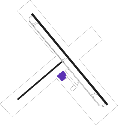
Runway info
Runway 14 / 32  | ||
| length | 1528m (5013ft) | |
| bearing | 141° / 321° | |
| width | 23m (75ft) | |
| surface | asphalt | |
| Runway 05 / 23 | ||
| length | 743m (2438ft) | |
| bearing | 58° / 238° | |
| width | 18m (60ft) | |
| surface | grass | |
| displ threshold | 0m (0ft) / 132m (433ft) | |
Nearby beacons
| code | identifier | dist | bearing | frequency |
|---|---|---|---|---|
| PSX | PALACIOS VORTAC | 20.9 | 74° | 117.30 |
| VCT | VICTORIA VOR/DME | 21.5 | 310° | 109 |
| CRP | CORPUS CHRISTI VORTAC | 60.4 | 225° | 115.50 |
| NGP | TRUAX (CORPUS CHRISTI) TACAN | 66.5 | 212° | 114 |
Instrument approach procedures
| runway | airway (heading) | route (dist, bearing) |
|---|---|---|
| RW14 | VULCE (141°) | VULCE 2200ft |
| RNAV | VULCE 2200ft HENHU (7mi, 141°) 1600ft JODUK (3mi, 141°) 700ft KPKV (2mi, 143°) 75ft (5757mi, 107°) 280ft TOVEE (5751mi, 286°) 2200ft TOVEE (turn) | |
| RW32 | TOVEE (321°) | TOVEE 2200ft |
| RNAV | TOVEE 2200ft WIVAM (7mi, 321°) 1600ft PIPIY (3mi, 321°) 700ft KPKV (2mi, 319°) 74ft (5757mi, 107°) 340ft VULCE (5764mi, 287°) 2200ft VULCE (turn) |
Disclaimer
The information on this website is not for real aviation. Use this data with the X-Plane flight simulator only! Data taken with kind consent from X-Plane 12 source code and data files. Content is subject to change without notice.