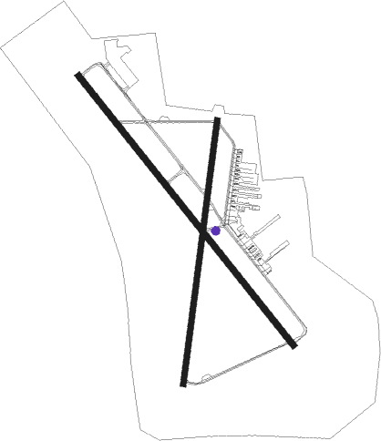
Provo - Provo Muni
Airport details
| Country | United States of America |
| State | Utah |
| Region | K2 |
| Airspace | Salt Lake City Ctr |
| Municipality | Provo |
| Elevation | 4497ft (1371m) |
| Timezone | GMT -7 |
| Coordinates | 40.21920, -111.72336 |
| Magnetic var | |
| Type | land |
| Available since | X-Plane v10.40 |
| ICAO code | KPVU |
| IATA code | PVU |
| FAA code | PVU |
Communication
| Provo Muni ATIS | 135.175 |
| Provo Muni CTAF | 125.300 |
| Provo Muni UNICOM | 122.800 |
| Provo Muni Ground Control | 119.400 |
| Provo Muni Tower | 125.300 |
| Provo Muni SALT LAKE CITY Approach | 118.850 |
| Provo Muni SALT LAKE CITY Departure | 118.850 |
Approach frequencies
| ILS-cat-I | RW13 | 110.3 | 18.00mi |
| 3° GS | RW13 | 110.3 | 18.00mi |
Nearby Points of Interest:
Lakeview Tithing Office
-Simon P. Eggertsen, Sr., House
-Silver Row
-George Angus and Martha Ansil Beebe House
-Provo Third Ward Chapel and Amusement Hall
-Provo West Co-op
-William D. Roberts House
-Joseph H. Frisby House
-George Taylor Jr. House
-Clark–Taylor House
-Hines Mansion
-Charles E. Davies House
-Startup Candy Factory
-William D. Alexander House
-William H. Ray House
-Provo Tabernacle
-Knight Block
-John E. Booth House
-Peter Wentz House
-Harvey H. Cluff House
-Reed O. Smoot House
-Dr. Samuel H. Allen House and Carriage House
-Provo City Library
-Charles E. Loose House
-Provo East Central Historic District
Nearby beacons
| code | identifier | dist | bearing | frequency |
|---|---|---|---|---|
| PVU | PROVO VOR/DME | 0.2 | 154° | 108.40 |
| FFU | FAIRFIELD (PROVO) VORTAC | 10.5 | 284° | 116.60 |
| TCH | WASATCH VORTAC | 39.6 | 338° | 116.80 |
| HIF | HILL (OGDEN) TACAN | 55.2 | 345° | 111.20 |
| PUC | CARBON (PRICE) VOR/DME | 58 | 122° | 115.50 |
| DTA | DELTA VORTAC | 65.8 | 220° | 116.10 |
Departure and arrival routes
| Transition altitude | 18000ft |
| Transition level | 18000ft |
| SID end points | distance | outbound heading | |
|---|---|---|---|
| RW13 | |||
| PROVO4 | 11mi | 284° | |
| RW18 | |||
| PROVO4 | 11mi | 284° | |
| RW31 | |||
| PROVO4 | 11mi | 284° | |
| RW36 | |||
| PROVO4 | 11mi | 284° | |
Instrument approach procedures
| runway | airway (heading) | route (dist, bearing) |
|---|---|---|
| RW13 | JAURN (138°) | JAURN DICOT (5mi, 138°) 8000ft |
| RW13 | ZUXAG (107°) | ZUXAG DICOT (10mi, 67°) 8000ft |
| RNAV | DICOT 8000ft ZEGUR (5mi, 138°) 6800ft WAVIT (2mi, 138°) 6300ft KPVU (6mi, 139°) 4547ft (6391mi, 110°) 4756ft HUNSU (6389mi, 290°) FEBGO (4mi, 209°) ZARAK (11mi, 237°) JAMUK (7mi, 306°) FFU (15mi, 13°) 9000ft FFU (turn) |
Disclaimer
The information on this website is not for real aviation. Use this data with the X-Plane flight simulator only! Data taken with kind consent from X-Plane 12 source code and data files. Content is subject to change without notice.

