Riverside - Riverside Muni
Airport details
| Country | United States of America |
| State | California |
| Region | K2 |
| Airspace | Los Angeles Ctr |
| Municipality | Riverside |
| Elevation | 814ft (248m) |
| Timezone | GMT -8 |
| Coordinates | 33.95175, -117.44760 |
| Magnetic var | |
| Type | land |
| Available since | X-Plane v10.40 |
| ICAO code | KRAL |
| IATA code | RAL |
| FAA code | RAL |
Communication
| Riverside Muni ATIS | 128.800 |
| Riverside Muni Ground Control | 121.700 |
| Riverside Muni Tower | 121.000 |
| Riverside Muni SOCAL Approach | 135.400 |
| Riverside Muni SOCAL Departure | 135.400 |
Approach frequencies
| ILS-cat-I | RW09 | 110.9 | 18.00mi |
| 3° GS | RW09 | 110.9 | 18.00mi |
Nearby Points of Interest:
Arlington Branch Library and Fire Hall
-Victoria Avenue
-Riverside Municipal Auditorium
-Harada House
-Hofer Ranch
-Bono's Restaurant and Deli
-Cucamonga Service Station
-Ontario State Bank Block
-San Bernardino County Court House
-Frankish Building
-San Bernardino Downtown Station
-Moyse Building
-Barton Villa
-Carnegie Library (Upland, California)
-Old San Antonio Hospital
-Beverly Ranch
-U.S. Post Office
-Smiley Park Historic District
-A. K. Smiley Public Library
-Redlands Santa Fe Depot District
-Redlands Central Railway Company Car Barn
-Sam and Alfreda Maloof Compound
-Perris Depot
-Russian Village District
-Auerbacher Home
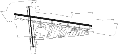
Runway info
Runway 9 / 27  | ||
| length | 1647m (5404ft) | |
| bearing | 101° / 281° | |
| width | 30m (100ft) | |
| surface | asphalt | |
| Runway 16 / 34 | ||
| length | 871m (2858ft) | |
| bearing | 178° / 358° | |
| width | 15m (50ft) | |
| surface | asphalt | |
Nearby beacons
| code | identifier | dist | bearing | frequency |
|---|---|---|---|---|
| RAL | RIVERSIDE VOR | 0.2 | 327° | 112.40 |
| PDZ | PARADISE (ONTARIO) VORTAC | 4.5 | 248° | 112.20 |
| SB | PETIS (SAN BERNARDINO) NDB | 7.4 | 38° | 397 |
| RIV | MARCH (RIVERSIDE) TACAN | 9 | 105° | 113 |
| HDF | HOMELAND (RIVERSIDE) VOR | 16.7 | 124° | 113.40 |
| POM | POMONA VORTAC | 18.5 | 290° | 110.40 |
| ELB | EL TORO (SANTA ANA) VOR/DME | 21.7 | 226° | 117.20 |
| SLI | SEAL BEACH (LOS ALAMITOS) VORTAC | 31.9 | 254° | 115.70 |
| VCV | VICTORVILLE VOR/DME | 38.6 | 5° | 109.05 |
| NFG | CAMP PENDLETON (OCEANSIDE TACAN | 40.7 | 175° | 111.80 |
| OCN | OCEANSIDE VORTAC | 42.7 | 178° | 115.30 |
| LAX | LOS ANGELES VORTAC | 49 | 269° | 113.60 |
| PMD | PALMDALE VORTAC | 50.9 | 318° | 114.50 |
| SXC | SANTA CATALINA VORTAC | 59.6 | 239° | 111.40 |
| JLI | JULIAN VORTAC | 65 | 133° | 114 |
| HEC | HECTOR VORTAC | 70.4 | 49° | 112.70 |
Departure and arrival routes
| Transition altitude | 18000ft |
| Transition level | 18000ft |
| STAR starting points | distance | inbound heading | |
|---|---|---|---|
| ALL | |||
| ZIGGY7 | 12.8 | 223° | |
| SETER5 | 17.1 | 279° | |
Instrument approach procedures
| runway | airway (heading) | route (dist, bearing) |
|---|---|---|
| RW09 | PIRRO (101°) | PIRRO JASER (10mi, 101°) 3300ft |
| RW09 | POM (110°) | POM JASER (7mi, 128°) 3300ft |
| RW09 | PRADO (85°) | PRADO JASER (7mi, 53°) 3300ft |
| RNAV | JASER 3300ft EXPAM (7mi, 101°) 2500ft KRAL (6mi, 102°) 801ft (6755mi, 106°) 1092ft JIKUB (6752mi, 286°) HDF (14mi, 130°) 6000ft HDF (turn) | |
| RW27 | BANDS (276°) | BANDS CUGVI (9mi, 272°) 8600ft WENVA (7mi, 272°) 5100ft PAYIG (3mi, 281°) 4100ft |
| RNAV | PAYIG 4100ft LAYEY (3mi, 281°) 3100ft KRAL (7mi, 280°) 868ft (6755mi, 106°) 1218ft ICIYE (6758mi, 286°) PRADO (14mi, 261°) 4000ft PRADO (turn) |
Holding patterns
| STAR name | hold at | type | turn | heading* | altitude | leg | speed limit |
|---|---|---|---|---|---|---|---|
| SETER5 | JLI | NDB | left | 108 (288)° | 1.5min timed | ICAO rules | |
| ZIGGY7 | PETIS | VHF | right | 76 (256)° | 1.0min timed | ICAO rules | |
| *) magnetic outbound (inbound) holding course | |||||||
Disclaimer
The information on this website is not for real aviation. Use this data with the X-Plane flight simulator only! Data taken with kind consent from X-Plane 12 source code and data files. Content is subject to change without notice.